
Hiking the Skye Trail – Wild Camping Through Scotland’s Rawest Landscape
The Skye Trail has long been on my bucket list. In fact, two years ago when I met Nigel on a bus heading to Hadrian’s Wall, I sent him someone’s IG video with the caption, “Maybe we could do this one day?!!” And it became a reality, just shy of two years later.
The Isle of Skye is often romanticised for its moody cliffs, black Cuillin peaks, and windswept coastline, and there are many popular day hikes including the Quiraing, Old Man of Stor, and Loch Coruisk to name just a few. The Skye Trail is a long, unofficial route that links these and other iconic spots into one breathtaking, unforgiving line.
The Skye Trail is one of Scotland’s toughest unofficial trails. By unofficial, I mean it’s not signed and there’s no government body servicing it. For clarity: most official long-distance trails in the UK are overseen by organisations like NatureScot or the National Trails office in England and Wales – this one isn’t.
This Trail is not an inn-to-inn hike, meaning hikers must carry their tent and be prepared to wild camp. For many, including myself, this totally adds to its appeal. Camping in the true wilderness is, and always has been, an integral part of hiking for me and as my readers know, I’ve always preferred sleeping in my tent, even in New Zealand with its renowned hut culture.
This often pathless journey through the Isle of Skye’s most rugged and exposed landscapes is not for the faint-hearted. But for those with the skills and stamina, it’s one of the most rewarding hikes in the UK.
Read on, and I guarantee this hike will be added to your “list”

This article may contain affiliate links. If you make a purchase using one of these links, we may receive compensation at no extra cost to you. See our Disclosure Policy for more information.
Quick Facts
- Location: Isle of Skye, Scotland
- Distance: Approx. 128 km (80 miles)
- Elevation Gain: 4,637 m (15,213 ft)
- Highest Point: 697 m (2,287 ft)
- Duration: 6–8 days
- Trail Type: Point to Point
- Grade: Hard – unwaymarked, exposed, often trackless
- Best Time to Hike: April to September
How and When to Walk the Skye Trail
Die-hard Scots seem to enjoy hiking in the Highlands all year round. However, many of us, myself included, prefer to hike the Scottish Highlands in season – and that perfect Goldilocks moment is April through to June. Scotland seems to turn on its best weather during this time, plus the infamous midges are absent until the beginning of June.

Route Direction and Variations
The Skye Trail runs the length of the Isle of Skye, with the most northern point being Rubha Hunish, and the southern end at Broadford. People typically walk the trail north to south. However, we hiked it south to north for a couple of reasons.
Although it wasn’t a huge factor for us, the prevailing wind is usually at your back heading north. But most importantly for us—carrying seven days’ food—I wanted to start at the southern end (the easy bit) and save the high inclines for when my pack was lighter.
And to be honest, I’m really glad we did it this way. The sheer beauty and magnificence of the Trotternish Ridge was an absolute highlight, and a fantastic way to finish the hike.
We also missed out on one section, due to being on a tight time schedule and pending foul weather. From Kilmarie, we headed straight through the pass to Camasunary Bay – missing out the Big Step.
If you only have a few days, a good option is to start at Portree and take the 3–4 days to walk to Rubha Hunish. It really is the best part of the hike by far.

Skye Trail Maps and Elevation

Online/GPS Maps
For an online Skye Trail map, we downloaded tracks from Mapy.com and AllTrails. Since this isn’t an official trail, it relies on crowdsourced data—so accuracy can vary. I had AllTrails on my phone, while Nigel used Mapy.com. Between the two, we found Mapy to be more accurate overall.
That said, if you do wander off-route, it’s very easy to course-correct. Especially on and around Trotternish Ridge, where the terrain is open and there are no trees to obscure your view. You can often see exactly where you need to go and just walk toward it.
Amongst other apps, WalkHighlands has all the GPS files to download and some great information about the hike.
Service can be spotty to non-existent in parts of Skye, so downloading maps prior is pretty important.

Pass It On, Like a Wee Dram
Good hikes, like good whisky, are best shared wi’ folk ye like.
Topographic Maps
Paper topographic maps are a valuable resource in the event your electronic mapping system fails. The UK Ordnance Survey Explorer Maps for the Skye Trail at 1:25,000 scale include:
- OS Explorer 408 – Skye – Northern Area (Portree & Trotternish)
Covers: Rubha Hunish, Quiraing, Trotternish Ridge, Portree - OS Explorer 411 – Skye – Cuillin Hills North
Covers: Portree to Sligachan section and Cuillin foothills - OS Explorer 412 – Skye – Cuillin Hills South
Covers: Loch Coruisk, Glen Sligachan, Broadford
If you’d prefer fewer maps and slightly less detail (but still enough for navigation), the Harvey Skye Trail map is available in 1:40,000 scale and is specifically designed for this route. It’s waterproof, lightweight, and covers the full trail on one sheet.
You will also need a Compass and the knowledge to use it. I recommend taking a navigational course. Just like First Aid, navigation is a good skill to have.
There are in-person training sessions in most areas, but if you can't get to any of these or need to brush up on your skills (like me), then The Columbia River Orienteering Club has excellent tutorials on YouTube. They also have tutorials on using GPS systems such as GAIA and similar.


Guide Books
The Skye Trail guidebook by Helen Webster (Cicerone Press) is a practical resource for those planning the full route. It breaks the trail into seven stages and includes OS mapping, elevation profiles, and useful notes on logistics like transport, accommodation, and water. There are also side sections covering the island’s geology, wildlife, Gaelic place names, and cultural background. I love guidebooks for this reason. I like understanding the landscape I'm walking through.
Battery Life on Trail
If you're relying on your phone for navigation (as most of us do these days), you’ll need a power bank. I carry 2 x 10,000 mAh power banks and ration them carefully. I switch my phone to flight mode while hiking and only turning on GPS when I needed it. Nigel carried a larger 20,000 mAh power bank. What works best will depend on how many devices you’re charging, their battery drain rate, how often you can top up, and how efficient your power bank is.
Not all power banks are created equal. The usable capacity depends not just on the mAh rating, but also on the quality of the internal lithium cells and the efficiency of the voltage conversion circuitry. Most power banks store energy at 3.7V and convert it to 5V for USB output, which results in some loss. In cheaper models, poor-quality components and less efficient converters can result in significantly more energy lost as heat. Meaning you may only get 60–70% of the advertised capacity in actual charging. Higher-quality units typically have better energy retention, more stable output, and longer lifespans.
From Portree to Rubha Hunish there is nowhere to charge, except for the pub at Flodigarry, so it's really important to conserve as much power as possible. Cold weather will drain batteries faster, so never keep your devices on the tent floor. The best place to keep them is in the pockets inside the tent walls, or if cold, tucked inside your sleeping bag.


Accomodation:
Accommodation on the Skye Trail is limited and scattered, with large sections of the route passing through remote terrain. There are a few places to stay along the way, but you can’t rely on towns or villages popping up when you need them. Below is a rundown of where you might find a bed from Portree south to Broadford.
At the very start near Rubha Hunish, there’s nothing there: just dramatic cliffs, seabirds, wind, and a red telephone box. Most people stay in Portree the night before and take the morning bus north. There are scattered B&Bs throughout Trotternish, but they’re not all on the bus line. However, these B&Bs can be a nice option for those finishing at Rubha Hunish for a bit of R & R.
Between Portree and Rubha Hunish, Flodigarry (essentially a small hamlet) has one hotel, which is also the local pub.
Many people stop for the night in Portree, which has a number of accommodation options as well as a good campsite. It’s also perfect for resupply, as there are a couple of Co-Ops (supermarket chain). Portree also has a good supply of cafés and restaurants. If you are stopping for the night at the Portree campsite, just be aware the closest pub/eatery is a 20 minute walk into town.

Moving south, Sligachan has a historic hotel with a decent pub attached to it. The Sligachan campsite is across the busy main road, but its location was so unappealing we moved on after an early dinner and found a nice spot by a loch.
Further along, Elgol, Glasnakille, and Torrin all have some seasonal B&Bs and the odd café to stop for a cuppa and whatnot. However, there are no stores to stock up on any food items.
And finally, Broadford, at the southern end of the trail, is the second main town on Skye. You’ll find a number of shops here, plus several B&Bs, hotels, a great campsite, and a full supermarket. If you're starting or finishing the trail here, it’s a convenient base.


Wild Camping on the Skye Trail
For 99% of hikers, wild camping is simply how you do the Skye Trail. The route doesn’t pass through many towns, and accommodation is patchy at best, so unless you're stitching together expensive detours and pre-booked stays, you'll be carrying a tent.
There’s no need to overcomplicate it. You’ll find plenty of suitable ground along the way. Some sections are a bit fiddly for flat ground, but others, like the Trotternish Ridge, are a wild camper’s dream, with endless pitch options and sweeping views out to both coasts.
My hands-down favourite spot in the south was camping at Boreraig, once a fishing village that succumbed to the cruel and infamous Clearances. North of Portree, every night was incredible—especially the ones we spent along the Trotternish Ridge. In fact, we loved it so much we stayed two nights between The Storr and the Quiraing.

In Scotland, wild camping is legal under the Land Reform (Scotland) Act 2003, which gives people access rights to most unenclosed land, including the right to camp. These rights are explained in the Scottish Outdoor Access Code, which permits small-scale, low-impact camping as long as it’s done responsibly. That means pitching well away from buildings, roads, and farmland, staying only a night or two, and always leaving no trace.
You can’t camp on enclosed land like cultivated fields or private gardens, and there are some locally restricted areas such as parts of Loch Lomond and The Trossachs National Park where wild camping is only allowed in designated zones or with a permit. For full guidance, see the Scottish Outdoor Access Code. And as always, follow basic wild camping etiquette: no fires, pack everything out, and avoid blocking access to bothies or croft land.


Bothies on the Skye Trail
There are two bothies on or near the Skye Trail—Camusunary Bothy and Suardalan Bothy. Both are managed by the Mountain Bothies Association (MBA), a volunteer-run organisation that maintains these shelters across remote parts of the UK.
What is a bothy? A bothy is a basic, unlocked shelter, usually an old croft or cottage, open to walkers and cyclists on a first-come, first-served basis. There’s no booking, no charge, and no guarantee of space. You’ll need to bring your own sleeping mat and bag, and hikers should always carry a tent regardless.
Camusunary sits in a stunning bay on the eastern side of the Cuillin, and Suardalan is tucked inland near Torrin. They’re both welcome options in bad weather.
If you use a bothy, respect the Bothy Code:
- Leave it as you found it (or better)
- Take all your rubbish out with you
- Don’t hog space (personal and physical) it’s a communal shelter
- Keep noise and fires sensible
- And never assume you’ll have it to yourself
You can read the full code at www.mountainbothies.org.uk.

Water
In general, water is easy to come by on the Skye Trail, especially in the northern and central sections. But you should never drink untreated water. Most of the Isle of Skye is pastoral land, and streams often run through areas grazed by sheep and cattle. This increases the risk of contamination from animal waste, which can carry pathogens like Cryptosporidium, E. coli, or Giardia. There’s also the chance of carcasses upstream.
We used our Katadyn BeFree for the entire trail but have since switched to the HydraPak filter. Katadyn recently changed their design, and we prefer the older model. The HydraPak filter fits our 3L HydraPak Seeker collapsible bottle, which we use constantly when dry camping.
There are two small lochs on the Trotternish Ridge, however there are nicer places to camp. This means if you plan to camp away from those water sources, you are effectively dry camping (meaning camping without access to water nearby). You'll need to carry enough water for the evening, overnight, the next morning, and until you reach the next water source. For this reason, we find our HydraPak Seeker 3L water bottle invaluable. It's super strong, can take boiling water and folds up to the size of a small fist when not in use.
The general rule for Nigel and I is at least 2L of water each when dry camping.

Keepin’ This to Yersel? That’s No Very Sound.
Pass it on so others can walk it right 😉
Food & Resupply
There are supermarkets in both Portree and Broadford, but that's about it. We bought our own breakfasts, dehydrated meals, and lunch and snacks to last us through to Portree. We ate at the pub in Sligachan and Portree.
As we travelled overland from Inverness, we brought our own gas with us. At the Portree campsite, we refilled one of our canisters using the many half-used ones left behind, using our FlipFuel, a brilliant little gas-saver that transfers gas from one canister to another. We never hike without one now. It permanently lives in our utility pouch.
There is a camping store called Inside Out at Portree that does sell gas and other camping equipment, but I would play it safe and take gas with you, just in case their supplies are depleted.


The Importance of Breakfast on Trail
I’ve always taken overnight oats with me for breakfast. They carry well, take up very little space, and they’re a great source of complex carbohydrates. That’s exactly what you need to keep your energy steady on long, demanding days. Oats also provide useful minerals like iron and magnesium, which help with endurance and recovery. On the few occasions we’ve eaten a cooked breakfast instead, we’ve noticed signs of fatigue and hunger creeping in much sooner.
We even took this breakfast on the Fishermen’s Trail. Instead of sitting down for a full café breakfast, we’d use the local pastelarias as a mid-morning stop, just a coffee and a pastel de nata. It worked perfectly.
If you’re looking for ideas, I’ve written up my go-to hiking breakfast here: Overnight Oats Recipe for Hikers – Nutrition That Lasts. It’s quick, easy, and doesn't need a stove.

Pack Light, Pack Right. Free Multi-Day Hiking Packing List
Plan methodically and keep track of every essential for your next multi-day hike. Add notes and quantities, save or print your list, and share it with hiking partners so everyone knows what’s covered. Works on any device.
Gear for the Skye Trail
As well as my normal hiking kit (which includes tent and sleep system), here are 10 items I needed on the Skye Trail
Midge Prevention and Relief
Scotland is notorious for midges during the warmer months, typically from late May through to early September. The Skye Trail is no exception. If you’re camping or stopping in sheltered areas, especially in the early morning or evening, you’ll need a plan to deal with them.
Here’s what I’ve found works not only for midges, but mosquitos as well:
- Head Net
A simple mesh head net is worth its weight. It keeps the midges off your face and neck when they’re at their worst. I always carry one. It takes up almost no space and makes cooking or packing up far more bearable. - Thermacell Backpacker Mosquito Repeller
Despite the name, it works brilliantly on midges. It screws directly onto your gas canister and emits a scentless repellent. At 114g, it’s lightweight enough for hiking and an alternative to topical sprays or creams. We usually set it up the moment we stop to cook. You can get generic cheaper brands for the replacement pads as well from Amazon. - Antihistamines
Good to have on hand if you react to bites. Even with solid prevention, you’ll probably end up with a few. A tablet can take the edge off the itching, even if you don’t usually react badly.


Water Filter and Carrier
We filtered all our water on the Skye Trail using a Katadyn BeFree, though we've since switched to the HydraPak filter. The newer Katadyn design doesn’t suit us as well, and the HydraPak system works well with the rest of our setup.
For dry camping (camping away from a water source), we use a HydraPak 3L Seeker bottle. It’s light, durable, and packs down small when empty. See the above section on Water on the Skye Trail for more information on our set-up.


Tent or Shelter
It goes without saying you'll need a tent for the Skye Trail and this might be your first hike where you need to add a shelter and sleep system to your kit.
When you are wild camping or backcountry camping, the size and the weight of your tent matters. By size, I'm referring specifically to the tent's footprint—the actual ground space your tent takes up. It's far easier to find a spot in the wilderness for a one-person tent than it is for a three-person tent. If you’re travelling in a group of three, my suggestion is to either bring three individual tents or one two-person tent and a single-person tent.
Weight is another key consideration. Not everyone can afford a top-end ultralight tent that weighs almost nothing and packs down to the size of a tennis ball. However the heavier your tent, the harder you will struggle, especially on the Ridge.

One thing I will mention: it’s very important to carry a ground sheet for your tent. This will protect the bottom of your tent, and ultimately your sleeping pad, from punctures caused by sharp stones, rocks, sticks or plants.
Most tent brands sell ground sheets that are measured to fit the tent exactly. However, these are expensive. A far cheaper option is to use Polycro, or even purchase Tyvek and cut it to size. I’ve made all of my tent ground sheets from Tyvek, and the stuff is not only lightweight but also indestructible and very cheap.
Manufacturers sometimes refer to the tent ground sheet as a footprint, so if you see that term used, it’s the same thing.
There are two main types of tents: freestanding tents, and tents that require trekking poles for setup. Either type will generally work fine on the Skye Trail, and it will be a matter of personal preference and budget. Nigel and I recently purchased a SlingFin Portal. It’s a premium ultralight tent designed to withstand gale-force winds.
Here are a few tent options:
SlingFin Portal (Free-Standing)
Durston Mid (Uses treking poles – best LW!)
Budget – Free-standing Tent
Budget – Trekking Pole Tent
Polycro Ground Sheet

Like this? We've got loads more!
Sign up for our weekly email and get your Free Copy of HIKE IT RIGHT.
An 88-page guide to staying well, looking after your body, and handling things when they don’t go to plan
You can unsubscribe anytime. For more details, review our Privacy Policy.
Boots or Trail Runners?
In recent years, I’ve made the switch from boots to trail runners and I haven’t looked back. Trail runners are lighter, more breathable, and far quicker to dry after stream crossings or rain. That’s a big deal on a trail like this, where the ground can be extremely boggy after rain.
They also tend to have a wider toe box, which makes a real difference on long days when your feet swell. And while boots might still suit some terrain, I’ve found that a good pair of trail runners with aggressive lugs and decent underfoot protection are more than capable for any type of trail.


The reduced weight on your feet makes a noticeable difference in overall fatigue—something I’ve definitely appreciated after consecutive days of hiking through bog, rock, and wind.
So what are lugs? Lugs are the raised tread patterns on the sole that help grip uneven or slippery terrain. The shape, depth, and pattern of the lugs determine what kind of ground the shoe is best suited for. Trail runners typically have aggressive lugs designed for rocky, muddy, and uneven terrain, which is why the under sole looks so different than those of say gym shoes or running shoes.
Topo Athletic Ultraventure 4 Trail Runners
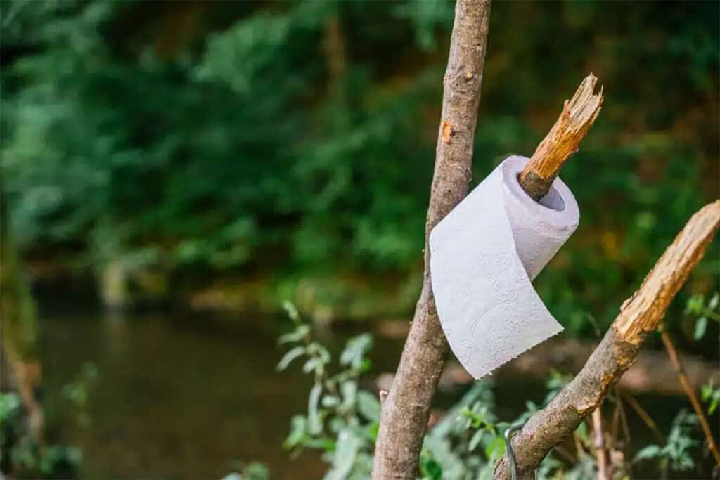
Poop or Hygiene Kit
I can't stress how important it is to carry your “toilet,” also known as a poop kit, toilet kit, or make up your own name. Toileting when hiking means you need to bury your waste properly and pack out anything that will not biodegrade, and that includes toilet paper.
In my article on How to Go to the Toilet When on the Trail, I go in depth on how to wee and poop when there is no toilet. If you're unsure how this works, it's worth a read.
M+F = Male and Female
F = Female
F | Kula Cloth (aka – Pee Cloth)
F | Female Urination Device – FUD
M+F | Portable Bidet (aka Backcountry Bidet)
M+F | Trowel
M+F | Wag Bags
F | Menstrual Cup
M+F | “Shit Kit” Toilet Kit Bag
There are no toilets on the trail – and even in small hamlets in the south, there are no public toilets. There is a toilet at The Storr, Portree, and Sligachan ( you need to pay or buy a beer). So for the sake of the environment and everyone else on the trail, it's really important you do this right.


Transport To and Around the Isle of Skye
The Skye Trail runs from Rubha Hunish in the far north to Broadford in the south. Public transport is limited, especially on Sundays when no buses run, so plan ahead.
Most hikers begin in the north. From Portree, take bus 57A or 57C to Duntulm, then walk to Rubha Hunish. At the southern end, Broadford is served by buses 52, 55, and 150, which connect to Portree and Kyle of Lochalsh.
From Kyle of Lochalsh, you can catch a direct ScotRail train to Inverness. If you're heading to Glasgow, the fastest overland route is via Fort William, which connects by train to Glasgow and further south.


Why Hike the Skye Trail?
You won’t find waymarkers. You won’t find shops every day. And you definitely won’t find crowds—at least not once you leave the tourist hubs behind. What you will find is one of the most elemental hikes in the UK. Walking this trail means navigating on your own, relying on your gear, and surrendering to the weather. It’s a test—and a gift.
If you’ve done easier trails like the West Highland Way and you’re ready for something wilder and more remote, the Skye Trail is a natural next step.
Popular Day Hikes on the Isle of Skye
- The Quiraing Circuit
Distance: ~6.5 km (4 miles)
Time: 2–3 hours
A loop walk through Skye’s iconic rock formations—The Needle, The Table, and The Prison. Epic scenery and relatively easy underfoot. - Old Man of Storr
Distance: ~4.5 km (2.8 miles)
Time: 1.5–2.5 hours
A short but steep climb to one of Skye’s most famous landmarks. Often crowded, but worth it for sunrise or in off-season. - Rubha Hunish Lookout
Distance: ~7 km (4.3 miles) return
Time: 2–3 hours
Northernmost point of Skye, with a sea lookout hut and views over to the Outer Hebrides. Great for spotting whales, seals, and seabirds. - Fairy Pools & Coire na Creiche
Distance: ~5.5 km (3.4 miles)
Time: 1.5–2 hours
Popular crystal-clear pools and waterfalls beneath the Cuillin. For a longer walk, continue up the glen toward the dramatic Coire na Creiche. - Bla Bheinn (Blaven)
Distance: ~8 km (5 miles)
Time: 4–6 hours
A tough but spectacular climb up one of Skye’s most accessible Cuillin peaks. Steep and rocky, but the views are among the best on the island. - Neist Point Lighthouse
Distance: ~3 km (1.9 miles) return
Time: 1 hour
A classic coastal walk with clifftop views and a photogenic lighthouse. Short, but often windy and exposed. - The Fairy Glen
Distance: Variable (~1.5–3 km / 1–2 miles)
Time: 1–1.5 hours
A whimsical landscape of grassy mounds, miniature ridges, and rocky spirals. Easy and family-friendly, with optional climbs. - Sligachan to Loch Coruisk (via boat or walk-in)
Distance: ~18 km (11 miles) return from Sligachan
Time: 5–7 hours
A challenging out-and-back walk into one of Skye’s most remote and stunning lochs. Can also be accessed via boat from Elgol.
Frequently Asked Questions
Is wild camping legal on the Skye Trail?
Yes, wild camping is legal in Scotland under the Land Reform Act. Most people camp on the Skye Trail, as accommodation is limited. You must follow Leave No Trace, camp away from roads and buildings, and be prepared to carry water, especially on higher sections like the Trotternish Ridge.
How difficult is the Skye Trail?
The Skye Trail is an unmarked, often pathless route with exposed ridgelines, peat bogs, and long distances between services. You’ll need to be confident with navigation in poor weather and comfortable hiking in remote areas. It’s physically demanding and better suited to experienced walkers who are used to multi-day backcountry routes.
Is there accommodation along the Skye Trail?
Accommodation is sparse. While a few walkers use B&Bs in Portree or Broadford, most hikers wild camp the entire route. If you’re planning to use indoor accommodation, you’ll need to book months in advance. Skye is extremely popular, and even small villages fill quickly during summer and Scottish school holidays.
What maps do I need for the Skye Trail?
The best paper maps are OS Explorer sheets 408, 410, and 411 at 1:25,000 scale. The Cicerone guidebook is also helpful and includes topographic maps with elevation. GPS is useful but shouldn’t replace map and compass. Phone signal is unreliable in remote sections, so offline navigation and backup tools are essential.
How many days does it take to hike the Skye Trail?
Most people take 7 to 8 days, though it depends on your pace and the weather. There are no shortcuts or alternative routes—it’s a point-to-point trail through remote terrain. The Cicerone guidebook breaks it into seven stages. It’s also worth building in a buffer day in case of storms.
When is the best time to hike the Skye Trail?
May to September is the main hiking season. May is drier and has fewer midges, while June to August is warmer but can be buggy and busy. September can be quiet with clearer skies. No matter when you go, always expect rain, wind, and fast weather changes—this is Scotland, after all.
Where can I resupply food on the Skye Trail?
Hikers should arrive on the island prepared, but you’ll find supermarkets in both Broadford and Portree for resupply. Portree also has a camping store (Inside Out) that sells gas canisters and basic gear. Supplies can be limited in peak season, so if you need something specific, it’s best to bring it with you.
Do I have to filter the water on the Skye Trail
Yes. The trail often crosses farmland, and many streams are exposed to livestock. Even if the water looks clean, it can carry harmful pathogens like Giardia or E. coli. You should always filter or boil all drinking water on the Skye Trail—there are no guaranteed safe sources.
Can I bring my dog on the Skye Trail?
Dogs are allowed, but the trail is rough and passes through sheep country. You must keep your dog on a lead near livestock and during lambing. The ground can be steep, boggy, and hard on paws. There’s also limited water in higher sections, so you’ll need to carry enough for them.
How do I get to the start of the Skye Trail
Take Stagecoach bus 57A/57C from Portree to Kilmaluag (red phone box) to start at Rubha Hunish. At the end in Broadford, catch bus 52, 55, or 150 to Portree or Kyle of Lochalsh. From Kyle, take ScotRail to Inverness. Buses are infrequent—check timetables.