
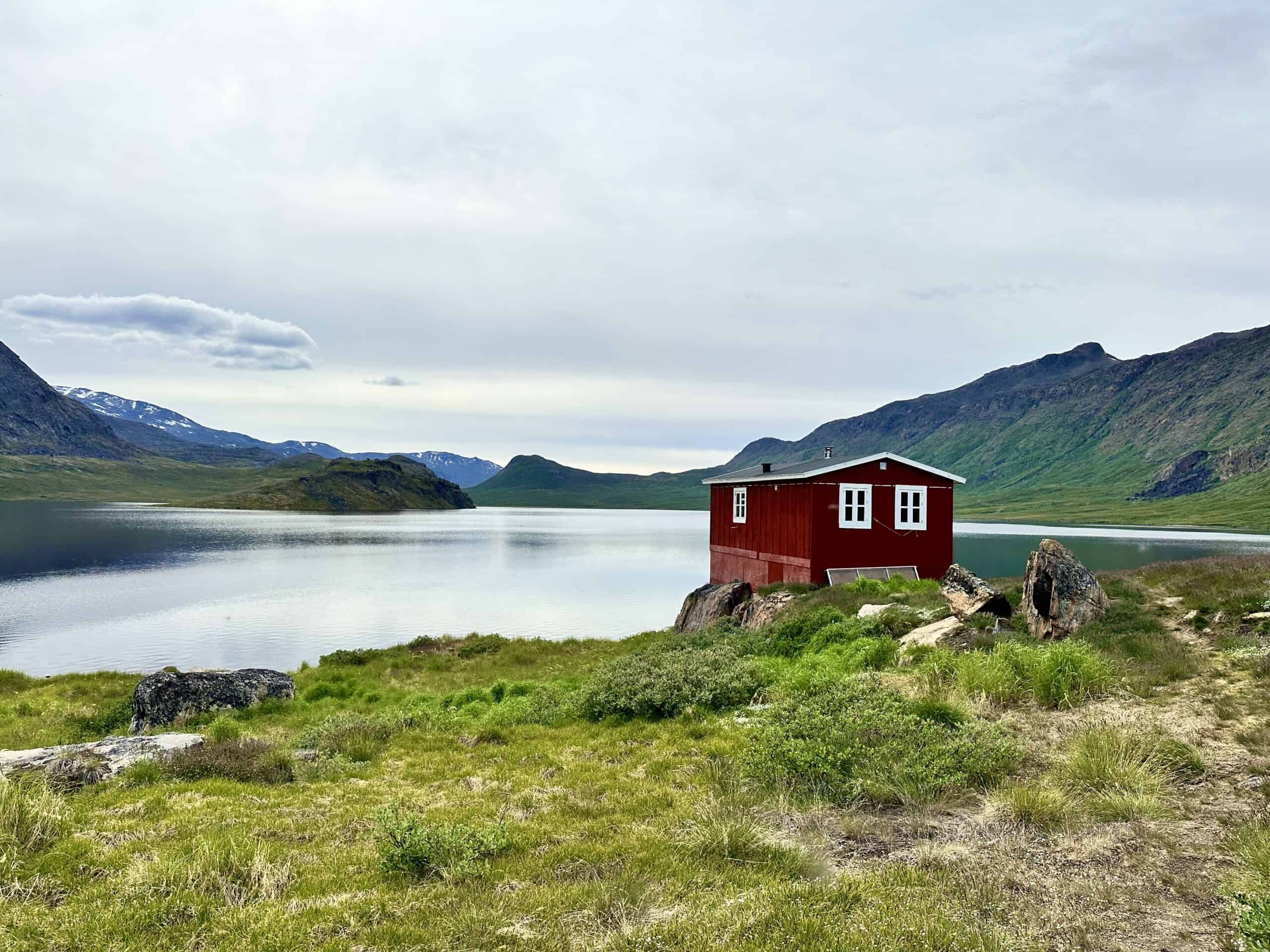
The Arctic Circle Trail – The World’s Most Northern Hike
The Arctic Circle Trail is the most northern hiking trail in the world, a remarkable long-distance Greenland hike that offered me an unparalleled adventure through one of the world’s most pristine and remote landscapes.
While the Arctic Circle Trail is easy on paper, it is rated difficult due to the water-ridden trails, river crossings, and temperature changes that can range from piping hot polar sun at what seems like 35°C (95°F) to -10°C (14°F) snow—all within a week. Additionally, the trail is totally remote, meaning you may not see anyone for 2-3 days.
Although this Greenland hike can be completed in 6 – 7 days, it may take up to 9 or even 10 days if you need to wait out a sudden snowstorm—even in July!
I hiked this incredible trail in July 2024, experiencing total serenity, boggy marshes that seemed endless, Greenland wildlife like reindeer grazing beside my tent, hot polar sun, crystal-clear glacier lakes, and a snowstorm. This Greenland hike was a challenge but remains one of my best hiking experiences to date.
Here’s my guide to the Arctic Circle Trail—Greenland’s best-kept secret!
Arctic Circle Trail Guide Quick Links:
- Arctic Circle Trail – Quick Facts
- What Maps do I Need?
- Does it Cost?
- Where does the Arctic Circle Trail Start and End?
- Can I Drink the Water?
- What About Food?
- Is it Safe?
- Why is Emergency Rescue Insurance Required?
- Arctic Circle Trail Sections
- Packing List for the Arctic Circle Trail
This article may contain affiliate links. If you make a purchase using one of these links, we may receive compensation at no extra cost to you. See our Disclosure Policy for more information.
Arctic Circle Trail – Quick Facts
|
Location: |
Central-western Greenland |
|---|---|
|
Distance (approx): |
164.6 km / 102.3 mi |
|
Elevation Gain: |
4,138 m / 13,576 ft |
|
Highest Point: |
495 m / 1,624 ft |
|
Duration: |
6 -10 days |
|
Trail Type: |
Remote backcountry trail, varied terrain including tundra and glaciers |
|
Trail Description: |
Point to Point |
|
Grade: |
Difficult due to the trail's remoteness |
|
Official ACT Website: |
Arctic Circle Trail Map and Elevation

Online/GPS Maps
For an online Arctic Circle Trail map, I downloaded maps from GAIA and AllTrails. GAIA is an online mapping app with a monthly subscription and also a great resource.
Other hikers have been known to use the following online maps:
Topographic Maps
A detailed set of topographic maps of the Arctic Circle Trail can be purchased in Sisimiut, Kangerlussuaq, or Nuuk at the airport souvenir shops and various lodges, such as the Polar Lodge in Kangerlussuaq or the Soma Hotel in Sisimiut.
You will need to buy 3 maps that cover the trail. The maps are:
- Sisimiut
- Pingu
- Kangerlussuaq
You can also buy maps in Denmark from Scanmaps or in the UK from Harvey Maps
Paper topographic maps are a valuable resource in the event your electronic mapping system fails and the weather turns nasty.
You will also need a Compass and the knowledge to use it. I recommend taking a navigational course. Just like First Aid, navigation is a good skill to have.
There are in-person training sessions in most areas, but if you can't get to any of these or need to brush up on your skills (like me), then The Columbia River Orienteering Club has excellent tutorials on YouTube. They also have tutorials on using GPS systems such as GAIA and similar.
Know Before You Go
Fees and Registrations for the Arctic Circle Trail
As of the time of writing, no fees or registrations are required for the Arctic Circle Trail. However, a fee is planned to be introduced in 2025 to support the trail and hut maintenance, as the Arctic Circle Trail does not receive funding from any government or independent body.
Destination Arctic Circle, which oversees the trail, gladly accepts donations. If you had the adventure of a lifetime, consider giving back to help preserve this incredible experience for others.
Hikers on the Arctic Circle Trail need to stop by the Canoe Centre and complete a quick, easy registration form. By doing so, you’re helping to protect this beautiful trail, as the information gathered is crucial for securing funding, maintaining the trail, and ensuring that the environmental impact is carefully managed.
Your participation is vital to preserving the Arctic Circle Trail for future adventurers!
All information is kept private within Destination Arctic Circle and aggregated before it is used for reports and planning purposes.
Fires
Fires on the tundra are notoriously hard to manage because they can spread both above and below the ground, and it can take years for the vegetation to recover. As a result, campfires are strictly banned on the Arctic Circle Trail. Additionally, it’s really important to be extra careful with stoves and cigarettes.
Options and Direction to Hike the Arctic Circle Trail
The “classic” Arctic Circle Trail extends between Kangerlussuaq and Sisimiut. You can choose to start at either end, depending on your flights and whether or not you want to start at the ice sheet/Russell Glacier or do the ice sheet and/or Russell Glacier before or afterwards. I started my hike at Kangerlussuaq.
During my hike, Kangerlussuaq Airport was the primary gateway, with daily flights to Denmark and additional flights during the high season. However, starting November 2024, Nuuk will become the main airport, potentially affecting the direction hikers choose based on flight schedules between Nuuk, Sisimiut, and Kangerlussuaq.
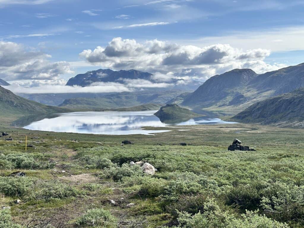
When it comes to elevation, the direction of travel doesn’t significantly impact the hike. I observed more canoes on the western end of the lake than on the eastern end, which meant hikers heading towards Sisimiut needed to walk around the lake instead of using the canoes.
Starting from the Ice Sheet
Instead of beginning your hike in Kangerlussuaq, you can join a tour that takes you to Point 660 and request to be dropped off there. From Point 660, you can walk along the road to the Russell Glacier, and then either continue on the road or follow the Ice Ridge Trail to reach Kangerlussuaq.
Adding the trek from Point 660 will extend your journey by approximately 37 kilometres and 2 to 3 additional days.
Starting from the Russell Glacier:
Similarly, you can opt for a tour that drops you off at the Russell Glacier once the group has departed. Camping near the towering 60-meter-high ice wall is an awesome experience and a great opportunity to enjoy the solitude of this spectacular location.
From the Russell Glacier, you have the option to either walk along the road back to Kangerlussuaq (a simpler route) or hike the Ice Ridge Trail (a more demanding option) that runs along the ridgeline above the road.
Starting from the Russell Glacier adds about 25 kilometres and 1 to 2 extra days to your trek.
The Southern Route Development
There is an alternate Southern ACT route under development. Although slightly longer, it offers the chance to visit one of Greenland’s small settlements a few days before reaching Sisimiut.
The Southern route is more physically demanding, with significant elevation changes and no established trail, requiring hikers to navigate through un-compacted tundra. It's also extremely remote, with only one hut and minimal chances of encountering other hikers, making it a challenging alternative to the classic Northern route.
I did not hike the Southern route, so this guide focuses solely on the classic Northern route.

Drinking Water Sources
Literally water, water everywhere. All the lakes and streams are perfectly fine to just fill up. There was just one lake, the first lake at Kelly Ville that tasted a little brackish – however, the next lake was perfectly fine.
A string of lakes accompanies the track so you are never far from a water source, which are fed by glacial streams. Some people take along a filter and the choice is entirely up to you – however the general consensus is filtering is not needed.
There are a couple of huts which are a little way from a water source (200 odd metres), so I was glad for my 3L Hydrapak, which folds up small when not needed.
Do I use a water bladder and drinking hose? No, I don't and it's a matter of preference. When water is plentiful, as with most Greenland hikes, I will just use a 1L Nalgene bottle, and I just dip it into a lake when I need it filled up. Both the Nalgene and the Hydrapak can serve as a hot water bottle if need be.

Like This?
We'd love you to share this great guide!
Food and Gas Supply on the Arctic Circle Trail
One of the beauties of this trail is its remoteness. You might not see anyone for two or three days. The trail runs between Kangerlussuaq and Sisimiut, with nothing in between. So, there is no opportunity to resupply at any point during your journey.
While some people can complete the trail in six days, others may take longer due to a slower pace, taking time to enjoy the surroundings, or needing to wait out foul weather. It's essential to carry at least 10 days' worth of food.
I took nine days on this hike, as I had a rest day for a blister and then had to stay put due to a snowstorm on my second-to-last day. I actually still had food left over. Yes, my pack was heavy when I set out, but I had made sure to pack nutrient-dense foods.
You can pick up gas in either Kangerlussuaq or Sisimiut at the general stores or the airport stores. When I arrived, only large canisters were available and my pack was packed to the brim with the extra food.
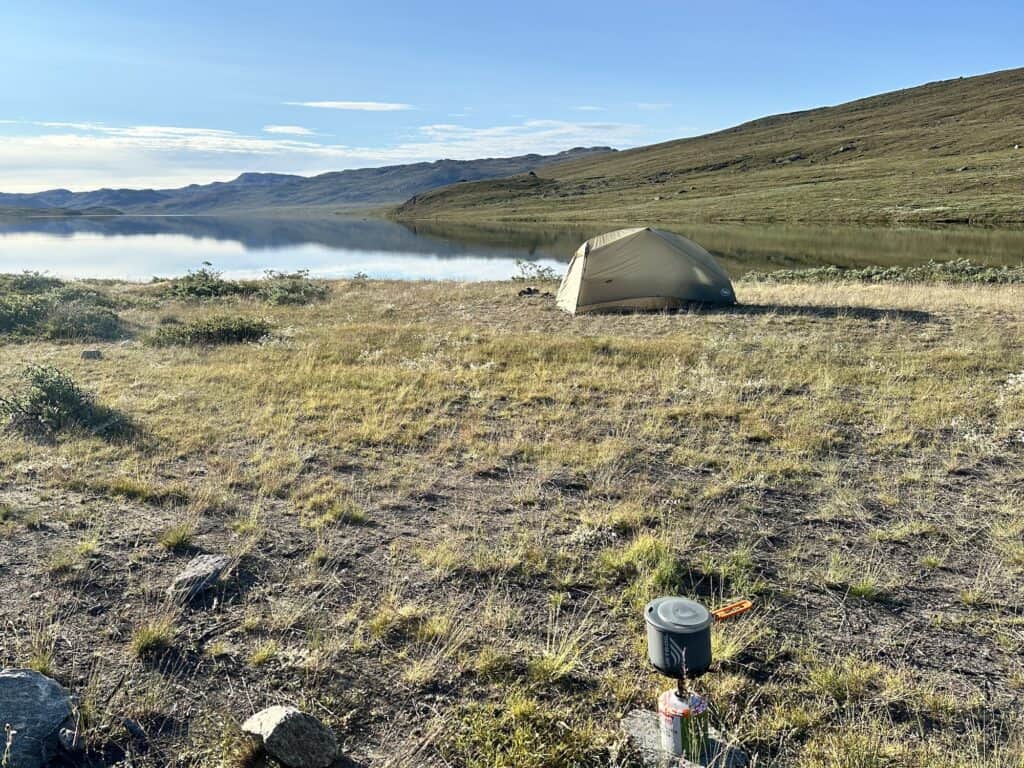
Fortunately, I had brought along my FlipFuel, which allowed me to consolidate gas from half-filled canisters I found at the Polar Lodge into a standard 250g canister. I highly recommend this smart little device, it weighs almost nothing and is a great way to make use of partially filled gas canisters you find along the route.
Bringing Food into Greenland
You can bring meat and dairy products up to 10kgs per person into Greenland. However, the problem occurs when you need to transit in Europe on your way to Greenland. You are not allowed to bring any meat or dairy products into the EU from a non-EU country. And this now includes the UK.
As I have had hiking food confiscated at the New Zealand border when arriving for the Rees Dart and Greenstone and Caples Tracks, I wasn't about to make the same mistake again!
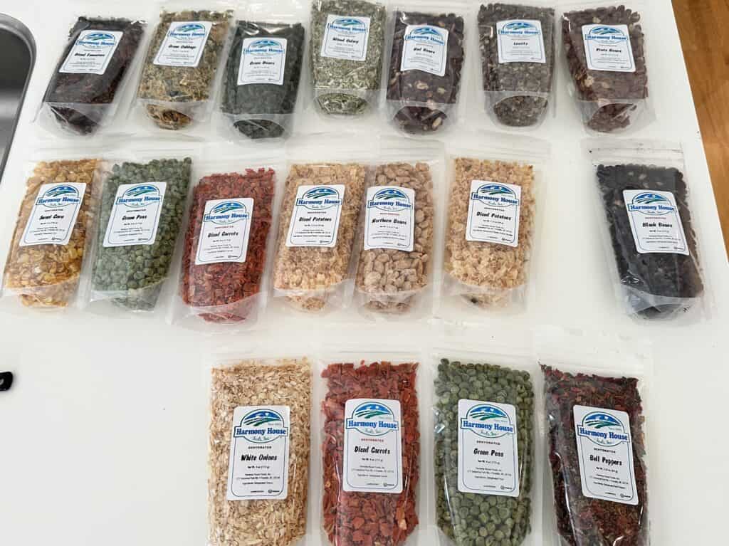
I arrived in Denmark from the USA and brought along the Harmony House Backpackers Kit, as I was keen to try it out. It was really amazing and I totally recommend it. 18 pouches of vegetables and legumes, are included, which amounts to 70 servings of vegetables. I stocked up on protein, rice and couscous in a Danish supermarket.
Signage
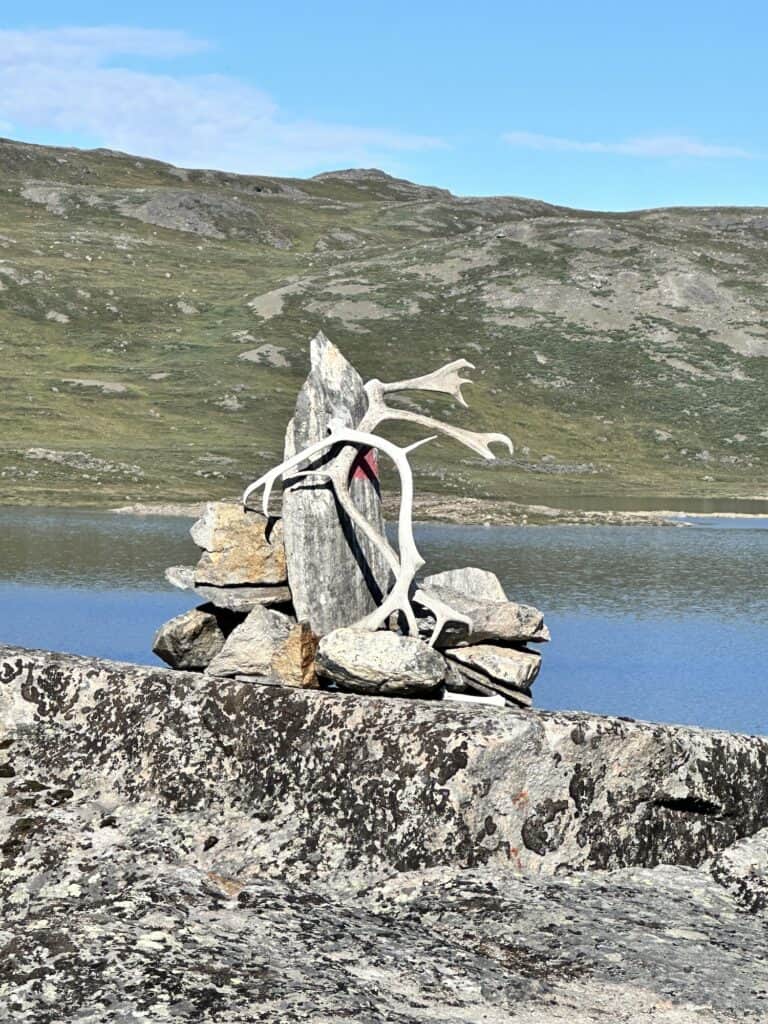
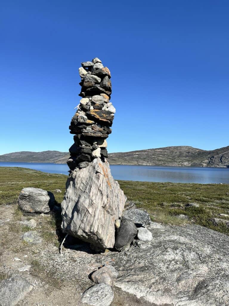
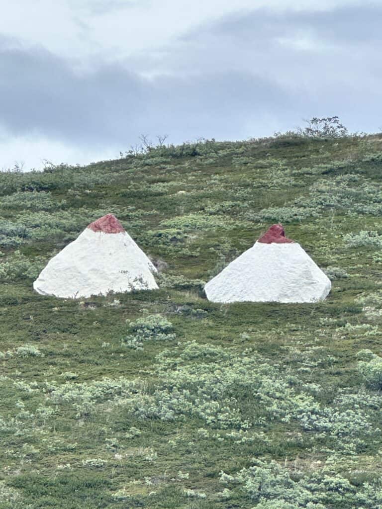
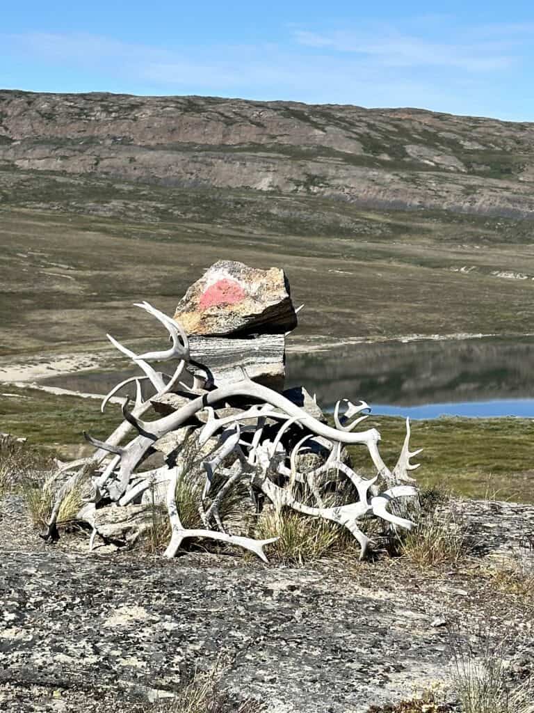
The Arctic Circle Trail is marked by cairns, often made of rocks and occasionally adorned with deer antlers. They are really quite cool, and my photo-feed is full of these cairns against an amazing backdrop, usually a lake.
The cairns are fairly easy to spot and are usually splashed with a bright red or orange paint stripe.
This region has been a significant Inuit hunting ground for more than 4,200 years, with archaeological evidence of ancient settlements and seasonal hunting camps. Some of the larger stone cairns along the route date back to these ancient times, and it is strictly prohibited to alter, add to, or remove them.
Trail Conditions
Generally the trail is fairly easy to follow. As it's an age old trail used by locals for hundreds of years, the trail is well worn – in sections.
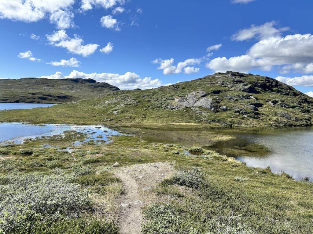
However run off from snow melt and glacial streams can cause insane bogginess. And I'm not talking about the odd wet area – at some sections the boggy ground can last for up to 2kms. In the first section between Kelly Ville and Kattifik it's almost like you are walking through a river in some sections – especially one area where two lakes meet.
I hiked the trail in 2024, when it was said to be way drier than previous years. As the days wore on, the heat of the polar sun dried the tracks of mud – however the boggy areas caused by snow melt and glacial streams remained boggy.
It's in these boggy or wet areas that it can be possible to lose the track. If the track isn't absolutely apparent, check your location and try and get back on track as soon as you can. As the Arctic Circle Trail has little or no trees and the hills can appear to be quite similar, sometimes you get the feeling that you are devoid of landmarks to orientate yourself.
Camping and Huts
There are 9 official huts along the route. Some are no more than a one room with a shared bunk, and a couple such as the Canoe Centre are more elaborate with separate sleeping areas. Each hut is surrounded by ample flat, dry ground, perfect for pitching a tent.
The huts cannot be reserved and are on a first come-first served basis. However, if a hut is “full” and the weather and temperatures outside are extreme, those already in the hut must allow newcomers in. That said, you need to carry a tent that will withstand the weather and temperatures you will face.
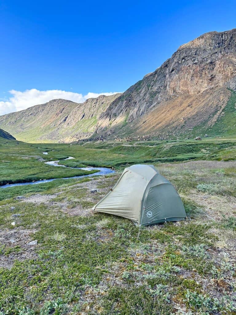
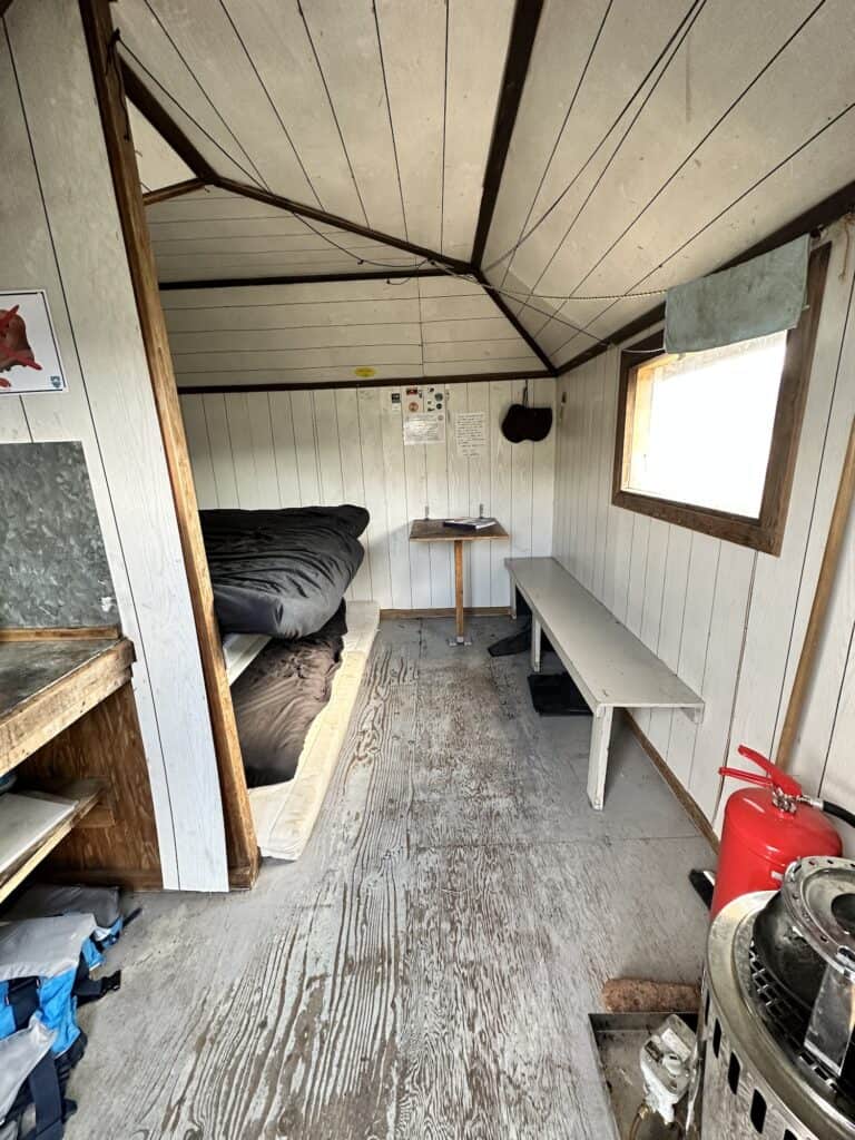
I'm a tent girl, and will always choose my tent over a hut, as I find I get disturbed through the night easily. However the 24 hour sun really did affect me on the Arctic Circle Trail, and I found it hard to sleep in my tent due to the light.
For the first time in my hiking history, I chose huts over tents. Luckily as it was “glorious weather”, everyone else chose tents over the huts, so I was left to my own dark sanctuary.
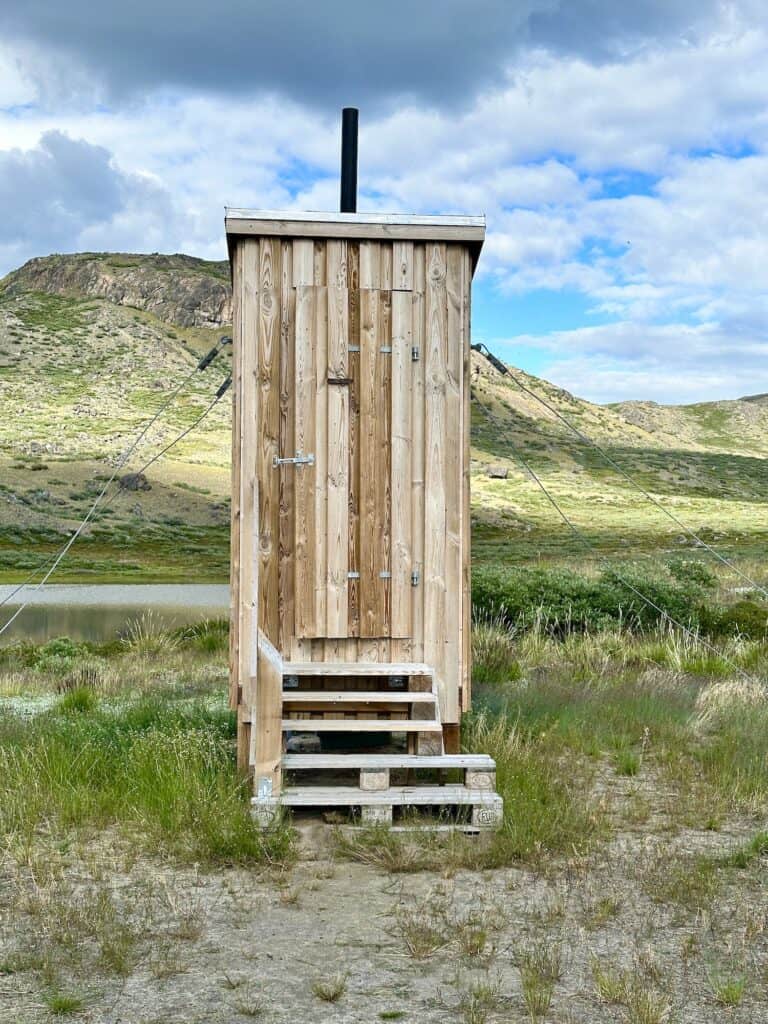
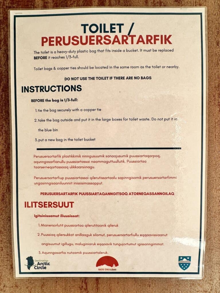
The cleaning of the huts is the responsibility of the users, which means evertone must clean up after themselves. This includes emptying the toilet in the huts which have them. The toilets are dry toilets, which means there is no plumbing or flushing system.
A plastic bag is placed inside the toilet and once 1/3 full, the plastic bag needs to be emptied. There are special bins allocated for the full bags. Please see image below for the full description on how this works.
Wild camping is permitted anywhere, however it can be limiting in terms of flat and dry ground.
Best Time to Hike the Arctic Circle Trail
Summer (Mid-June – Late-August)
Summer is hands down the most popular time to hike the Arctic Circle Trail, with July and August being the busiest months. It’s easy to see why:
For starters, there’s loads of daylight. Around June 21st, the sun doesn’t actually set along the Arctic Circle. From early June to mid-July, you’ll have 24 hours of daylight, and even by late August, it never gets completely dark. If you’re someone like me, who struggles to sleep if it's not completely dark, definitely pack an eye mask.
The temperatures are usually pretty comfortable too. Bluebird skies with the polar sun does mean you will need good sun protection, and generally you can expect it to hover between 0°C at night and up to around 17°C during the day.
That said, the weather can be unpredictable—I went from hot polar sun (35°C) for the first 5 days, then experienced cooler temps around 15°C and light rain, to -10°C snow! Adding to that, the wind chill can make it feel a bit colder, so make sure you’ve got the right gear for all scenarios.
Summer is also the time when Greenland’s plant life really comes to life. Despite the lack of trees, there’s an amazing variety of wildflowers, plus edible treats like mushrooms. I collected mushrooms as I walked the trail and either ate them raw as a nutritious snack, or added them to my evening meal.
And if you’re into birdwatching, this is the season to keep your eyes peeled. While you can spot most of the land animals year-round, summer brings a burst of bird activity that’s hard to miss.
However, be prepared for swarms of Arctic mosquitoes and flies from mid-June to mid-August, and the terrain will be boggy with the run off from the melting glaciers, especially earlier in the season.
Autumn (Late August – Late September)
I am told that few hikers get to experience the Arctic Circle Trail in autumn, which may be due to the European summer holidays coming to a close. However reading reports, it sounds like the landscape is quite breathtaking. Plus the summer insects are reportedly almost nonexistent.
The temperatures drop significantly (expect overnight lows around -10℃) and snow becomes more likely, especially in September. However, considering I experienced snow in July, nothing would surprise me.
I've read the vibrant autumn colours are insanely gorgeous at this time. Though the wildflowers have faded, the Arctic landscape is still alive with colour, with the rich reds and burgundies of Arctic Willow and Dwarf Birch.
As well, by September, the nights are finally dark enough to witness the mesmerising northern lights. Almost nightly, you could catch a glimpse of this Arctic wonder, with the intensity and colours varying depending on the solar wind.

Pack Light, Pack Right – Free Interactive Checklists
No More Overpacking. No More Forgetting Essentials.
Our free interactive packing lists help you pack methodically and remember everything. Add notes, quantities, save or print, and share with hiking partners so everyone knows what’s covered and what they need. Works on any device.
Available for multi-day wilderness camping, hut-to-hut hikes, and inn-to-inn walks, with new lists added frequently.
Leave No Trace
Huts on the Arctic Circle Trail that are accessible by ATVs can only be reached during the winter. Transporting garbage back to Kangerlussuaq or Sisimiut is incredibly difficult because ATVs are small vehicles, and the remote trail is long and arduous. That’s why it’s crucial to pack out all your garbage, including toilet paper.
It was kinda sad to see some parts of the trail littered with toilet paper. If you need a refresher on toilet responsibly when on the trail, be sure to check out our in-depth guide on how to go to the toilet when hiking.
Emergency Rescue and Precautions
Every year, ill prepared hikers are rescued off the track. The majority of the reasons for evacuation in 2023 could well have been avoided and include: blisters, not enough food, set device off by accident, and too cold. Only one rescue in 2023 involved a hiker who was actually injured enough to warrant the rescue with a badly sprained ankle.
Limited Emergency Resources in Greenland
Greenland faces a significant challenge in its emergency response capabilities, with only one helicopter available for the entire country. To put this in perspective, imagine having just one helicopter to cover the entire state of Western Australia or the entire East Coast of the USA.
This helicopter is crucial for emergencies involving the local Greenlandic population, including fishermen, hunters, and others in remote areas. Using this limited resource for non-emergencies can strain the system and potentially delay life-saving rescues for those in critical situations.
This is why the Arctic Circle Trail organisers stress that visitors planning to hike the trail are well-equipped and experienced enough to handle such a remote and challenging trek.
Essential Equipment for Safety
When hiking in Greenland, it's essential to carry a 2-Way Satellite Emergency Notification Device (SEND). This device allows you to communicate directly with emergency services, helping determine whether your situation requires immediate rescue or if you can wait for assistance at a more accessible location, such as the first inlet near Sisimiut where you might be picked up by boat.
Previously, Arctic Circle Trail organisers rented out Personal Locator Beacons (PLBs), which are one-way communication devices. However, these are now expired, and hikers are strongly advised to bring their own two-way emergency communication devices.
I personally recommend the Garmin Inreach Mini, which not only allows you to contact emergency services but also lets you stay in touch with friends and family during your trek.
For more information on the difference between a
Personal Locator Beacon (PLB) and a Satellite Emergency Notification Device (SEND),
check out our article on First Aid which covers these in detail.
Importance of Emergency Rescue Insurance
Having emergency rescue insurance is crucial. A helicopter rescue in Greenland can cost thousands of dollars, and it's vital to ensure you're covered. Garmin offers emergency rescue insurance, but it's important to note that their coverage typically only includes transportation to the nearest hospital.
For more comprehensive coverage, I highly recommend Global Rescue. Unlike other policies, Global Rescue has no restrictions on activities or elevation, meaning they will rescue you from anywhere, whether it’s the peak of Mount Everest or deep within the Amazon rainforest. They will also repatriate you to the country of your choice, a service not covered by Garmin's insurance.
Why I Choose Global Rescue
I rely on Global Rescue for all my hiking activities because 95% of travel insurance policies don’t include emergency rescue. While many travel insurance companies offer Emergency Assistance, this is often a broad term that typically involves coordinating medical help or repatriation through call centres, rather than providing direct rescue services.
Emergency rescue is about getting you from the point of injury or distress to a hospital. Think of it as a wilderness air ambulance, complete with specialised teams trained to handle the unique challenges of remote rescues.
Having worked for an Emergency Assistance company that provided services for travel insurance companies in the past, I cannot stress enough the importance of having proper coverage if the unexpected happens. Being prepared with the right equipment and insurance can make all the difference in ensuring your safety on the Arctic Circle Trail.


Greenland Wildlife
Greenland's wildlife is renowned, with the polar bear being the most famous. While these iconic animals are typically found in the northern regions on the ice shelf, far from the Arctic Circle Trail, sightings are rare, and the chances of encountering one on your hike are extremely slim. If a polar bear is sighted, locals and hunters will drive it north.
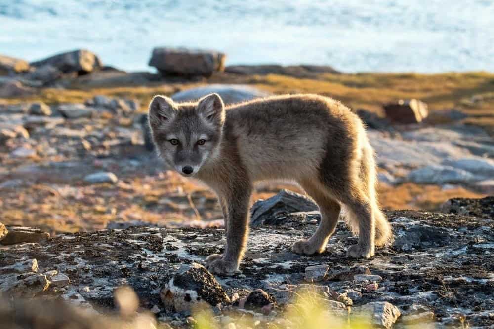
Arctic foxes, though small and sometimes seen darting across the tundra, are an adorable yet resilient part of Greenland’s ecosystem. They’re biologically able to carry the rabies virus, but there have been no reports, so the risk remains minimal.
The rest of Greenland’s wildlife, though sparse, is captivating. One night I stepped out of my tent at midnight (when it was still light) and found a reindeer grazing right beside my pack. It just looked at me and then carried on as if this was an everyday occurrence.
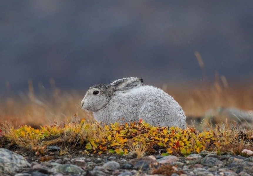
I also spotted an Arctic hare from a distance, a small, white blur darting across the tundra. Greenland, along with the Canadian Arctic, is one of the few places where you can witness these elusive hares in their natural habitat.
Other common animals on the tundra include musk oxen, which resemble small bison but are actually related to the goat family. After my hike, I had the opportunity to taste musk oxen, which had a flavour reminiscent of wild sheep.
One of the striking aspects of Greenland wildlife is the absence of bird song. With no trees on the tundra, only a few bird species live close to the ground. It might take you a few days to realise that the peaceful silence around you is partly due to the lack of birdsong, a unique feature of Greenland's remote wilderness.
Arctic Circle Trail Sections
|
Kangerlussuaq – Kelly Ville: |
23 kms |
|---|---|
|
Kelly Ville – Kattifik: |
17kms |
|
Kattifik – Canoe Centre: |
20kms |
|
Canoe Centre – Ikkattooq: |
22kms |
|
Ikkattooq – Eqalugaarniarfik: |
11kms |
|
Eqalugaarniarfik – Innajuattoq: |
19kms |
|
Innajuattoq – Nerumaq: |
16kms |
|
Nerumaq – Kangerluarsuk Tulleq: |
17kms |
|
Kangerluarsuk Tulleq – Sisimuit: |
20kms |
Kangerlussuaq – Kelly Ville
If you’re starting your hike from Kangerlussuaq, be aware that the road to Kelly Ville, where the trail officially begins, is mostly unpaved. This road also doubles as the main route to the harbour where tourist boats and supply vessels dock. Beyond the harbour, the road narrows, serving just a few scattered houses.
When I arrived in Kangerlussuaq, my goal was to hit the trail immediately. After some hunting around for gas, I could only find large canisters. Unfortunately, I didn’t have any room for the larger size in my pack, but I managed to scrounge a few half-empty canisters from the Polar Lodge and using my FlipFuel, filled up my preferred 250g size to take with me. I had calculated the amount of freeze dried food vs ready to eat, and I knew 250g would be the perfect amount to carry.
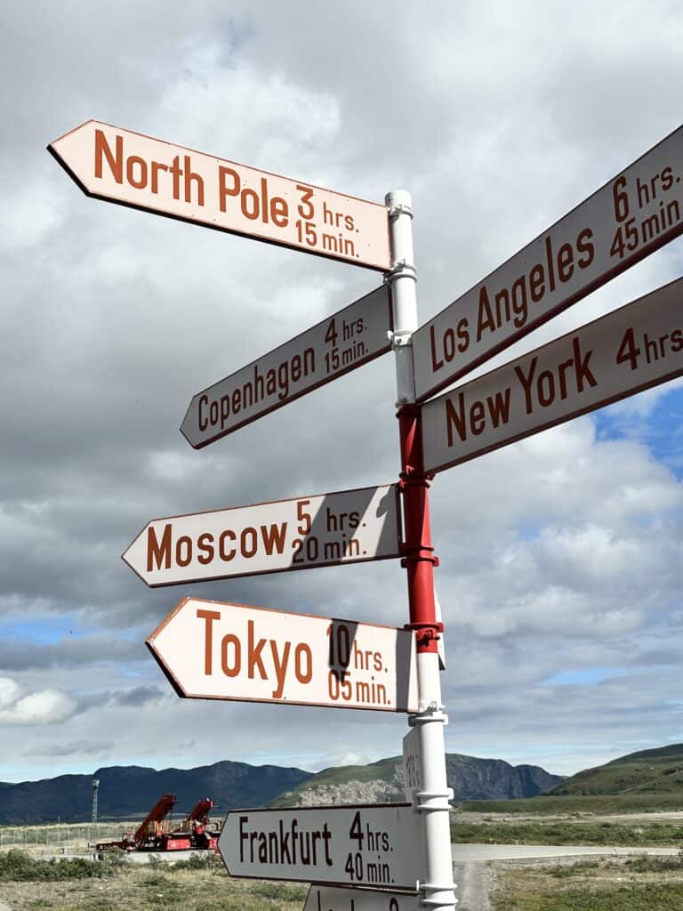
You can book a ride to Kelly Ville, where the trailhead officially starts, but the shuttle leaves at 10am daily—less than ideal for those arriving on the daily flight from Copenhagen. On the plus side, it gives hikers a chance to reach Kattifik on the first day.
Eager to get on the trail, I started walking along the road, but soon stuck out my thumb at the first car that passed by. Luckily, I caught a lift to the turnoff for Kelly Ville, happy to have avoided 20 kilometers of road walking. Not long after, another car came by and took me right up to Kelly Ville.
As it was around dinner time by now, and I was feeling a little jet-lagged, I walked along the ATV track until I got to the official turnoff of the Arctic Circle Trail, pitched my tent and ate dinner listening to the absolute silence. My first night in Greenland – pretty magical.
Like This?
We'd love you to share this great guide!
Kelly Ville – Kattifik
The first day on any trail in a new country is always full of wonder—the smells, the flora and fauna, the subtle cultural differences, and the overall vibe can be quite mesmerising. Today was no different.
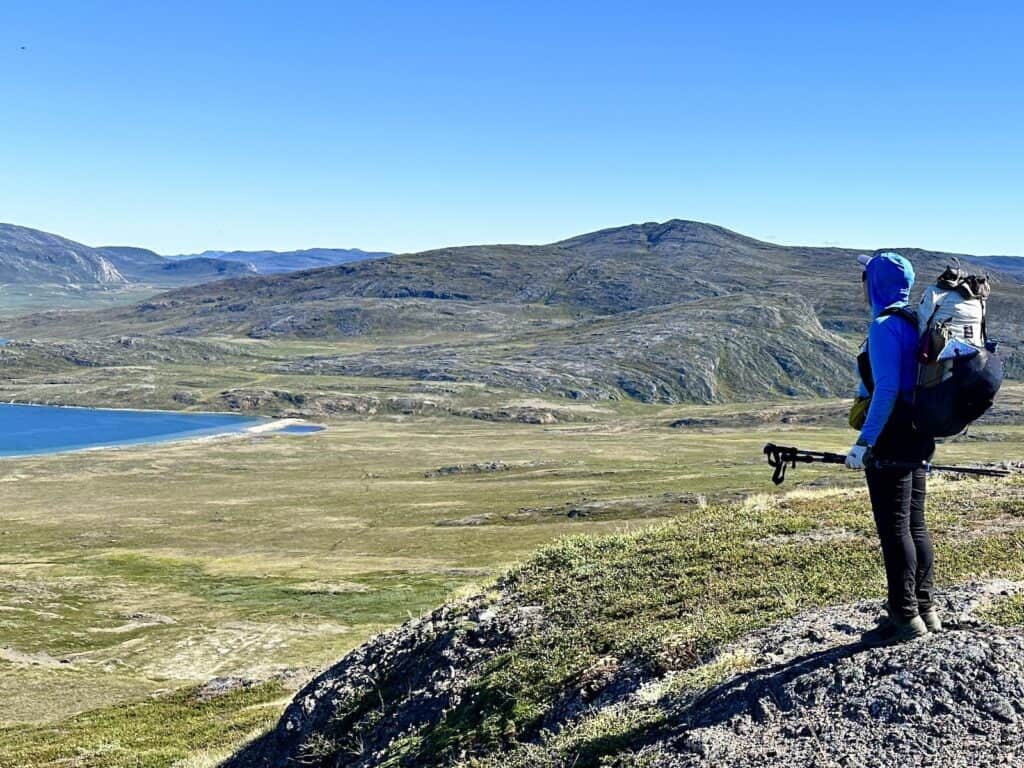
As I passed by cairns backdropped against jaw-dropping blue lakes and green mountains, I remember thinking how easy this hike was! Yes, the first day of the Arctic Circle Trail is easy, elevation-wise. Until you come to the water that is.
Knowing this part of the trail would be wet, I had packed hiking sandals specifically for the occasion. I wasn’t wrong—the trail was incredibly boggy, with water sometimes reaching up to my shins. But under a bluebird sky with the sun beating down, wading through the rivers was actually cool and refreshing on my feet.
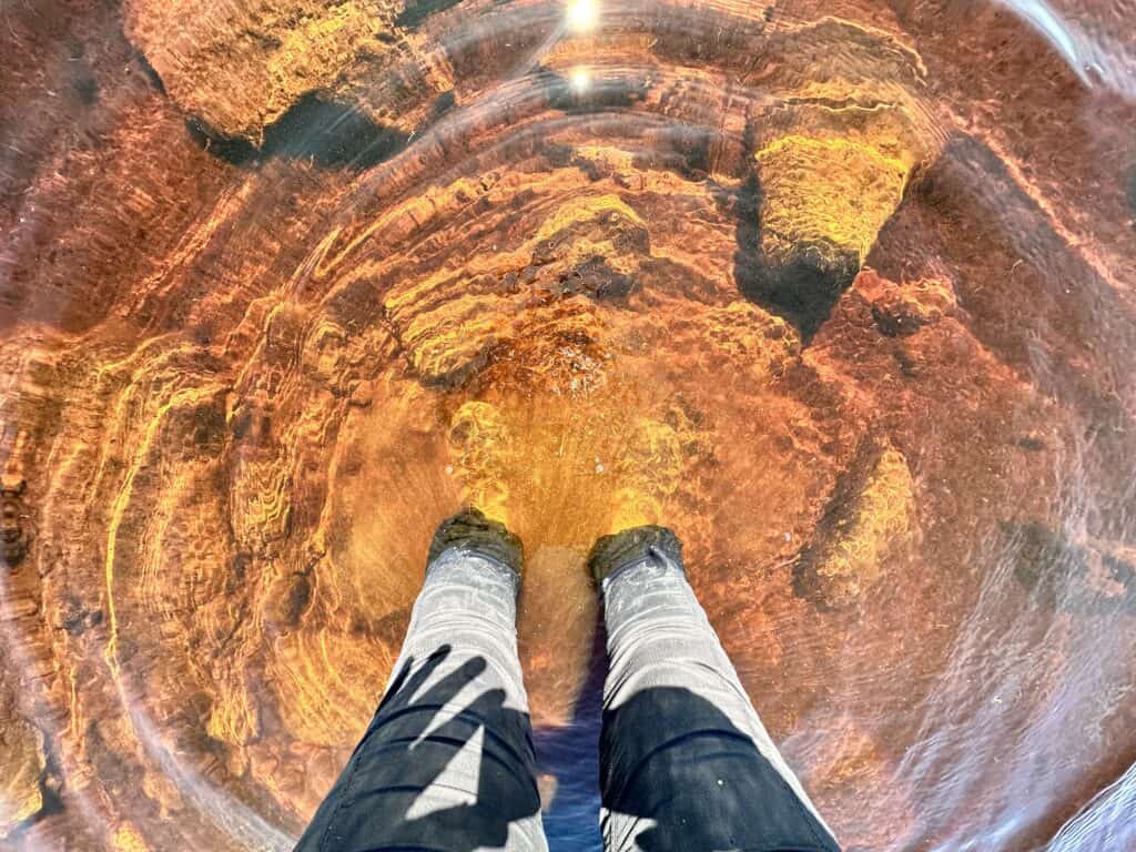
I recommend bringing water shoes for this section, as the water can get quite deep and will easily flood over the tops of your boots. Alternatively, trail runners that dry quickly are a good option, but you might run into trouble if the weather turns and you encounter snow later on. So take that into consideration before choosing your footwear.
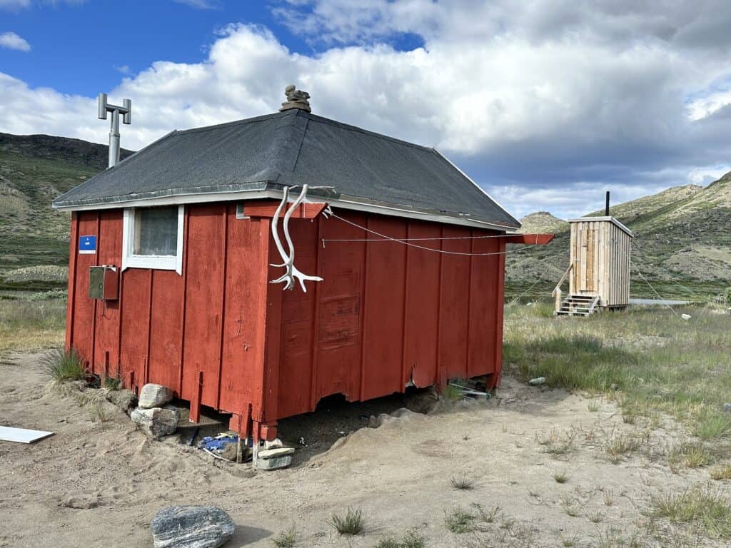
Kattifik Hut is perched right on the shores of Amitsorsuaq Lake, with a lovely grassy area outside. The hut has a separate toilet is a little ways away. It’s also the spot where you can either canoe to the canoe centre or walk the length of the lake to get there. A couple of people were camped here, patiently waiting for a spare canoe to make its way down from the western end of the lake.
Kattifik – Canoe Centre
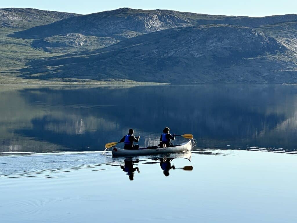
To get to the Canoe Centre from Kattifik, you have two options: paddle across Amitsorsuaq Lake using one of the available canoes, or walk the length of the lake. When I set out that morning, there weren’t any canoes available, and to be honest, I wouldn’t have been able to paddle the entire length on my own. I know my limits, and I four hours of paddling would’ve been too much for me.
I started my hike around lunchtime, after sleeping in a bit—still feeling the effects of jet lag and struggling with the 24-hour sunlight. The trail follows the southern shore of the lake and is relatively easy, with just a few boggy spots that aren’t too major. I’d heard about the boulders you have to climb over, but they weren’t as challenging as I expected. The lighter your pack, the easier it is to manoeuvre over them.
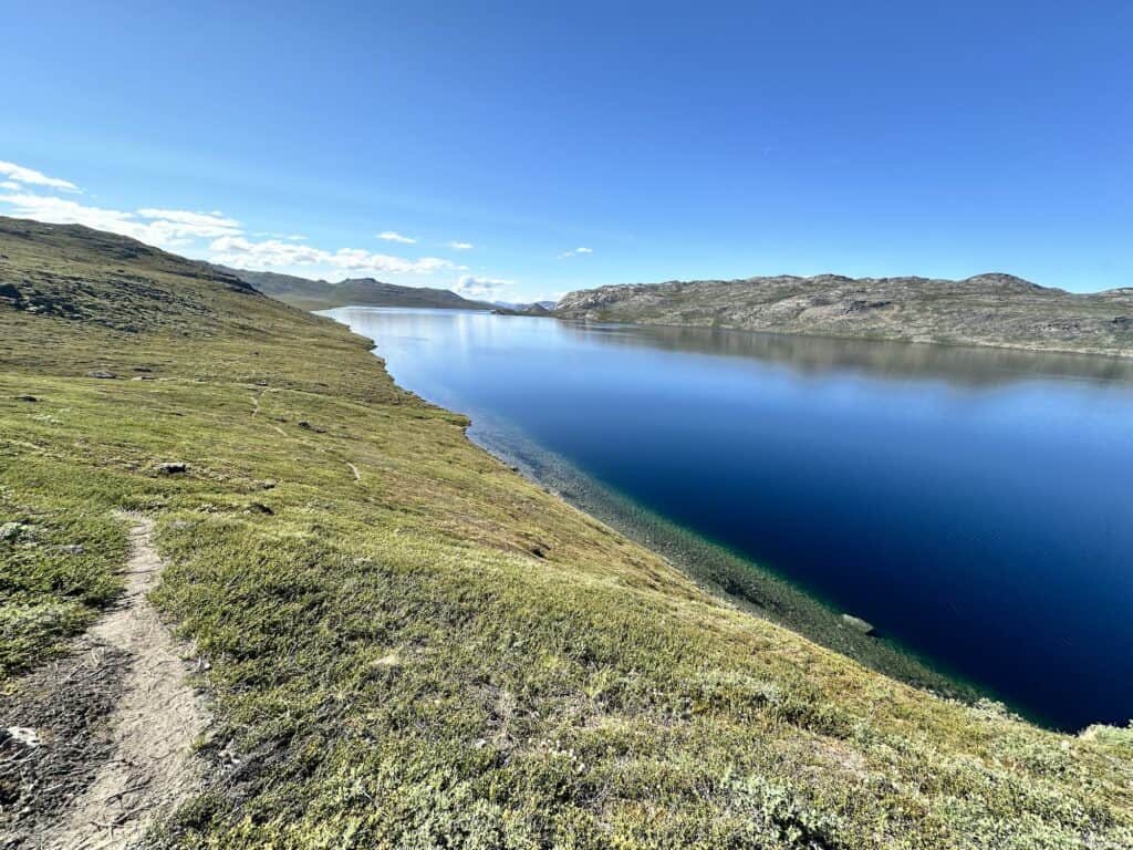
The jet lag really hit me that day, so I decided to take it slow. I stopped halfway for a swim, then lay down in the sun and ended up taking a nap. When I woke, I decided to set up my tent and just enjoy a relaxed day. I’m glad I did—it was really nice. Around midnight, I woke to find a reindeer grazing peacefully beside my tent under the midnight sun. It was a truly magical moment.
The next morning, I set off to the Canoe Centre and arrived by late morning. The centre is quite spacious, with two bunkrooms, each with about six beds, and another six beds in the main room. It turned into a social evening as hikers heading eastbound and westbound gathered.
The Canoe Centre is where you fill out the registration form that helps the trail organisers keep track of the number of hikers, which direction they’re heading, and other pertinent information. This data is vital for securing funding and planning maintenance on the trail, so please take the time to do this – even if you are planning to camp further on.
Canoe Centre – Ikkattooq
If you're looking to break up this section, there's a lovely beach about halfway that makes for a great camping spot. I stopped here for lunch, and lay in the sun for a while —those midday naps were becoming a bit of a habit!
After lunch, the trail took me on a steady climb that seemed to stretch on much longer than the elevation map suggested. Eventually, the ascent plateaued into a rocky path leading to Ikkattooq Hut. This small, one-room shelter has a couple of bunks, and while the lake is just a short walk down a steep path, the best spot to wash up is in a small stream off to the right.
It had been a long day, and a blister on my heel had gotten pretty bad. After tending to it, I was more than ready for a much-needed early night.
Ikkattooq – Eqalugaarniarfik
The section between Ikkattooq and Eqalugaarniarfik is renowned as the hardest, even though it’s the shortest. It includes 2 to 3 kilometers of flooded terrain, plus the infamous river crossing.
The first part of the section is a steep descent down the mountain. It’s relatively easy, especially with trekking poles, and the path is dry. However, once you reach the valley, things change drastically. Traversing across the valley towards Itinneq River is boggy, wet, and can feel never-ending.
When you reach the Itinneq River, you have two options: cross where the path meets the river, or continue downstream to find the bridge. If you're hiking eastbound, it's easier to spot the bridge, while it's more challenging heading westbound.
Pack Light, Pack Right – Free Interactive Checklists
No More Overpacking. No More Forgetting Essentials.
Our free interactive packing lists help you pack methodically and remember everything. Add notes, quantities, save or print, and share with hiking partners so everyone knows what’s covered and what they need. Works on any device.
Available for multi-day wilderness camping, hut-to-hut hikes, and inn-to-inn walks, with new lists added frequently.
The river can be quite swollen in June and into July, so if you’re inexperienced with river crossings, it’s a good idea to wait and cross with another person. I ended up crossing about 20 meters downstream from where the two paths meet. Having some knowledge of river crossings and knowing where to choose your crossing point is highly beneficial.
After successfully crossing the river, the path leads you down the valley to Eqalugaarniarfik Hut. The closest water source to the hut is about 200 meters away, but there’s a lovely pool at the ATV crossing, perfect for a much-needed dip. On this day, the temperature soared to 38°C, and coupled with the polar sun, the cool water was pure bliss.
I ended up staying an extra day at Eqalugaarniarfik to give my blister time to heal.
Eqalugaarniarfik – Innajuattoq
You literally follow a string of lakes on this section and it really is beautiful. There is a slight incline at the start of the trail, but nothing to write home about.
For me, the weather was much cooler and it made such a difference. At this point, you can tell you are getting closer to the coast with the cooler temperatures and the view of the higher snow covered mountains. It certainly made it easier to sleep!
There are two huts to choose from and they are only 500 metres apart. The first hut you come to, perched on a hill, is tiny with just one bed. The second is on the banks of a large lake and is larger with a separate sleeping room with 6 beds, and two in the main room.
Innajuattoq – Nerumaq
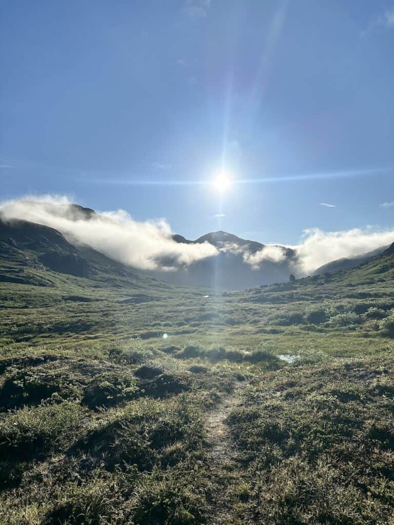
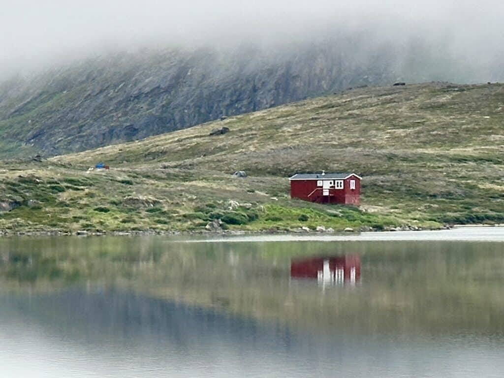
By this point in the journey, the mornings began to greet me with a blanket of fog which was a refreshing change. The way the fog hung around the lake and those little red huts made everything look quite magical. It usually lifted around 10 a.m., which coincided with the timing of the first departing flights out of Sisimiut—seems like that’s just how the fog works around here.
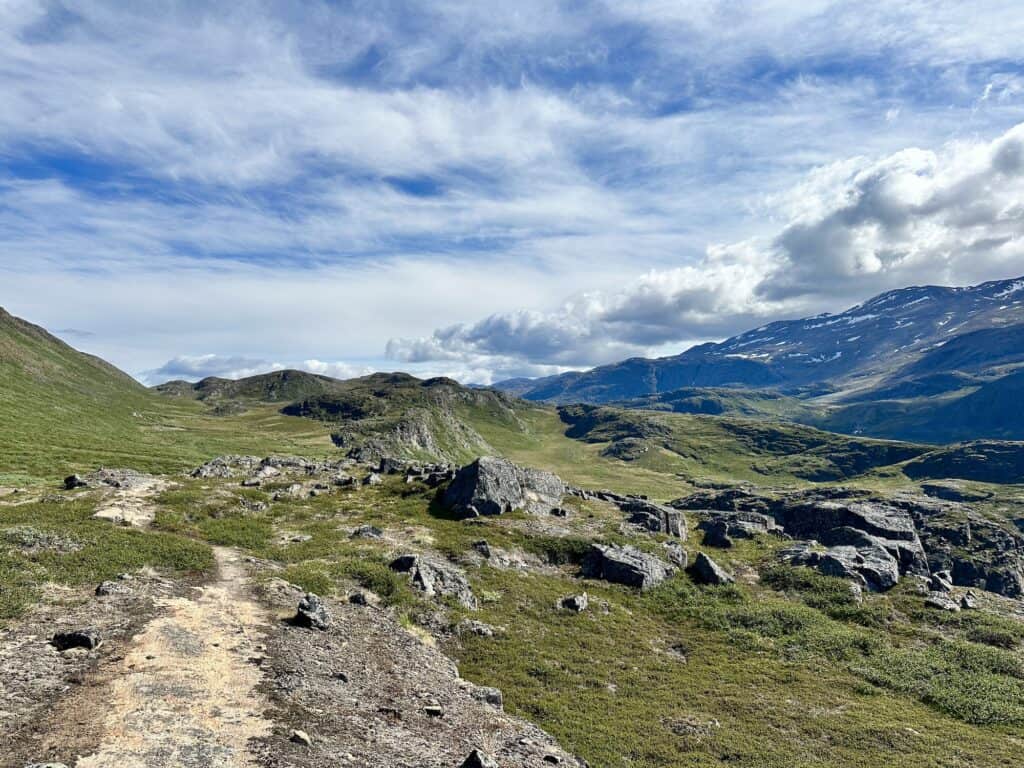
There’s a slight climb before you reach the pass, followed by a nice couple of hours walking down the valley. Once you descend, you’ll come across a river at the base of the valley. Stay on the left-hand side, and the path will lead you to Nerumaq, which is in a gorgeous location. The hut is surrounded by the curve of the river, so you can peacefully sleep with the sounds of the water nearby.
The hut is just one room with two sets of bunks. There is no toilet at this hut.
Nerumaq – Kangerluarsuk Tulleq
The temperature dropped quite a lot today, and the fog made coming down the valley look quite dramatic. Once you reach the base of the valley, you’ll need to cross a river a few times, plus there are multiple boggy areas that just can't be avoided. During a rainy period, the track here would become extremely muddy.
Eastbound hikers I had crossed paths with warned me of light rain in the afternoon, which turned up right on cue. By that stage, I'd reached the start of the lake, and it was really quite easy going, despite the cold rain.
Once you get to the western end of the lake, you might spot a hut on the hill to the right. I made the mistake of heading up there, seeing a couple of people walking around—only to find out it’s a private hut, all locked up.
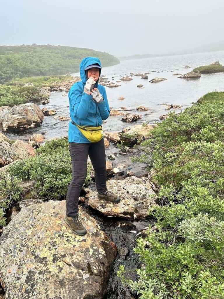
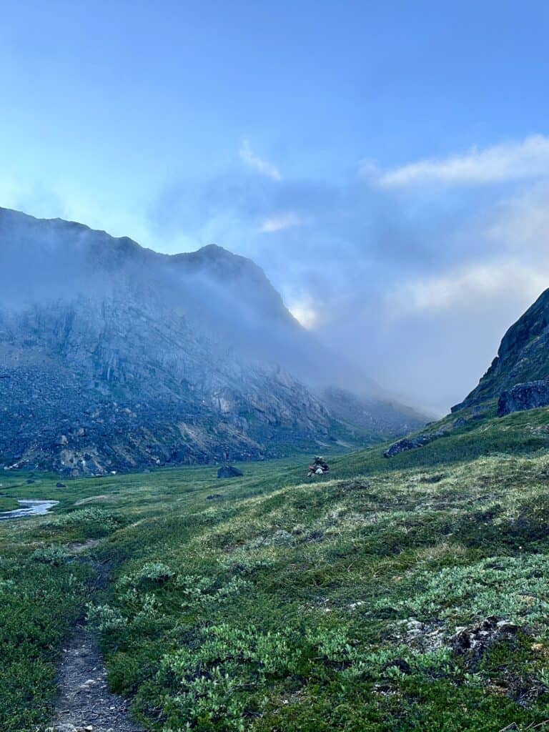
By this time, the rain had set in, and I hurried to the public hut—which, by my calculations, was around 2 km away and took me half an hour. I filled up my 3L Hydrapak at the last stream before reaching the hut, as this was the last water source before the hut, heading west.
Kangerluarsuk Tulleq hut is a small, one-room hut, in the same design as Kattifik. It’s perched on a rock foundation and held down by steel cables. That night, the storm hit, and the little hut was swaying from side to side. “Interesting” is a good way to describe it!
I woke the next morning to the storm still raging, so since I had enough food and was hiking solo, I decided to wait it out for a day in this little hut. With something to read, I settled in, making tea and taking naps.
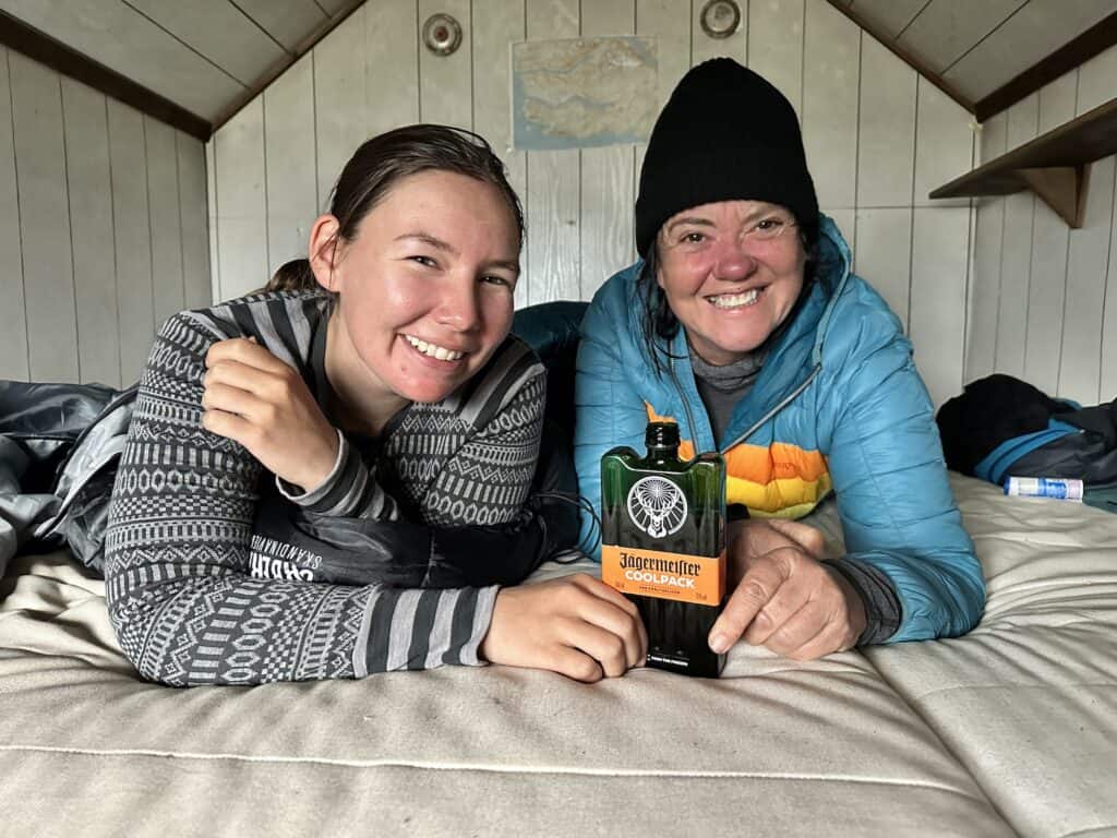
Then, lo and behold, around 5 p.m., the door swung open, and in walked a couple of Greenlandic ladies—with a bottle of Jägermeister in hand! Happy days!
Kangerluarsuk Tulleq – Sisimuit
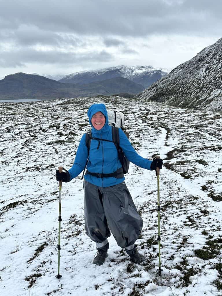
The next morning, I woke to snow! I went outside, and it was absolutely freezing with the wind howling. The two Greenlandic ladies contacted a family member to get an up-to-date weather report. The wind was supposed to die down around 10 am, so we decided to leave together then.
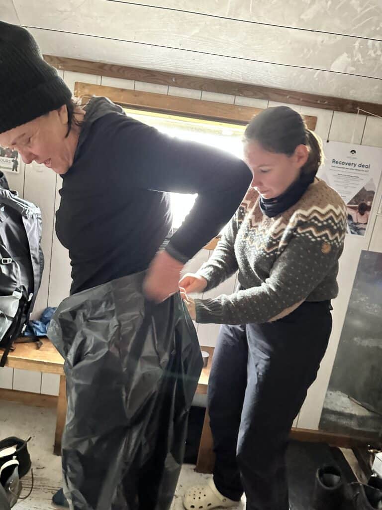
I had made the mistake of leaving my rain kilt in Kangerlussuaq, and one of the Greenlandic ladies didn't have rain pants either, so we fashioned makeshift rain pants out of garbage bags!
A Swiss couple had arrived late the previous night and had set up their Hilleberg expedition tent, but even that had a tough time standing up to the wind. For safety, we all agreed to cross the pass as a group.
The wind did die down around 10, and we set off on a steep ascent toward the pass, navigating several river crossings along the way. These rivers were flowing directly down the mountains, making them fast running and potentially quite dangerous. You had to be really careful—most of them could be crossed on rocks, but if they had been any more swollen, that wouldn’t have been possible.
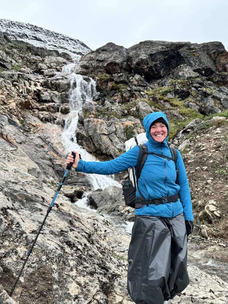
At the top of the pass, the snow was at least 12 inches deep in places. I was glad for the extra company because in places it was quite treacherous, and you really had to navigate the path which was obscured by the snow.
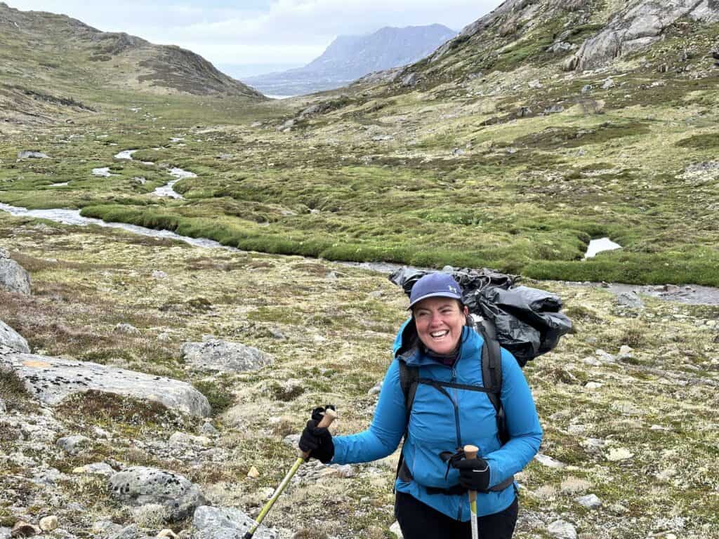
Once we made it over the pass, the snow gave way to a stunning green valley leading down toward Sisimiut. There was one river crossing about 10-12 metres wide that had to be forded; however it was only thigh deep at the time of crossing.
The emerald green valley, surrounded by the snow capped mountains, was an absolutely gorgeous sight and a perfect way to end an amazing hike!
Tours of the Arctic Circle Trail
For tours of the Arctic Circle Trail, I highly recommend Arctic Circle Treks, run by Salik Groenvold, a Greenlandic Kangerlussuaq local who knows and understands the land intimately. He has spent his life hiking, camping, hunting, and exploring the vast area surrounding the Arctic Circle Trail. Salik is always happy to share stories of life in Greenland and looks forward to sharing this magnificent wilderness and his Inuit heritage with you.
As a certified Arctic Adventure Guide and Wilderness First Responder, Salik speaks Greenlandic, Danish, and English fluently. Having lived his entire life in Kangerlussuaq, he possesses a deep connection to the land and culture. Hiking, camping, and exploring the backcountry are integral to his daily life.
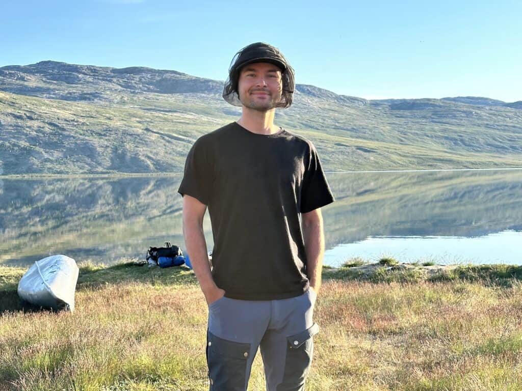
Salik provides guided tours of the Arctic Circle Trail through his company, Arctic Circle Treks. He is the only true local tour operator in the region, offering private group tours that promise an authentic and unforgettable adventure. Contact Salik and Arctic Circle Treks if you’d like to explore the Kangerlussuaq region or the Arctic Circle Trail through the eyes of a local expert.
Arctic Circle Treks
Salik Groenvold
Kangerlussuaq, Greenland
(+299) 223-023
Packing List for the Arctic Circle Trail
The Arctic Circle Trail demands that you be prepared for everything—literally. From scorching polar sun at 38°C (100°F) to freezing temperatures as low as -10°C (14°F), you need to be ready for any condition the trail throws your way. But that doesn’t mean you have to carry everything, including the kitchen sink.
As a lightweight hiker, I managed to pack everything I needed for 10 days, plus some extra food, into my 48L Bonfus pack. Though the 58L version would have provided a bit more room, I prioritise packing light while ensuring I have the essentials to handle any weather conditions.
For a detailed breakdown of what was in my pack, check out my full packing list. Below are my top 10 must-have items for the Arctic Circle Trail.
2-Way Satellite Emergency Notification Device (SEND)
A 2-Way Satellite Emergency Notification Device (SEND) is just a good idea. It's actually necessary. As the ACT is very remote, this maybe your only option to contact emergency services if need be. Even locals carry a two-way emergency device. And if hunters, most know the land intimately.
Two-way devices such as the Garmin InReach Mini are a preferred over one-way devices, such as a personal, locator beacon, as it allows you to communicate directly with emergency services, helping determine whether your situation requires immediate rescue or if you can wait for assistance at a more accessible location, such as the first inlet near Sisimiut where you might be picked up by boat.
Keep in mind, there's only one helicopter serving the entire Greenland region. If your situation isn't truly critical, calling for a rescue could divert this vital resource from someone facing a life-threatening emergency. Make sure your use of emergency services is absolutely necessary, so you're not putting others at risk.
Emergency Rescue Insurance
Emergency Rescue services are known to cost in excess of €40,000. Yes, you read that right!
Many people are under the false impression that travel insurance will cover Emergency Rescue. 95% of the time, it doesn't, and when it does, the insurance often has restrictions based on activity, location, or elevation. For peace of mind, I strongly recommend Global Rescue insurance.
Unlike most other policies, Global Rescue has no restrictions and includes repatriation to the country of your choice. This isn't just a nice-to-have; it's essential for ensuring you're fully covered in case of an emergency.
4 Season Tent
SlingFin Portal 1
I've seen a lot of people with light weight tents on the Trail, including myself. On the last two nights, had I not had a hut to sleep in, I would've been up the swampy creek with no paddle. Not having adequate shelter, during a snowstorm, is a matter of life or death. It really was a wake-up cool for me. However I do not want to carry a 4 kg tent!
I now have a SlingFin, which I will be taking on various alpine hikes from now on. SlingFin tents are known for unparalleled performance in extreme conditions. Engineered with a focus on strength-to-weight ratio, these tents are exceptionally lightweight at just 1kg, yet built to endure severe weather far beyond high alpine environments.
Due to their advanced tensile structures and premium materials, SlingFin tents offer superior durability and reliability, making them an ideal choice for professional hikers navigating harsh and unpredictable terrain.
Like This?
We'd love you to share this great guide!
Waterproof Liner
With a number of river crossings, a waterproof liner it is essential, in case you slip and fall. It will also protect the contents of your pack in foul weather and rain. If your sleeping bag or warm clothing gets wet, you could be at the risk of hypothermia in cold conditions. It is extremely important that you keep your pack contents dry at all cost.
As I have a Bonfus Dyneema pack, if it gets wet, it will dry very very quickly. So there is no need to have a rain cover. I have also seen discarded pack covers littering various trails, where they have blown off – so I'm not a fan. If you have a fabric pack, a pack cover may be neccesary to keep your pack dry – but it won't keep it completely dry.
Mosquito Management
Insect Repellent
Mosquito Head Net
Natural Mosquito Repellent
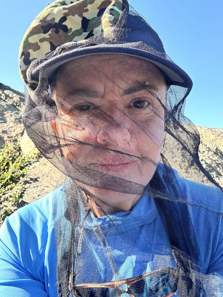
Yep, the bugs are real! I took bands mosquito net and very strong insect repellent. I wore my mosquito net every day, and learnt to eat and drink under it! It's not just the mosquitoes, it's also the small flying insects that have the insane ability to enter your mouth if you mouth breathe!
I did take some coiled stretchy citronella bands I picked up from Amazon – but they were pretty useless, so I wont recommend them.
Water Shoes
Crossing rivers in barefeet is an absolute No-No. It's dangerous as crossing a river barefoot can lead to foot injuries from sharp rocks and hidden debris, and significantly increases the risk of slipping on unstable surfaces. The lack of proper footwear makes it harder to maintain stable footing, raising the chance of accidents.
As you are unable to wear your boots or hiking shoes inside the huts, most Europeans wear Crocs, which double as a water shoe and a camp shoe. If you don't like Crocs, then a hiking sandal might be a better option. For the record, I have both Crocs and Tevas. I'm personally not a fan of crocs, but I will wear them in Europe. It's a kind of when in Rome thing.
Neoprene wet shoes can do as well – however if you arrive at the hut, and they are still wet, it might be a little uncomfortable.
Sleeping Quilt
I switched from a sleeping bag to a quilt last year. A quilt is lighter because it eliminates the extra fabric and down that typically sits under you, which is ineffective since compressed down loses its insulating properties.
I used a Katabatic quilt in a range of conditions, from hot, sunlit nights to -10°C/14°F, and it kept me snug and warm the entire time. Katabatic also offers excellent customer service, making their quilts a reliable and high-quality choice.
R-rated Sleeping Pad
My sleeping pad is a Klymit, and it’s comfortable no matter how you sleep—side, back, or even on your stomach. It’s incredibly durable too; I’ve been using the same pad for three years, and it’s held up through constant use. On top of that, it packs down really small, which is a huge plus. I’ve tried other brands, but this one is my favourite.
Sun Hoodie
A lightweight, moisture-wicking high-performance Sun Hoodie is an absolute game changer in any hot or high UV environment. I was totally protected from the hot polar son the entire time. It was probably the best thing that I took a long on this hike. Coupled with my cap, sunglasses and sun gloves – my nose, lower face, and fingertips were the only parts of me that were exposed to the high UV rays.
Waterproof Gear
Waterproof Jacket
Rain Wrap/Kilt
Waterproof Pants
Being able to waterproof yourself is critical on the Arctic Circle Trail. The weather can change abruptly, and once it starts raining and the wind picks up, temperatures can drop quickly, making it incredibly cold. When you get wet, especially in combination with wind, your body loses heat rapidly, increasing the risk of hypothermia.
Therefore, it's essential to carry reliable waterproof gear. A high-quality waterproof jacket will shield you from rain and wind, while waterproof pants or a rain kilt will keep your lower body dry.
Toilet Kit
The Essential Toilet Kit (DIY)
Pact Outdoors Toilet Kit
You will need a toilet kit. You can either purchase a ready made one from Pact Outdoors, or you can make your own up. Visit our complete guide to Toileting on the Trail to find out what needs to be in your Toilet Kit
First Aid Kit
The Essential First Aid Kit (DIY)
Ready Made First Aid Kit
When hiking the Arctic Circle Trail, you're truly on your own in the wilderness. With no easy access to medical facilities, you're entirely responsible for your own non-emergency medical care. That’s why it’s essential to carry a comprehensive first aid kit that can handle any minor injuries or ailments you might encounter.
While good ready-made kits are available, they may not cover everything you need. I recommend customising your kit with essentials from our DIY First Aid Kit, to ensure you're prepared for any situation.

Interested in
Hiking Safety?
We have a dedicated Hiking Health, Safety and Hygiene Facebook group!
Transport and Logistics for the Arctic Circle Trail
As the main airport is shifting from Kangerlussuaq to Nuuk in November 2024, please be aware that this information may be subject to change.
Flying into and within Greenland
In Greenland, there’s no road network, so traveling between towns means flying. The flights can be pricey for a few reasons. One major factor is that delays or cancellations—often caused by fog at the coastal airports—lead to added expenses, as Air Greenland has to accommodate you in hotels and provide meals. This, combined with the general costs of operating flights in such a remote region, contributes to the higher price.
At the time of writing (and subject to change November 2024), here are your flight options for the Arctic Circle Trail:
Starting the trail in Kangerlussuaq, you can fly:
- Copenhagen -> Kangerlussuaq (Air Greenland)
- Reykjavik/Keflavik -> Nuuk -> Kangerlussuaq (Air Greenland or IcelandAir + Air Greenland)
Starting the trail in Sisimiut, you can fly:
Reykjavik/Keflavik -> Nuuk -> Sisimiut (Air Greenland or IcelandAir + Air Greenland)
Copenhagen -> Kangerlussuaq -> Sisimiut (Air Greenland)
Getting to the Trailhead
Kangerlussuaq: The trailhead in Kangerlussuaq is 23 km from the airport. There are several providers that organise transfers to the trailhead. Alternatively, you can walk or hitchhike.
The providers are:
Albatros Arctic Circle,
Arctic Ice Tours,
Kang Mini Tours.
Sisimuit: The trailhead at Sisimuit is a short walk through the town, heading towards the ATV track. Although it's about a half an hour walk, there is an option to take a taxi as well.
Accomodation in Kangerlussuaq
Polar Lodge
Hotel Kangerlussuaq
Accomodation in Sisimuit
Luggage Storage
You can leave luggage at either airport in the lockers. It costs 10DK per 24 hours – however unofficially, the staff at Hotel Kangerlussuaq advised that the storage time was not monitored. At the time of my trip I left my suitcase in the lockers for just over 10 days with no problem.
Alternatively, you can store your luggage at your hotel. All the hotels understand the logistics of needing storage for non-hiking items, so I have not heard any issues with this.
If you wish to send your items between Kangerlussuaq and Sisimuit, you will need to post them. The Kangerlussuaq post office is located directly opposite the airport terminal, a 2 min walk. The Sisimuit airport is 5 km outside the town, so bear this in mind if you have a connecting flight.
The Arctic Circle Trail A Journey Like No Other
Wrapping up a journey on the Arctic Circle Trail is more than just completing a hike—it's an unforgettable adventure that tests your limits and rewards you with breathtaking landscapes. Whether you're drawn to the challenge of hiking in Greenland’s remote wilderness or the thrill of experiencing the world’s most northern hike, this trail offers something truly unique. Prepare well, pack smart, and embrace the unpredictable weather, because this is one hike that will leave a lasting impression. Happy trails!
Like This?
We'd love you to share this great guide!