
Hiking the Rees Dart Track – Mt Aspiring National Park
The Rees Dart Track is one of the most beautiful hikes in New Zealand, linking two wide glacial valleys in Mount Aspiring National Park, the Rees and Dart valleys.
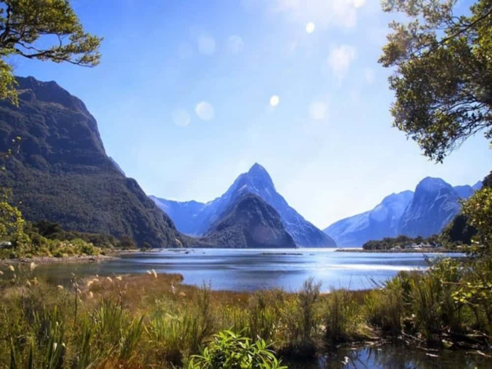
The Rees Saddle separates the valleys, an alpine pass at 1471m with jaw-dropping views down the golden-tussocked Dart Valley towards Mt Edward.
In fact, there are quite a number of jaw-dropping views during the 5-day hike. The Rees-Dart Track has some serious wow factor. Let's check it out!
Quick Links – Main Points Covered in this Guide:
- Map & Profile of the Rees Dart Track
- Supply and Resupply for the Rees Dart Track
- Safety on the Rees Dart Track
- Huts and Accomodation
- Distances between Huts and Side Trips
- Track Notes
- Gear List


This article may contain affiliate links. If you make a purchase using one of these links, we may receive compensation at no extra cost to you. See our Disclosure Policy for more information.
The Rees Dart Track can be walked in either direction, but locals recommend walking the Rees-Dart Track anticlockwise (counterclockwise)—“up the Rees, down the Dart”, so the wind is at your back.
The track traces the Rees River upstream east of glacier-capped Mt Earnslaw/Pikirakatahi, which sits at 2830m, the national park's second-highest peak in the Forbes Mountain Range.
Once the Rees Saddle is crossed, the track follows the Dart River down through the Dart Valley on the western side of the range.
The Rees and Dart valleys are surrounded by towering mountains, and cold air from the Dart Glacier has lowered the tree line in the Dart valley to 900 m.
The beech forest in the Dart Valley contains the southern red beech and was the location for many scenes filmed in the Lord of the Rings Trilogy. Walking through this part of the forest was seriously magical. In fact, the entire Rees-Dart Track is magical.

Trails Worth Writing Home About
Send this on to a mate planning their own tramp.
The Rees-Dart Track – Overview
|
Location: |
Aspiring National Park, Otago, South Island, New Zealand |
|---|---|
|
Distance: |
63 km (40 miles) |
|
Elevation Gain: |
2089 m / 6854 ft |
|
Highest Point: |
1561 m / 5122 ft |
|
Duration: |
4-5 days one way (an extra day for side trips from Dart Hut) |
|
Track Type: |
Point to Point (with trailheads relatively close) |
|
Grade: |
Difficult (Level 4) |
The Rees Dart Track Map and Elevation

Here is a link to a basic Rees Dart Track map from the Department of Conservation (DOC) – it is not to be used for navigational purposes, but to given you an idea of the layout when planning your campsites and itinerary.
I totally recommend taking a compass and paper map (on any remote hike). You can purchase a Rees Dart Track topographic map from New Topo NZ or at any at any DOC Visitors Centre.
If you are unsure about using a compass, I recommend taking a navigational course. Just like first aid, navigation is a good skill to have. If you can't get to an in person navigation course, The Columbia River Orienteering Club has excellent tutorials on YouTube. They also have tutorials on using GPS systems such as GAIA and similar.
As far as an electronic map goes, while I normally use FarOut Guides, they have yet to release the map for the Rees Dart Track Map. I turned to GAIA for my online map for this hike.


Know Before You Go
The Rees-Dart Track Route Description
Mostly unformed track with steep, rough or muddy sections. However, the track is easy to follow, with orange markers on poles or cairns placed in regular intervals.
Trailheads
Muddy Creek Carpark (Rees Track) -42.98567350511446, 164.27606053095346
Chinamans Flat Carpark (Dart Track) -44.65484530427843, 168.31523437288544
The two trailheads are near each other as the crow flies; however, to drive between the two is approximately 70 km round trip. Both valleys are accessed through Glenorchy.
Options and Direction to Hike The Rees-Dart Track
The Rees-Dart Track can begin at either trailhead. There are also side trip options to Cascade Saddle or Dart and Whitbourn glaciers from Dart Hut.
Best time to Hike the Rees-Dart Track
It is best to walk this track between late November and the end of April. Due to significant avalanche risk, the upper Snowy Creek Bridge is removed in mid-May and returned in late spring/early summer.


Supply and Resupply
There are no resupply options available en route.
Supply is better in Queenstown than in the nearby town of Glenorchy. Queenstown has several supermarkets, including a well-stocked Asian grocery store.
Queenstown is the “Adventure Capital of New Zealand” and has several outdoor stores. The best for hiking gear, including dehydrated meals, is Small Planet Sports, which also has a box of free half-empty gas canisters at the door.
Take along your Flip Fuel and make a couple of full canisters from the halfies, giving you free gas plus helping save the environment.
A word about bringing food into New Zealand. New Zealand has strict biosecurity laws, but you will be fine if you follow the guidelines to a T. and declare everything. This is useful for those with dietary requirements or who prefer to make and bring their own hiking food – such as my overnight oats breakfasts.
Water Sources on the Rees-Dart Track
New Zealand spring water is some of the best. Once you are in the national park, there is no livestock upstream, so the water from the numerous streams is pretty much safe.
However, as on all hikes, the decision to treat all water is entirely your own. Further downstream, past the national park borders, the Rees and Dart Rivers run through farmland, and you need to take this into consideration.
All huts have water tanks with a plentiful water supply; again, it is your decision to treat or not. I didn't, the locals didn't, and no one seemed to have any problems.

Safety on the Rees-Dart Track
This is alpine territory, meaning sudden changes of weather can and do happen frequently, so make good choices and hiking out of season should only be attempted by serious hikers.
The hut wardens will receive weather updates daily, report at around 9am each day, and update the info board inside the hut. It's wise to set off after the daily announcement as foul weather approaching could mean another night at the hut base for your own safety.
Mobile/cell reception is nonexistent along the Rees-Dart Track.
Throughout this circuit, there are river and stream crossings that become hazardous in heavy rain or snowmelt. Make sensible decisions about river crossings and have alternative plans. You should carry an emergency shelter on this track – even if you plan on staying in the huts.
I have the MSR Pro for taking wilderness alpine day hikes, but a cheaper option would be the Sol Emergency Bivvy.
Are Dogs and Drones Allowed on The Rees-Dart Track?
Dogs are not allowed. Unauthorised drones are not allowed.
Fees and registrations
No national park fees or registrations exist for this hike, but camping or hut fees apply.


Track Accommodation on The Rees-Dart Track
There are 3 huts on this track, and each hut has a camping area.
The focus in the New Zealand hiking community is on the huts, not the camping, as opposed to Australian or North American hikes, and therefore tent dwellers are the minority.
Campers can use the hut facilities, which are great for interacting with fellow hikers; they're also pretty cosy. Huts on this track have flushing toilets, a kitchen (no stove, BYO), and running drinkable water.
During the high season, there are rotating wardens who are there for general advice and also receive and announce the daily weather and warning reports.
The 3 huts are:
- Shelter Rock Hut
- Dart Hut
- Daleys Flat Hut
Many stay 2 nights at Dart Hut to undertake side trips to Cascade Saddle or the Dart or Whitbourn Glaciers.
The Rees and Dart Track huts are in the “serviced huts” category, and the nightly fee per adult is $25 for hut sleepers and $10 for campers. Book hut and campsites here

Free New Zealand Hiking Packing List
Pack light and stay organised for your next hike on Aotearoa's famous trails. Add notes, save or print, and share with your hiking partners so everyone knows what’s covered. Works on any device.
Wild Camping on the Rees-Dart Track
Wild or Dispersed Camping is allowed in all areas except the fragile alpine and subalpine areas between Shelter Rock Hut and Dart Hut and on the Rees Valley Station.
Cascade Saddle Route Camping
Camping on the Cascade Saddle Route is only permitted near Cascade Creek. Be aware that Kea chew tents and steal people's gear at the Cascade Creek campsite on the Cascade Saddle Route.
Sections and Distances between Campgrounds / Itinerary
|
Muddy Creek to Shelter Rock Hut: |
19km 6 – 8 hours |
|---|---|
|
Shelter Rock Hut to Dart Hut: |
10km 4 – 6 hours |
|
Dart Hut to Daleys Flat Hut: |
18km 5 – 7 hours |
|
Daleys Flat Hut to Chinamans Carpark: |
16km 5 – 7 hours |
Side trips
|
Dart Hut to Dart Glacier (one way): |
7km 2–3 hours |
|---|---|
|
Dart Hut to Cascade Saddle (one way): |
10km 4–5 hours |


The Rees-Dart Track Track Notes
Day 1 – Muddy Creek to Shelter Rock Hut / 19km 6 – 8 hrs


The Rees River
Starting at the Muddy Creek Carpark, I entered the Rees Valley Station and followed the vehicle track alongside the river. The marker poles point across the boggy section beyond Arthurs Creek.
You can see the swing bridge clearly. The Rees River is stunning and was a filming location for the 2018 Mission Impossible movie Fallout.
Rees Valley Station is private land and probably one of the most Insta-Worthy pieces of farmland I've ever laid eyes on.
Mt Aspiring National Park
Once you reach the Mt Aspiring National Park border, you cross a swing bridge into the bush (NZ term for forest), and after the valley floor, the shade of the silver beech trees is a welcome respite.
The track then crosses several gullies with creeks that are classified avalanche paths, which can be dangerous in spring and early summer when late snow may still pose a risk. About 30 min from the bush edge, cross a bridge to the river's east bank to reach the 22-bunk Shelter Rock Hut.
Day 2. Shelter Rock Hut to Dart Hut / 10km 4-6hrs


The Rees Saddle and the Dart Valley
The track really comes into its own on day 2, with the spectacular views back down the heads of both the Rees and Dart Valleys when crossing the Rees Saddle.
It's not far from Shelter Rock Hut that the track starts a steep climb. Leading up to the saddle, the track isn't difficult, there's no boulder climbing, and the track is distinguishable – it's just steep.


Hiking poles would definitely be of assistance if you were hiking this track clockwise. Once at the saddle, the track starts winding its way down the Dart Valley, and it's hard at this point not to keep looking up in awe at the stunning views towards Mt Edward.
Note – The upper Snowy Creek bridge is removed each winter and is returned when the snow clears, which can be as late as December. Check with DOC to ensure the bridge is back in place if starting this hike in early spring.


The Dart Hut
From the bridge, you know you're on the home run, plus it's basically downhill. It's quite a sharp descent to Dart Hut, which is nestled above the Snowy Creek.
Dart Hut is in a spectacular location and not a bad place to spend 2 nights. The camping ground is on the other side of the creek, but check in with the warden first at the hut.
Day 3 Dart Hut to Daleys Flat Hut / 18km 5 – 7 hrs


Cattle Flat
Leaving Dart Hut, the track meanders through a beech forest before opening onto the Dart Valley floor.
This is the start of the 4km Cattle Flat. Cattle Flat is a lovely walk, slightly on the decline and undulating through terraces and gullies.
All the gullies at the time of writing were passable by rock hopping; however, the streams and rivers in this section are known to become impassable during heavy rain or snowmelt.


Around the halfway mark between Rees Dart and Daleys Flat Hut is the Cattle Flat Rock Bivvy (Veints Biv), a large cave-like rock shelter. It has a fireplace and can accommodate 10 or more. The bivouac makes a good lunch stop or emergency shelter.
After Cattle Flat, the track becomes well-marked through the beech forest to Daleys Flat Hut. While the hut is in a gorgeous position on the riverbank, the sandflies can become a nightmare, and even I, a staunch tenter, succumbed to a night of hut sleeping.
Day 4. Daleys Flat Hut to Chinamans Carpark / 16km 5 – 7hrs


Daleys Flat Hut
If you are meeting the Info & Track transport, you will need to leave Daleys Flat Hut by 6am. The track is relatively flat for the first hour before becoming steep and uneven.
Coming down from Sandy Bluff, you enter a beautiful red beech forest with moss-draped branches and ferns covering the ground—woodland paths that were used in scenes from Lord of the Rings.
Friendly native robins cheekily hop around your feet when you stop, hoping for some crumbs. They're adorable!
After descending to Surveyors Flat, the track stays close to the river, and you can witness the jet boats full of tourists in that section of the river – a stark reminder you are entering back into civilisation.
As you climb over Chinamans Bluff, the track then leads you to the Chinamans Flat carpark


Don’t Gatekeep the Good Stuff.
Share this with your hiking crew — or anyone planning a New Zealand adventure!
Transport, Accommodation and Logistics
Shuttle Transport for the Rees-Dart Track
We used Info & Track. They're an excellent shuttle service between Queenstown, Glenorchy and the Rees and Dart, Routeburn, and Greenstone and Caples Tracks.
As we continued with the Greenstone and Caples Track after the Rees-Dart, we got the shuttle as far as Glenorchy. Info & Track also does luggage storage (at their office in Queenstown) and gear rental.
Luggage Storage
As well as luggage storage in Queenstown with Info & Track, you may need storage in Glenorchy, especially if you follow the Rees and Dart Track with the Greenstone and Caples Track or Routeburn and wish to rest in Glenorchy.
We dropped our “street clothes” and additional luggage off at Mrs Woolleys on the way to the Rees-Dart Track, and although we called and confirmed beforehand, they seemed very unsure when we did drop it off.
On our return, we spent one night at Mrs Woolleys and the next at the Glenorchy Hotel, which we preferred WAY better. The owner/manager of the Glenorchy Hotel will take your luggage as long as you're staying on your return. As will the Kinloch Wilderness Retreat.


Vehicle Access and Parking
The Rees track begins 68 km from Queenstown via Glenorchy at the Muddy Creek Car Park. There are fords to cross, so checking forecasts before leaving your car for any extended period is advisable.
The Dart track begins 76 km from Queenstown, again via Glenorchy. A 2WD road extends to Chinamans Bluff. However, this is a fine-weather road subject to washouts and flooded creeks.
Parking is free at both car parks.
Getting There and Away
There are regular domestic flights into Queenstown from Auckland, Wellington and Christchurch. Queenstown is also an international airport serviced by Qantas and Virgin Australia from Sydney, Melbourne, Brisbane and the Gold Coast. Check flights here

Where to stay in Queenstown
Save Your Pennies
Pinewood Lodge and Apartments
Very Good and Won't Break the Bank
Blue Peaks Lodge
Splash Out
The Rees Hotel & Luxury Apartments
Essential Gear List for The Rees-Dart Track
Emergency Bivvy MSR Pro
Those hiking in New Zealand embrace the hut system – and it seems 99.9% of “hut dwellers” don't carry a tent or any type of shelter.
On a hike such as the Rees-Dart Track, there is no shelter between huts and the Rees-Dart Track and many others run through alpine regions or areas where weather can and has changed suddenly.
I found this rather alarming, as hypothermia can set in very quickly. In fact, I remember, as a kid growing up in New Zealand, learning about hypothermia.
Yet few people carry an emergency shelter. An emergency bivvy, weighing only 340 gm, is an essential piece of equipment when hiking in New Zealand and relying on hut accommodation.
Free New Zealand Hiking Packing List
Pack light and stay organised for your next hike on Aotearoa's famous trails. Add notes, save or print, and share with your hiking partners so everyone knows what’s covered. Works on any device.
Pack – Bonfus Framus 48L Ultra 200X Pack
I chose the Bonfus because of the internal frame. Weighing just 450 grams, the Bonfus 48L Framus is exceptionally well made and super strong, using the new Ultra 200X.
Ultra fabrics are likely the strongest, most durable materials on the market, and many ultralight backpack makers are now moving towards Ultra. Plus, Ultra 200X is waterproof.
If you're new to exploring ultra-light packs and notice many are white, which seems odd for a pack about to get incredibly dirty, there's a reason.
Most of the new fabrics used by ultra-light brands (not to be confused with the Ultra fabric) cannot be dyed easily, and if dyed, the chemical footprint is significant. The fabric is so durable; dirt just cleans right off, so the white colour is not an issue.
Bonus packs are minimalist, meaning there are no additional zippers, pockets, bells and whistles. Trust me, you don't need them.
Poop Kit
To help Keep New Zealand Beautiful ,you will need a Poop Kit to practice Leave No Trace Principles. I think “toilet bag” sounds like “toiletry bag”, so I will continue to call it a Poop Kit, which is an Americanism.


Here is a list of what I carry in my Poop Kit
Trowel – The Deuce #2 Ultralight Backpacking Trowel
Toilet Paper – I like to use Who Gives a Crap. I roll up small amounts of paper in “mini-rolls” and carry these in my kit.
Bags to Pack Out T-Paper – Lux & Bones Eco Poo Bags
Pee Cloth OR – Kiwi Ultralight Bush Cloth
Female Urination Device (FUD)* – pStyle – Recycled Ocean Plastic
Hand Gel – Sea to Summit Hand Sanitiser
Pouch for toilet stuff – Hilltop Pack Zipper Pouch – Yellow Poop Kit
If you are sleeping in the hut or your tent, being comfortable at the end of the day is pure magic. Here are my top choices for hut luxury without the heavy load.
Pillow Hyperlite Mountain Gear Stuff Sack Pillow
My waterproof clothing stuff sack that keeps my clothes nice and dry magically transforms into a soft pillow at night. I've tried blow-up pillows, but I find them too hard.
The HMG Stuff Sack Pillow (48gm) has a Dyneema Composite outer and a polar fleece inner. No matter how grubby or damp the outside gets, it becomes a soft cushion to rest your head when the sack is turned inside out. Best hiking invention, IMO.
Sleeping Bag – North Face Blue Kazoo Eco-Down sleeping bag
I liken my sleeping bag to slipping into a soft, warm, weightless cloud. Your sleep system is one of the most important aspects of hiking; after a long day, your body craves warmth and comfort. At just 884 gm, this little beauty packs down into a small compact stuff sack.
EDIT. Since writing this article, I have changed from a Sleeping Bag to a Sleeping Quilt.
Merino Base Layer – XTM Merino Wool Women's Thermal Top
Merino Pants – Icebreaker Merino Crush Womens Pants
I use my Merino thermal top and pants as camp clothes and pyjamas. I bought my Merino pants in Aldi, and they are the best pants ever. Unfortunately, I haven't been to Aldi again during “Merino base layer week”, and I would dearly love another pair. If you ever see them, nab them. They're affordable and good quality. The Icebreaker brand is the closest I can find on the market.
If sleeping in a tent, I would wear my Merino base layers, a beanie, my puffer jacket and my windbreaker draped over the sleeping bag if it's really cold. In a hut, your base layers are all that you need.
Hut Booties The North Face Therrmoball Traction Womens Booties
No boots in the hut means either socks or camp shoes. Why not choose luxury ThermoBall™ Eco, North Face's sustainably-conscious synthetic alternative to down.
These lightweight booties weigh just 214 gms and keep your feet toastie while you relax in the evenings. With a 40% recycled rubber sole for supreme traction, your feet stay dry as you run out to the loo, with little chance of slipping on ice.
Cooker – Jetboil Stash Cooking Pot Camp Stove System
Unlike the huts on the Great Walks, Greenstone and Caples Tracks huts do not have any cookers, so you must bring your own. I use the Jetboil Stash because it's super lightweight, packs really small, and boils just under a litre of water in less than 2 minutes. Perfect for a cuppa on the trail.
Coffee Plunger – Jetboil Silicone Grande Coffee Press
Talking about a cuppa, my morning brew is super important. Just because I'm hiking in the wilderness does not mean I compromise my coffee. Not a chance. The Jetboil coffee press transforms your Jetboil saucepan into a French press, and voila! Damn fine coffee (disclaimer, for damn fine coffee, you will need to buy decent coffee as well).
Final Thoughts on the Rees Dart Track
Arguably, it is one of the most beautiful hikes in New Zealand – without the crowds, without the necessity to book, and without the high cost. It's not a long hike, so it's very easy to combine with other hikes in the area, such as the Greenstone and Caples Tracks.
While I witnessed Kiwi kids hiking the track with their parents (we were all brought up in the outdoors), this hike is challenging and would suit hikers with some overnight or alpine hiking experience.
If You Enjoyed this Guide. – You May Also Like:
- Navigating the Overland Track Solo
- Hiking Frenchmans Cap -Tasmania’s Iconic White Peak
- Hiking the Rees Dart Track – Mt Aspiring National Park
- The Rakiura Track – A Great Walk on Stewart Island
- Traverse Walls of Jerusalem to the Overland Track via Lees Paddock
- Hiking The Tahoe Rim Trail – A Guide for Overseas Visitors
- Conquering the Gold Coast Kokoda Challenge
- Plan Your Larapinta Trail Sections, Best Time of Year, Resupply, and Transfers
- Larapinta Trail Food Essentials and Nutrition Plan
Frequently Asked Questions
Is the Rees Dart track hard?
The Rees-Dart Track presents a true test of endurance over 4-5 days. It's not overly demanding, standing at a Grade 4 level, yet it requires hikers to possess good fitness, backcountry experience, and a plan for unpredictable weather. Sweeping through New Zealand's Southern Alps, the journey rewards with rugged terrain, river crossings, and panoramic alpine passes, encapsulating nature's raw beauty.
How do I get to the Rees Dart track?
To access the Rees-Dart Track, make your way to Glenorchy, the starting point for both the Rees and Dart valleys. Muddy Creek Carpark serves as the beginning for the Rees Track, Chinamans Flat Carpark for the Dart Track. Despite their proximity in the air, driving between them covers a 70 km round trip.
What is the elevation gain of the Rees Dart track?
The Rees-Dart Track in Aspiring National Park spans 63 km (40 miles) across Otago on New Zealand's South Island. It entails an elevation gain of 2089 meters (6854 feet), reaching its zenith at 1561 meters (5122 feet). Typically, the track takes 4-5 days to complete one way, with the option to extend the journey with side trips from Dart Hut.
Is there a bus from Queenstown to Glenorchy?
There is no public transport in the form of regular bus services from Queenstown to Glenorchy. Instead, private transportation options are available, including taxis, which may cost around $120 NZD, and shuttle services provided by private companies such as Info & Track. It's important to arrange these services in advance to ensure availability.
Is Glenorchy worth visiting?
Absolutely, Glenorchy is worth visiting. This picturesque town on Lake Wakatipu offers stunning landscapes with mountains, rivers, and forests. It's the gateway to the Rees-Dart, Greenstone and Caples, and Routeburn Tracks. With activities like hiking, horseback riding, and jet boating, Glenorchy is an ideal escape for nature lovers and adventure seekers.
Is there a road between Queenstown and Glenorchy?
Yes, there is a road between Queenstown and Glenorchy. The scenic drive along State Highway 6 and Glenorchy-Queenstown Road spans approximately 45 kilometers (28 miles) and takes about 45 minutes to an hour. The route offers stunning views of Lake Wakatipu and the surrounding mountains, making the drive itself a memorable experience.