
Hiking in North Island New Zealand – 28 Alternatives to the Great Walks
While the Great Walks in New Zealand are well-known and widely celebrated, hiking in North Island New Zealand offers a wealth of stunning secondary hikes that are equally as breathtaking. These hikes, often overlooked by tourists, provide a chance to explore spectacular landscapes that range from lush rainforests and rugged coastlines to volcanic peaks and serene lakes.
In this post, we've compiled a list of 28 must-do hikes or adventures in the North Island that will take you off the beaten path. Whether you're a seasoned hiker looking for a new challenge or someone wanting to experience the wild beauty of New Zealand beyond the Great Walks in NZ, these hikes will inspire your next adventure.
So, lace up your boots, pack your gear, and let’s explore the North Island’s hidden gems together!
Note: Hiking or Trekking is known as Tramping in New Zealand. I just may revert to my native colloquialism from time to time.

This article may contain affiliate links. If you make a purchase using one of these links, we may receive compensation at no extra cost to you. See our Disclosure Policy for more information.
Quick Links:
Mount Taranaki Circuit | Pouākai Circuit | Round the Mountain Track – Mount Ruapehu | Tama Lakes Track | Tararua Southern Crossing | Te Paki Coastal Track | Sandboarding Te Paki Sand Dunes | Cape Brett Track | Aotea Track | Hauhungaroa Track | Mine Bay Māori Rock Carvings (Ngātoroirangi) | Manuoha to Waikareiti Track (Te Urewera) | Moerangi Track | Mangapurua/Kaiwhakauka Track (Bridge to Nowhere) | Mountains to Sea | Fly Fish on the Whanganui River
Mountain Bike Friendly:
Moerangi Track | Mangapurua/Kaiwhakauka Track | Waihāhā and Waihora | Mountains to Sea Ngā Ara Tūhono
I have numbered the main multi-day hikes, along with secondary hikes in the nearby vicinity. Some of the secondary hikes are multi-day, while others are a great little day hike you can tack on or use as a wind-down hike. Plus, many of these hikes do not require bookings, which means you can plan right here – and when the time is right, just go!
Around the Mountain Circuit – Hiking Mount Taranaki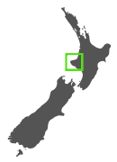
Duration: 52 km / 32 mi | 4-5 days
Grade: Advanced/Expert
Best Time to Walk: October to April
Location: Te Papa-Kura-o-Taranaki, North Island, New Zealand
The Around the Mountain Circuit is one of New Zealand’s most underrated treks. This advanced trail is perfect for hikers wanting a diverse, rugged landscape while avoiding the crowds of more popular routes.
The circuit circumnavigates the base of Mount Taranaki, with ever-changing views of this iconic peak, which is surrounded by lush rainforests, alpine meadows, and volcanic terrain.
Hiking Taranaki Maunga (Mount Taranaki) also adds an element of awe, as the mountain is an active volcano with a 50 percent chance of erupting within the next 50 years.

Not to be confused with the Round the Mountain Track (of nearby Mount Ruapehu), Taranaki is linked by Māori legend to these mountains of the central North Island and Taranaki's journey from the central plateau has been recounted by iwi for centuries.
It is said Taranaki Mounga formerly stood near Tūrangi, with Ruapehu, Tongariro, and Pihanga. Taranaki and Tongariro both loved Pihanga and fought over her. But Tongariro was stronger and Taranaki, bearing the scars of battle, withdrew underground, carving out the bed of the Whanganui River on his journey to the sea. When he surfaced he saw the beautiful Pouākai range standing inland and he was drawn towards her. Pouākai and Taranaki’s offspring became the trees, plants, birds, rocks and rivers flowing from their slopes.
Route and Highlights:
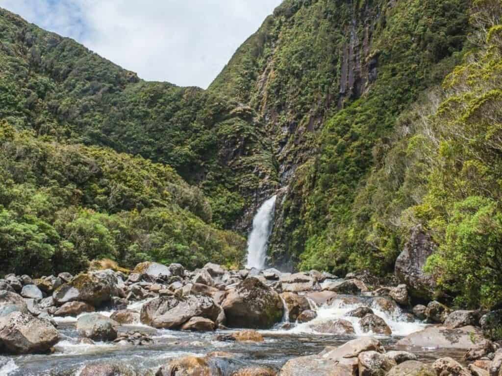
The track takes you through a variety of terrain, including dense rainforest, alpine tussock, and rugged lava fields. Key highlights include crossing the Manganui Gorge, picturesque waterfalls, and stunning swing bridges over rivers. The constantly shifting views of Mount Taranaki’s slopes are a real treat, giving hikers a full 360-degree perspective of this famous volcano.
Huts and Facilities:
Although there are 4 sections to this trail, Lake Dive Hut burnt down in 2020 and has yet to be replaced. However, there is a campsite with toilets and water available. The other huts along the track include Holly Hut, Waiaua Gorge Hut and Waingongoro Hut. These secondary huts offer bunks, water, and toilets only.
Difficulty and Accessibility:
Track conditions can be challenging on the Around the Mountain Circuit, as rivers and streams are not always bridged and can flood at any time of year. Tracks may also be eroded or overgrown in places, making backcountry experience and good navigation skills essential. The track is suitable for experienced hikers who are confident in reading a topographic map and finding markers or poles along the way.
There are both high and low-level track options for some sections, with the higher-level routes offering superior scenery. However, in winter, the high-level tracks may be impassable due to snow, while lower tracks can become overgrown or blocked by tree windfalls. In winter, snow and ice are common on the upper tracks, requiring an ice axe and crampons.


Some Awesome Nearby Trails
Te Papa-Kura-o-Taranaki, previously Egmont National Park, is an adventure seeker’s paradise, with a multitude of day hikes and another well-known multi-day trek in Taranaki—the Pouākai Circuit. For a unique twist, you can also paddle along the Whanganui River, one of New Zealand’s Great Walks (though completed by canoe, rather than on foot).
The Pouākai Circuit
Duration: 25 km /15.5 mi | 2-3 days
Grade: Advanced
Best Time to Walk: October to April
Location: Te Papa-Kura-o-Taranaki, North Island, New Zealand
The Pouākai Circuit is a loop that overlaps with part of the Mount Taranaki Circuit. This circuit is graded Advanced, although the first two sections are easier and at Intermediate level.
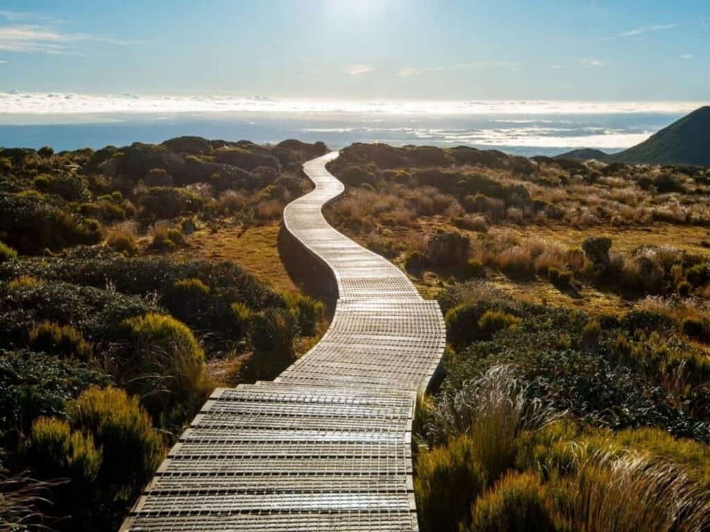
The final day leads to Pouākai Tarn, the most photographed scene in Taranaki, where under the right conditions, the tarn reflects the stunning outline of Taranaki Mounga.
Mangorei Track to Pouākai Tarns
Duration: 5 km /3 mi | 2.5 hours
Grade: Easy
If you're pressed for time, or have less experienced hikers in your group, you can take the Mangorei Track to Pouākai Tarns Trail to the Pouākai Tarns. This 5 km / 3 mi one-way hike takes just 2.5 hours and is rated easy. The trailhead begins at the car park at the end of Mangorei Road, around 20 minutes’ drive from New Plymouth.
The Whanganui Journey
Duration: 145 km / 90 mi | 5 days
Duration: 88 km / 55 mi | 3 days
Grade: Easy/Intermediate
If canoeing the Whanganui River appeals to you, this Great Walk is in close proximity to Taranaki.
The Whanganui Journey is a unique adventure among the Great Walks in NZ, following the winding course of the Whanganui River. Unlike traditional hikes, this journey involves paddling through stunning, remote landscapes across 145 kilometres, in a kayak or canoe.
The route stretches between Taumarunui and Pipiriki, taking 3 or 5 days and is a blend of scenic tranquility and cultural significance, with ancient Maori sites and lush native forests lining the riverbanks.

Trails Worth Writing Home About
Send this on to a mate planning their own tramp.
Round the Mountain Track – Mount Ruapehu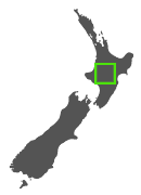
Duration: 66.2 km / 41 mi | 4-6 days
Grade: Advanced
Best Time to Walk: October to April
Location: Tongariro National Park, North Island, New Zealand
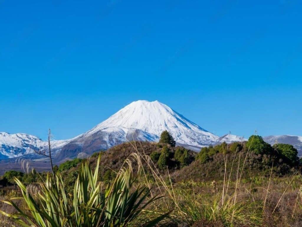
The Round the Mountain Track encircles Mount Ruapehu, New Zealand's largest active volcano. This multi-day hike takes hikers through diverse terrain, from native beech forests to desolate, windswept tussock, and turquoise lakes created by explosion craters.
Known for its raw, remote beauty, the track offers a challenging adventure for those seeking an off-the-beaten-path route around this iconic volcano.
You can also section-hike the Round the Mountain Track over 2 or 3 days, such as between Whakapapa Village and Ohakune Mountain Road on either the western or eastern side of Ruapehu. Shuttle services are available for section hikers.
Route and Highlights:
Starting near Whakapapa Village, the Round the Mountain Track encircles Mount Ruapehu, and can be hiked clockwise or anti-clockwise.
Highlights include the Rangipo Desert, Upper and Lower Tama Lakes, and the striking volcanic landscape. The track offers dramatic scenery with unique geological features, including rocky volcanic slopes, lush native bush, and tussock-covered plateaus.
The track also passes Mangaturuturu Valley and Ohinepango Springs, all set against the impressive backdrop of Mount Ruapehu.


Huts and Facilities:
The Round the Mountain Track features six huts: Waihohonu, Rangipo, Mangaehuehu, Blyth, Mangaturuturu, and Whakapapaiti. Additionally, there is a campsite at Waihohonu. During the Great Walks season, advance booking is required for Waihohonu Hut and Campsite, as they are part of the Tongariro Northern Circuit. Outside the Great Walks season, these facilities operate on a first-come, first-served basis.
Difficulty and Accessibility:
The Round the Mountain Track traverses rugged and exposed alpine terrain, with only a few forested sections on the western and southern sides. The track ranges from an altitude of about 1,100 meters at its lowest point to nearly 1,600 meters at Rangipo Hut.
It features several unbridged streams and river crossings, including the larger Whakapapaiti and Mangaturuturu rivers on the western side of Mount Ruapehu. Hikers will need to know how to cross rivers safely and should be prepared for challenging conditions throughout the hike.
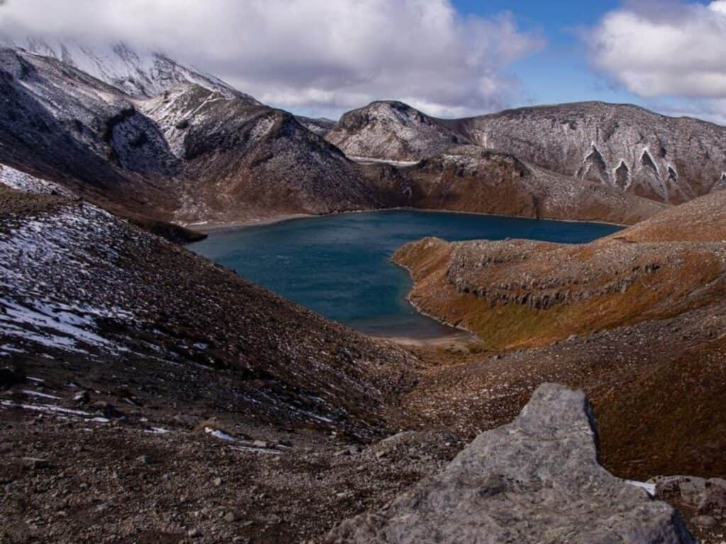
The Round the Mountain Track is a more rugged and remote alternative to the famous Tongariro Alpine Crossing. Mount Ruapehu is the highest active volcano in New Zealand, and takes you over volcanic landscape that feels otherworldly. The constant presence of Mount Ruapehu creates a dramatic backdrop, with views of its glaciers and lava fields.
Hikes You’ll Love Nearby:
Tama Lakes Track
Duration: 17 km /10.5 mi | 6-hour return
Grade: Intermediate
The Tama Lakes Track is an advanced 17 km /10.5 mi, 6-hour return hike that leads to two stunning lakes situated in old explosion craters.
Lower Tama Lake (1,240 m) and Upper Tama Lake (1,440 m) are located on the Tama Saddle, nestled between Mount Ruapehu and Mount Ngauruhoe. The views along the track are incredible, but the terrain is steep and often unmarked. The weather can change rapidly, with strong winds common due to the corridor between the two mountains.
This track is an extension of the Taranaki Falls Walk, a 2-hour, 6 km loop that is graded easy and suitable for children.
Tongariro Northern Circuit
Duration: 43.1 km / 26.8 mi | 3–4 days
Grade: Advanced
Tongariro Northern Circuit is one of the eleven Great Walks in NZ and the most popular of the North Island Great Walks. This 45 km / 28 mi loop includes the extremely popular Tongariro Alpine Crossing Track which you need to book in advance.
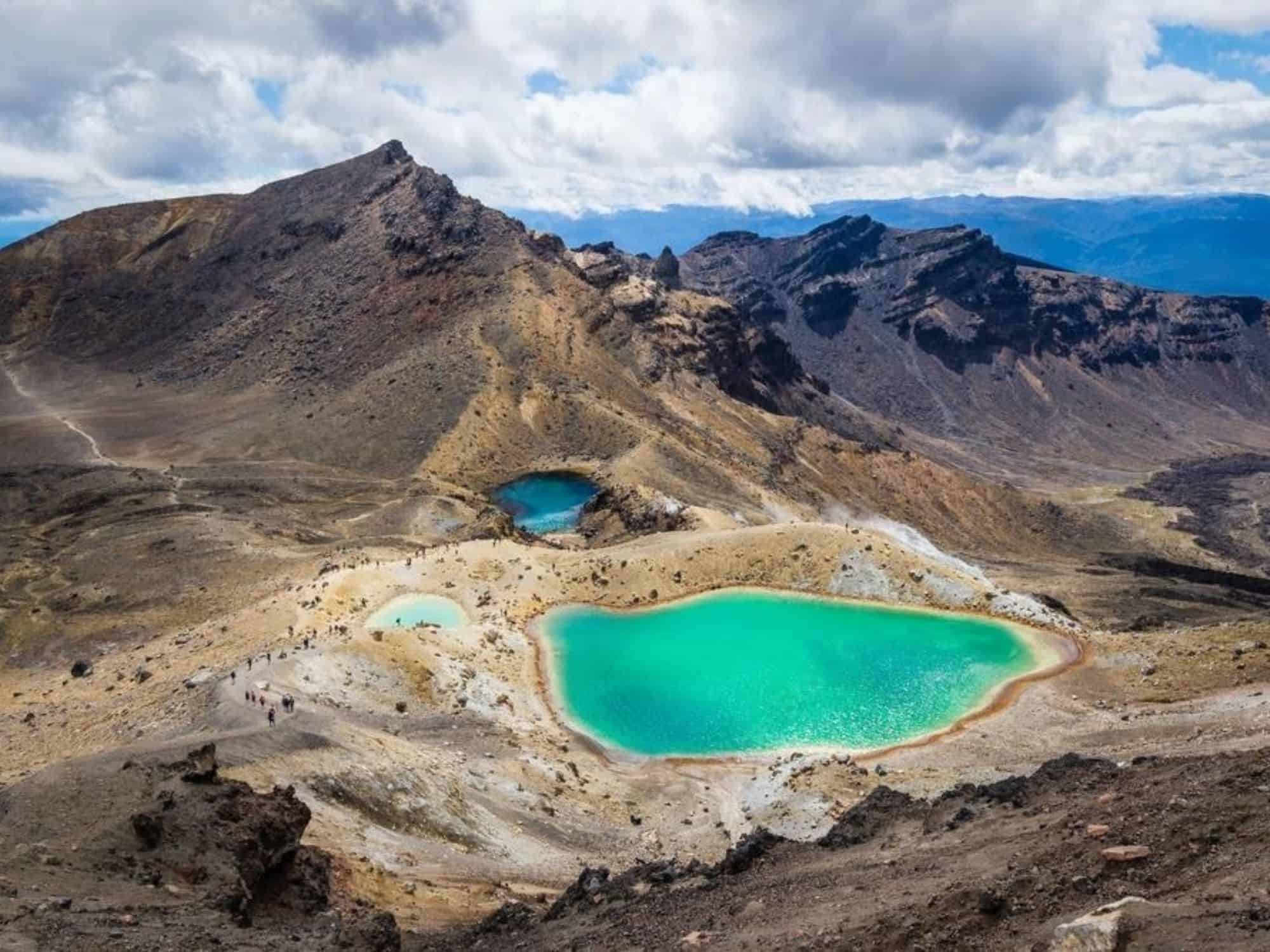
The track passes Ngā Rotopounamu-The Emerald Lake and The Blue Lake which can also be seen from the Red Crater.

Tawhai Falls Track
Duration: 0.6 km / 0.4 mi | ~20 mins return
Grade: Easy
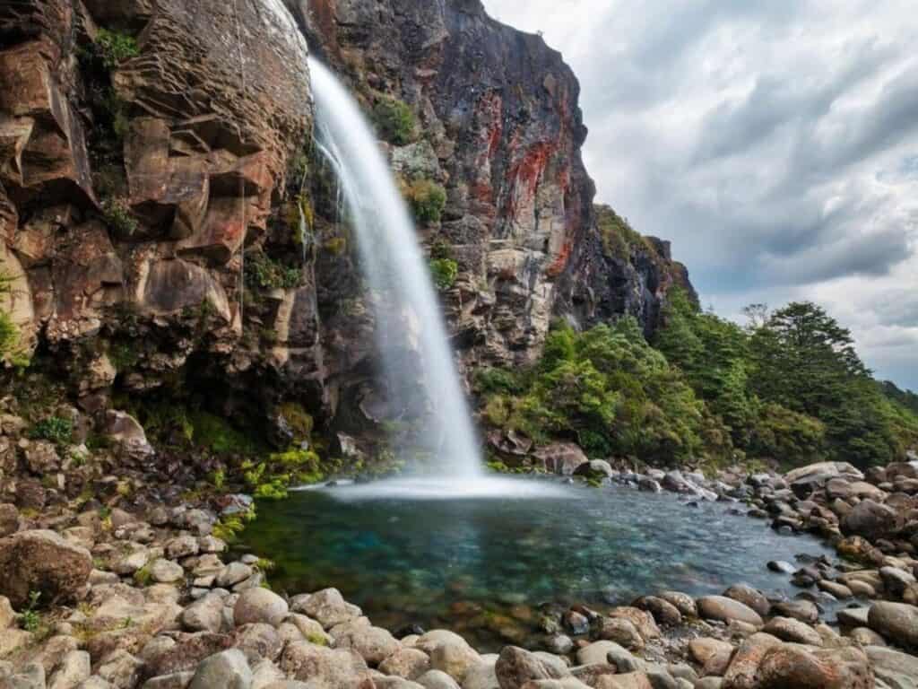
This easy 20 min, 600 m return hike to a seriously pretty waterfall is great for those less mobile. The track gives you wonderful views to the volcanoes in Tongariro National Park.

Free New Zealand Hiking Packing List
Pack light and stay organised for your next hike on Aotearoa's famous trails. Add notes, save or print, and share with your hiking partners so everyone knows what’s covered. Works on any device.
Tararua Southern Crossing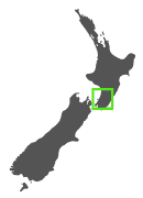
Duration: 35 km / 21.7 mi | 3 days
Grade: Advanced
Best Time to Walk: Year round
Location: Tararua Forest Park, Kapiti Region, New Zealand
The Tararua Southern Crossing is located in the Tararua Ranges, north of Wellington. It's a legendary rugged, alpine adventure perfect for experienced hikers looking to challenge themselves. Starting from Otaki Forks, the trail climbs steeply through dense forests before breaking out into alpine terrain, offering stunning vistas across the Tararua Ranges and beyond.
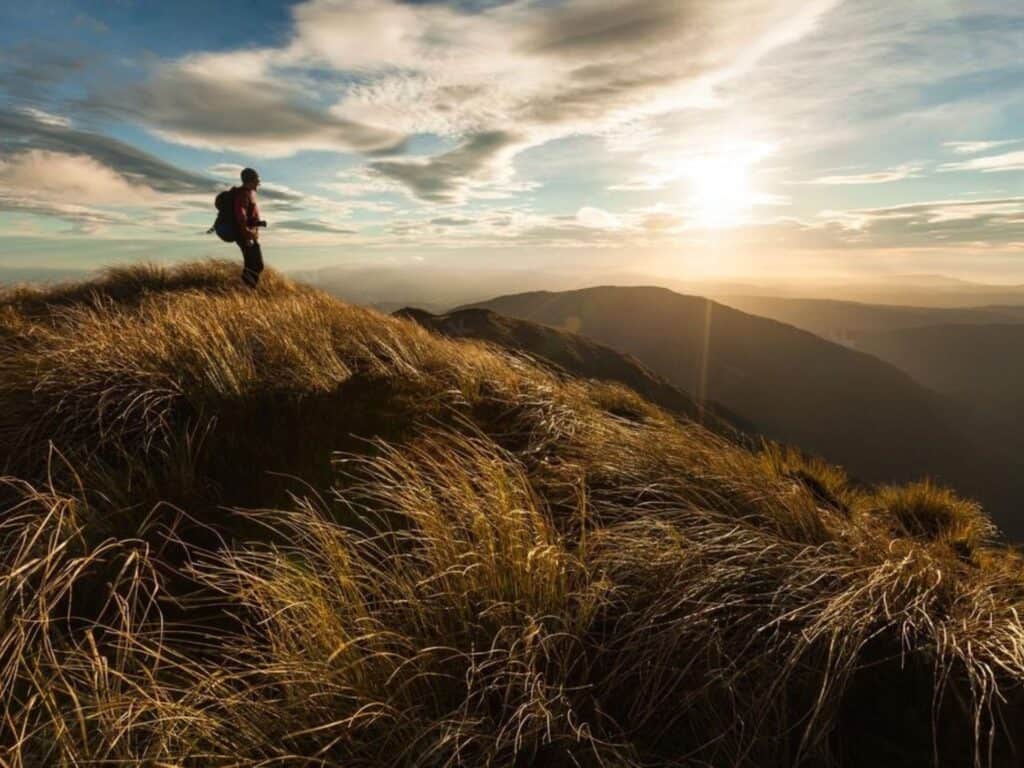
The ridge lines, though beautiful, are often exposed to strong winds and unpredictable weather, so hikers need to be prepared for anything. The alpine tops section from Table Top to Alpha (1,361 m) takes around 6–8 hours and in fine weather, offers panoramic views of Wairarapa, Wellington Harbour, South Island mountains, and Kapiti Island and the coast.
This crossing is a rewarding trek for those seeking a less-traveled, but iconic New Zealand hike, with standard huts along the way for shelter.
Route and Highlights:
The hike starts at Otaki Forks, climbing through dense beech forest before reaching alpine tussock and ridgelines. Highlights include panoramic views from Mt Hector and the traverses along the Southern Crossing ridgeline. The open tops and rugged terrain make this track a rewarding but demanding hike.
Huts and Facilities:
Field Hut, Kime Hut and Alpha Hut, are the standard hits along this route with basic accommodation with bunks, water, and heating facilities. Each have 20 bunks and bookings are not required, but availability is on a first come, first served basis.
Difficulty and Accessibility:
This track is for experienced hikers only, as it requires a good level of fitness and navigation skills. Tararua is renowned for it's wild weather and the weather can change rapidly, with high winds and heavy rain common on the exposed ridges. Careful planning is crucial, especially around weather forecasts.


Nearby Trails Worth Exploring
The Tararua Southern Crossing is one of four in the Tararua Ranges – the others being Tararua Peaks, the Northern Crossing and the Mid Crossing. If you are in Wellington for the day before and after the hike, Wellington City has a multitude of great day hikes
Matiu/Somes Island Loop Track
Duration: 2.1 km / 1.3 mi | 2–3 hours loop
Grade: Easy
Best Time to Walk: Year round
Location: Wellington Harbour, New Zealand
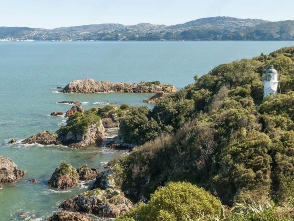
The Matiu/Somes Island Loop Track is a 2-3 hour hike that combines scenic views, native wildlife, and fascinating history in Wellington Harbour.
Accessible via scheduled ferry service from Queens Wharf and Days Bay, the island welcomes visitors with a biosecurity check to protect its delicate ecosystem. For those staying overnight or arriving by kayak, you need to contact the island ranger at least three days in advance, as per the instructions in your confirmation email.
Overnight stays provide a chance to explore at dawn and dusk, with potential sightings of little blue penguins and unique native plants.
Mount Victoria Lookout Walkway
Duration: 4.6 km / 2.9 mi | ~1.5 hours loop but various options available
Grade: Easy/Advanced
Best Time to Walk: Year round
Location: Wellington City, New Zealand
Once upon a time, this was a favourite hike back in my student days. I’d often climb Mount Victoria at sunset – or sometimes at sunrise if we were winding down a late night! It’s truly a spectacular spot to catch those first or last light moments, especially on a clear day.
Starting from inner-city Courtenay Place, the 4.6 km / 1.5 hr Mount Victoria Lookout Walkway winds through streets lined with Wellington’s quintessential colorful wooden houses. The path then leads into historic pine forests, offering unbeatable views of the harbor and city.
Multiple routes along the track make it accessible for various fitness levels, and at the summit, informational panels highlight Wellington’s rich history and unique geography. The track returns via Oriental Parade, a perfect stop for a coffee or a meal after the sunset.


Te Paki Coastal Track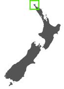
Duration: 49 km / 30.5 mi | 3-4 days
Grade: Intermediate
Best Time to Walk: Year round
Location: Te Paki Reserve, Northland, New Zealand
Located at the northernmost tip of New Zealand, the Te Paki Coastal Track is a great hike through a remote and rugged landscape. Starting (or ending) at Spirits Bay, the track passes through Cape Reinga, the most northerly point, where an ancient pōhutukawa tree and lighthouse mark this special place.
For Māori, Cape Reinga/Te Rerenga Wairua holds deep spiritual significance. It is here that Māori spirits travel after death, passing over the windswept vista to the pōhutukawa tree on the headland of Te Rerenga Wairua. They descend into the underworld by sliding down a root into the sea below, before journeying to the Three Kings Islands to bid their final farewell, and return to the land of their ancestors, Hawaiiki-A-Nui.
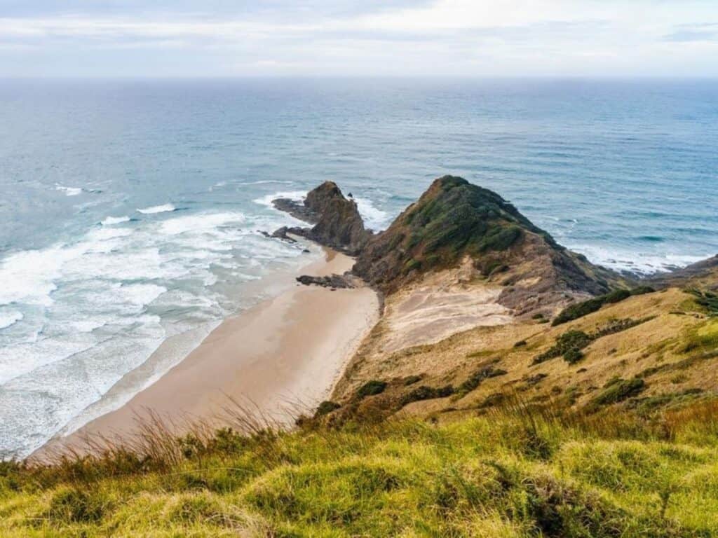
The Te Paki Coastal Track is a combination of tidal flats, giant sand dunes, and exposed headlands. This hike offers an unparalleled experience for those seeking unspoiled wilderness, where the rugged coastline and expansive views compliment the spiritual aura of the landscape.
Route and Highlights:
The trail can be hiked from west-to-east (W2E) or east-to-west (E2W). Either direction showcases dramatic coastal cliffs, open beaches, and lush forests, stretching from Spirits Bay on the east coast to Scott Point on the West Coast.
Hikers get to experience amazing sunrises and sunsets as they traverse the narrow land between New Zealand’s east and west coasts. Another natural wonder on this track is witnessing where the Tasman Sea meets the Pacific Ocean at Cape Reinga, which is considered the separation marker between the Tasman Sea to the west and the Pacific Ocean to the east. From the lighthouse, it is possible to watch the tidal race, as the two seas clash to create unsettled waters just off the coast.
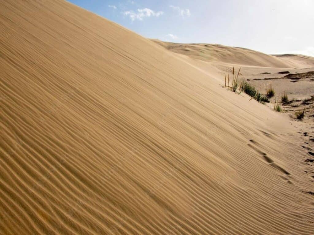
The track also traverses the expansive Te Paki Sand Dunes, spanning roughly 10 kilometres (6.2 mi) by 1 kilometre (0.62 mi). Some individual dunes rise up to 150 metres (490 ft), making this area a popular spot for sandboarding. Also at Sandy Bay on the eastern side of Cape Reinga, whales are sometimes seen close to shore, using the rocks to remove barnacles from their bellies.
Huts and Facilities:
There are no DOC huts along this track, so hikers will need to be fully self-sufficient. However, there are three basic campsites located at Pandora, Tapotupotu Bay, and Twilight Beach, with pit toilets and water, which are available on a first-come, first-served basis. As well, the Kapowairua (Spirits Bay) Campsite is a standard campsite with flush toilets, showers and potable water and requires bookings.
Since fresh water sources outside the campsites are nonexistent, carrying enough water is important. With the exception of a drinking water fountain at the lighthouse, there are no additional facilities or services en route. Wild camping is allowed along the track, with the exception of the Cape Reinga Lighthouse area.
Difficulty and Accessibility:
Graded as intermediate, this track presents a challenge due to its remoteness and varying terrain. Walking long stretches of soft sand can be tiring, and weather conditions are often unpredictable, with strong coastal winds.
Tidal crossings require careful timing, and hikers should cary a tide chart. Despite these challenges, it’s a great hike for those prepared for the wilderness.
Pass it on – this guide’s Gold.
Perfect for anyone planning a hike in Aotearoa.
More Far North Island Adventures to Explore
The northernmost tip of New Zealand holds a special place in my heart, it’s where I honeymooned with my children’s father, camping in the wilderness as newlyweds. Remote, wild, and breathtaking, it’s a corner of New Zealand that not many people make their way up to. Let’s explore a couple of adventures at the very tip of this beautiful country.
Sandboarding Te Paki Sand Dunes
Fancy a bit of excitement? Why not try sandboarding the Te Paki Sand Dunes. There are several places along the main road leading to the dunes that hire out boogie boards, as well as a truck at the base of the dunes. The cost is typically $15 for the day.
The road access to the dunes is at Te Paki Stream Road, 5 km north of Waitiki.
Top Tips for Sandboarding the Te Paki Dunes
- Go Early or Late: Early mornings or late afternoons are ideal—not only are there fewer people, but the sand can get extremely hot mid-day.
- Wear Socks Instead of Shoes: Socks protect your feet from the heat, and you can easily tuck them in your pocket once at the top.
- Bring Sunglasses: They’ll protect your eyes from both the glare and any flying sand.
- Tuck in Your Arms and Use Your Elbows: This helps cushion your ribs, especially when it gets bumpy near the bottom.
- Plan Ahead: There are toilets at the car park, but no food or water available on-site.



Cape Brett Track
Duration: ~ 16 km / 10 mi | 7-8 hours one-way
Grade: Advanced
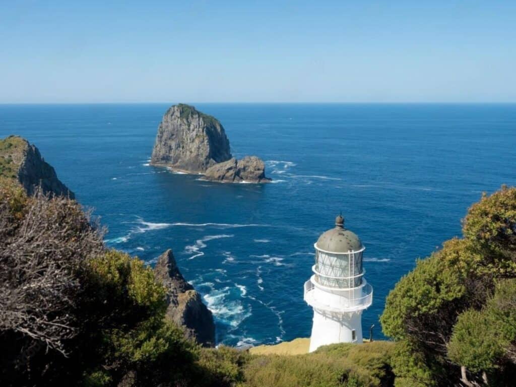
The Cape Brett Track is a challenging 16.5 km / 10.3 mi hike, offering sweeping ocean views, rugged coastal landscapes, and rich Māori history.
Starting near Rawhiti, the track winds through native bush, up steep ridges, and along exposed cliff edges, providing breathtaking vistas of the Bay of Islands and the dramatic Cape Brett Peninsula.
The hike ends at the historic Cape Brett lighthouse, where you can book a night’s stay in the lighthouse keeper’s hut for an unforgettable remote experience.


Aotea Track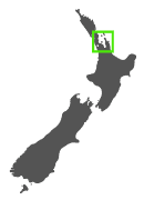
Duration: 25 km / 15.5 mi | 2-3 days
Grade: Intermediate
Best Time to Walk: Year round
Location: Great Barrier Island (Aotea), North Island, New Zealand
The Aotea Track gives trampers the chance to explore the wild, untamed landscapes of Great Barrier Island. Just a 4.5 hr ferry ride or short flight from Auckland, this track is a hidden gem for those looking to escape the mainland’s more crowded routes.
With its combination of rugged mountains, serene bush, and coastal views, this trail packs a lot of variety into a relatively short distance. It’s ideal for intermediate hikers who want to get into nature without taking on a longer, more demanding hike.

The track showcases Great Barrier Island’s diverse ecosystems, from regenerating native forests to wetlands, and stunning vistas over the Hauraki Gulf. This trail is less about altitude and more about the beautiful mix of terrain that makes it unique.
Although it doesn’t reach alpine heights, the climb to the summit of Mount Heale gives you panoramic views over the island and out to the distant Coromandel Peninsula. The Aotea Track is a great option for hikers looking to combine adventure with a bit of relaxation, as it can easily be paired with visits to the island's hot springs or beautiful beaches.
The well signposted Aotea Track is part of a labyrinth of trails that include day hikes ranging from easy to advanced.
Route and Highlights:
The track begins at Windy Canyon, climbing gradually through regenerating forest to Mount Heale. Along the way, the track passes the famous Kaitoke Hot Springs, where you can take a detour for a relaxing soak.
Highlights include the scenic lookout at Hirakimata (Mount Hobson), the highest point on the island, offering sweeping views of the coastline and surrounding ocean. The descent takes hikers through lush bush and past wetlands before finishing at the Medlands car park.
Huts and Facilities:
There are two huts on the Aotea Track: Mount Heale Hut and Kaiaraara Hut. Both are standard DOC huts which including bunks toilets, water and gas cooking facilities. However, there is no cooking equipment, so hikers will need to carry their own gear for food preparation. There are also several campsites along the trail for those who prefer tenting.
Difficulty and Accessibility:
While the track is rated intermediate, its varied terrain and the possibility of rapid weather changes mean hikers should be prepared for all conditions. The hike is manageable for anyone with a reasonable fitness level, though the climbs can be taxing in places. Wet conditions can make some sections slippery, so proper footwear is essential. The trail is well-marked and accessible year-round.
More “To-Dos'” on Great Barrier Island
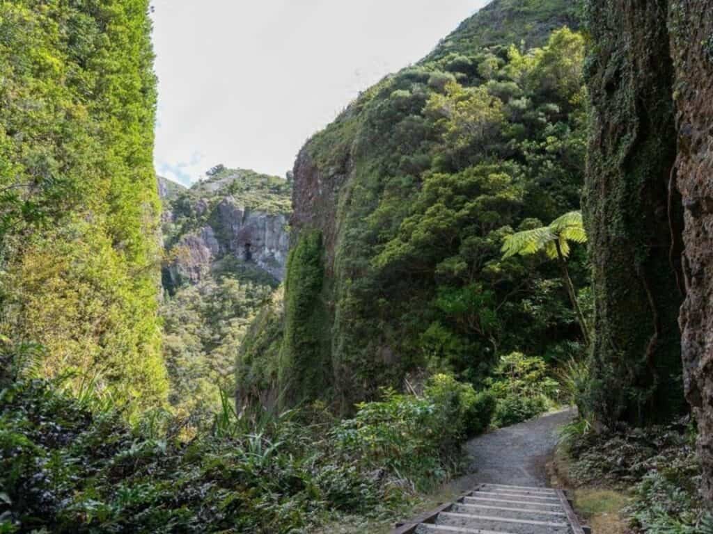
Great Barrier Island, located 90 km northeast of Auckland, is a hidden gem for nature lovers and adventurers. Known for its untouched landscapes, the island offers diverse hiking trails, pristine beaches, and stunning coastal scenery.
The island’s remote feel is enhanced by its off-the-grid lifestyle; there’s no mains electricity, so many locals rely on solar power. Designated as an International Dark Sky Sanctuary, Great Barrier has some of the best stargazing in New Zealand.
Free New Zealand Hiking Packing List
Pack light and stay organised for your next hike on Aotearoa's famous trails. Add notes, save or print, and share with your hiking partners so everyone knows what’s covered. Works on any device.
Kaitoke Hot Springs Track
Duration: 4 km / 2.5 mi | ~1–2 hours return
Grade: Easy
The Kaitoke Hot Springs Track is an easy, 45-minute walk each way through lush wetlands and native forest, leading to natural geothermal pools. The 2 km / 1.2 mi track meanders along a well-maintained path, suitable for all fitness levels, and crosses several bridges over gentle streams.
At the end of the trail, the Kaitoke Hot Springs await, where hot mineral water pools offer a relaxing soak surrounded by peaceful forest. While the springs are a popular spot, they still retain a quiet, natural charm.
The Kaitoke Hot Springs are free, however, there are no facilities at the springs, so bring essentials like water and towels, and be sure to pack out all rubbish to leave no trace.
Harataonga Coastal Walkway
Duration: 11.17 km / 6.9 mi | 4-5 hrs one way
Grade: Intermediate
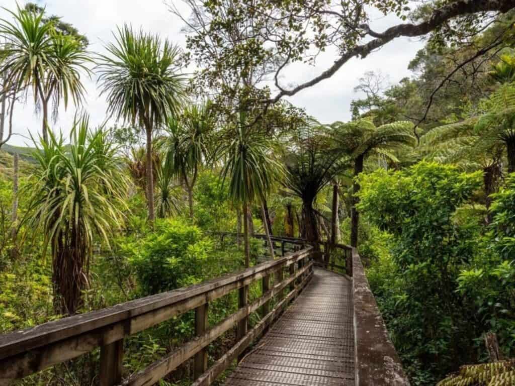
The Harataonga Coastal Walkway is a scenic 10 km / 6.2 mi track along Great Barrier Island’s eastern coastline, taking about 3-4 hours one way. Graded Intermediate, the Harataonga Coastal Walkway gives you stunning views over white sand beaches, rocky shorelines, and the deep blue of the Pacific.
Following an old Māori trail, the route winds through native bush, passing through groves of pūriri and pōhutukawa trees, with opportunities to spot native birds like the tūī and kererū. The walkway ends near Harataonga Bay, a beautiful sheltered beach, ideal for a relaxing swim.


Hauhungaroa Track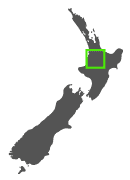
Duration: 25 km / 15.5 mi | 2-3 days
Grade: Advanced
Best Time to Walk: Year round
Location: Hauhungaroa Range, North Island, New Zealand
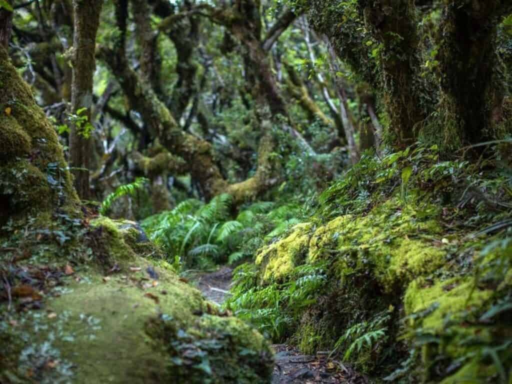
The Hauhungaroa Track is a lesser-known but rewarding multi-day hike in the heart of the North Island. Pureora Forest Park is a hidden wonderland of ancient tōtara, rimu, miro, and mātai trees covered in moss, with clear rivers and rare wildlife.
Traversing the remote Hauhungaroa Range, this trail is a great hike for those seeking solitude and a genuine backcountry experience. Far from the tourist routes, this track requires a higher level of self-sufficiency, as it’s largely unserviced, with limited hut accommodation. The track provides fantastic opportunities to explore dense native bush, volcanic landscapes, and the high ridges of the range, with stunning panoramic views over Lake Taupō and the surrounding region.
For experienced hikers looking for a tranquil, off-the-beaten-path adventure, the Hauhungaroa Track is ideal. With a mix of undulating terrain and some steep climbs, it's a great option for those wanting to escape the busier trails of the central North Island and test their endurance in a remote setting.
Route and Highlights:
The track runs through native beech forests, across open ridges, and along the flanks of the Hauhungaroa Range. The ascent to the highest point, Pureora Peak, offers the best vantage point for spectacular views of Mount Ruapehu, Lake Taupō, and the distant Kaimanawa Ranges.
Another highlight is the remoteness of the bush. This track gives hikers a sense of isolation and immersion in nature, with very few other hikers to be seen. Birdlife is abundant, and there are occasional chances to spot native species such as the tūī and kererū. This includes the rare North Island kōkako, kākā (forest parrot) and pītoitoi (toutouwai/North Island robin).
Huts and Facilities:
The Hauhungaroa Track has two key huts—Hauhungaroa Hut and Waihaha Hut. These are rated basic huts which include bunks, water, and toilets. There are no cooking facilities, and there are designated camping areas surrounding the huts.
Difficulty and Accessibility:
While not technically difficult, the Hauhungaroa Track requires a good level of fitness and navigational skills. The terrain is varied, and weather conditions can change quickly, making it essential to be well-prepared.
Some sections may be overgrown or muddy, especially after rain, adding to the challenge. The track is marked, but it’s important to carry maps or a GPS as some parts are less well-defined. Access to the track is via several entry points around the Hauhungaroa Range, with shuttle services available from nearby towns like Taupō and Turangi.


Uncover Nearby Adventures
As a child, we spent almost every school vacation on the south western shores of Lake Taupō and the area holds many fond memories.
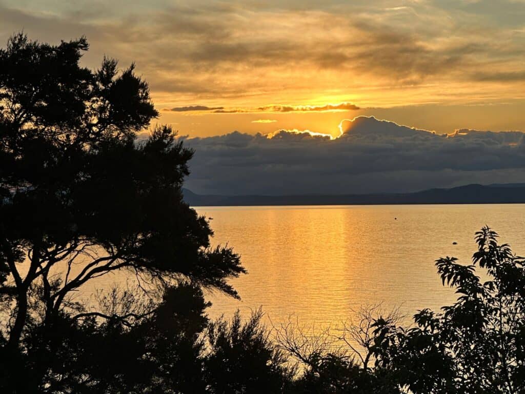
The area west of Lake Taupō is a captivating blend of forested wilderness, geothermal landscapes, and historic sites. Lake Taupō itself, New Zealand’s largest lake, sits in a volcanic caldera created by one of the most powerful eruptions in human history.
Here are two ways to explore Lake Taupō’s stunning western shores: a scenic hike and an unforgettable kayak adventure.
Waihāhā and Waihora
Duration: 17 km / 10.5 mi | 4 hours hiking or 2 hours mountain biking
Grade: Easy (MTB Grade 3)
The Waihāhā and Waihora Tracks are two remote connecting trails on the western side of Lake Taupō, winding through remote bush, cliffs and waterfalls of the Western Bays of Lake Taupō.
The combined 17 km / 10.5 mi tracks can be hiked (4 hr) or mountain biked (2 hr) and are graded Easy (MTB Grade 3). The Waihāhā Track follows the Waihāhā River, winding through ancient beech and podocarp forest before reaching stunning lake views. From here, you can connect to the Waihora Track, a short walk to a secluded lakeside spot with a small beach ideal for picnics and swimming.
These tracks showcase the beauty of Taupō’s pristine, less-travelled western landscape.
The Mine Bay Māori Rock Carvings (Ngātoroirangi)
For something a little different, you can kayak to Ngātoroirangi Mine Bay Māori Rock Carvings on the southern end of Lake Taupō.
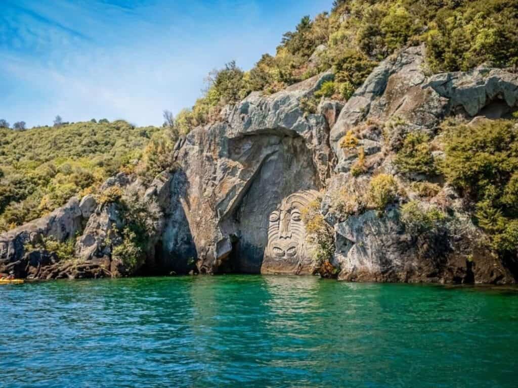
The 14-metre high carvings, created in the 1970s by master carver Matahi Whakataka-Brightwell, depict the face of Ngātoroirangi, a Māori navigator and ancestor, as well as smaller symbolic carvings nearby.
The kayak journey gives you stunning views of Lake Taupō’s surrounding mountains and forests, with plenty of time to marvel at the intricate rock art up close. Guided tours are available, providing cultural insights and a safe, scenic kayaking experience.


Manuoha to Waikareiti Track
Duration: 32 km / 20 mi | 3 days
Grade: Advanced
Best Time to Walk: November – April
Location: Te Urewera, North Island, New Zealand
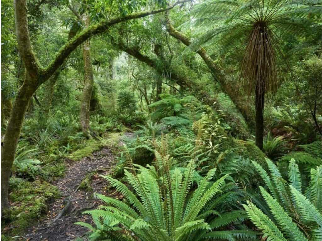
The Manuoha to Waikareiti Track is a serene escape into the heart of Te Urewera, an area renowned for its mystical lakes and lush, ancient forests.
Starting at Manuoha, the highest point in Te Urewera, the track descends through dense podocarp forest, leading to the serene Lake Waikareiti. This track offers deep tranquility and isolation, with opportunities to see rare native birds and enjoy undisturbed forest landscapes.
In 2014, Te Urewera became the world’s first natural resource granted legal personhood, setting a precedent for environmental law. Recognised as a living entity, this former national park embodies Māori values and guardianship, ensuring its protection and management as a respected being rather than a piece of property.
Route and Highlights:
This track from Manuoha to Lake Waikareiti showcases Te Urewera’s spectacular natural beauty, characterised by its dense, ancient forests and serene alpine lakes. The hike starts at the highest peak in Te Urewera and descends to the picturesque Lake Waikareiti.
Ascending Manuoha offers expansive views over Te Urewera, while the descent to Lake Waikareiti passes through dense, bird-rich forests. A highlight is the opportunity to row across Lake Waikareiti, a smaller, more secluded lake than its famous neighbor, Lake Waikaremoana.
Huts and Facilities:
The Manuoha Hut, near the start, and Sandy Bay Hut, near Lake Waikareiti, provide basic accommodations with bunks and toilets. Huts in Te Urewera are nestled in scenic locations giving hikers a rustic wilderness experience. Hikers need to carry their own supplies as there are no shops or additional facilities along the track.
Difficulty and Accessibility:
This track is intermediate in difficulty, with the main challenge being the altitude change and the potentially slippery, steep descents. Well-maintained paths and clear signage make navigation straightforward for those with moderate hiking experience.
Continue Exploring Te Urewera
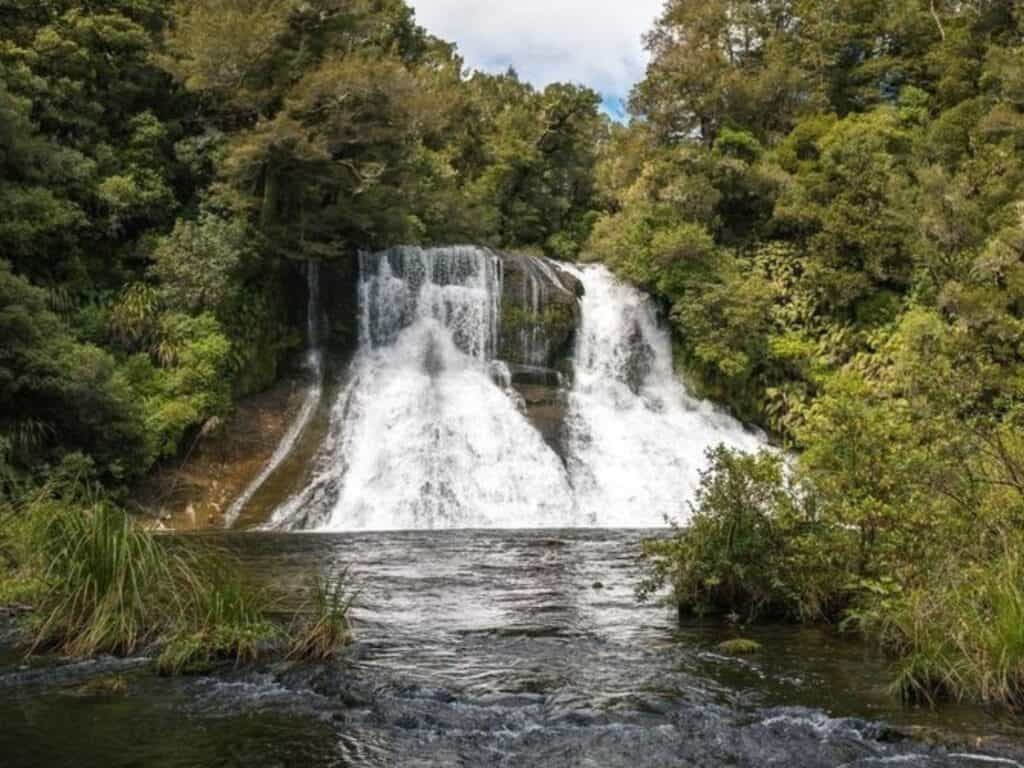
Te Urewera is an exceptional destination for outdoor activities, offering a remote, pristine wilderness rich in cultural and natural significance. Known for its dense forests, rugged hills, and stunning lakes, Te Urewera provides ample opportunities for hiking, kayaking, and bird-watching.
Trails like the Lake Waikaremoana Great Walk lead adventurers through ancient rainforest and alongside cascading rivers. Lake Waikaremoana itself is ideal for kayaking and fishing, with clear waters surrounded by native bush.
Throughout Te Urewera, visitors can connect with Māori culture, as the land is regarded as a living entity and treasured by local iwi.
Lake Waikaremoana Great Walk
Duration: 46 km / 28.5 mi | 3–4 days
Grade: Intermediate
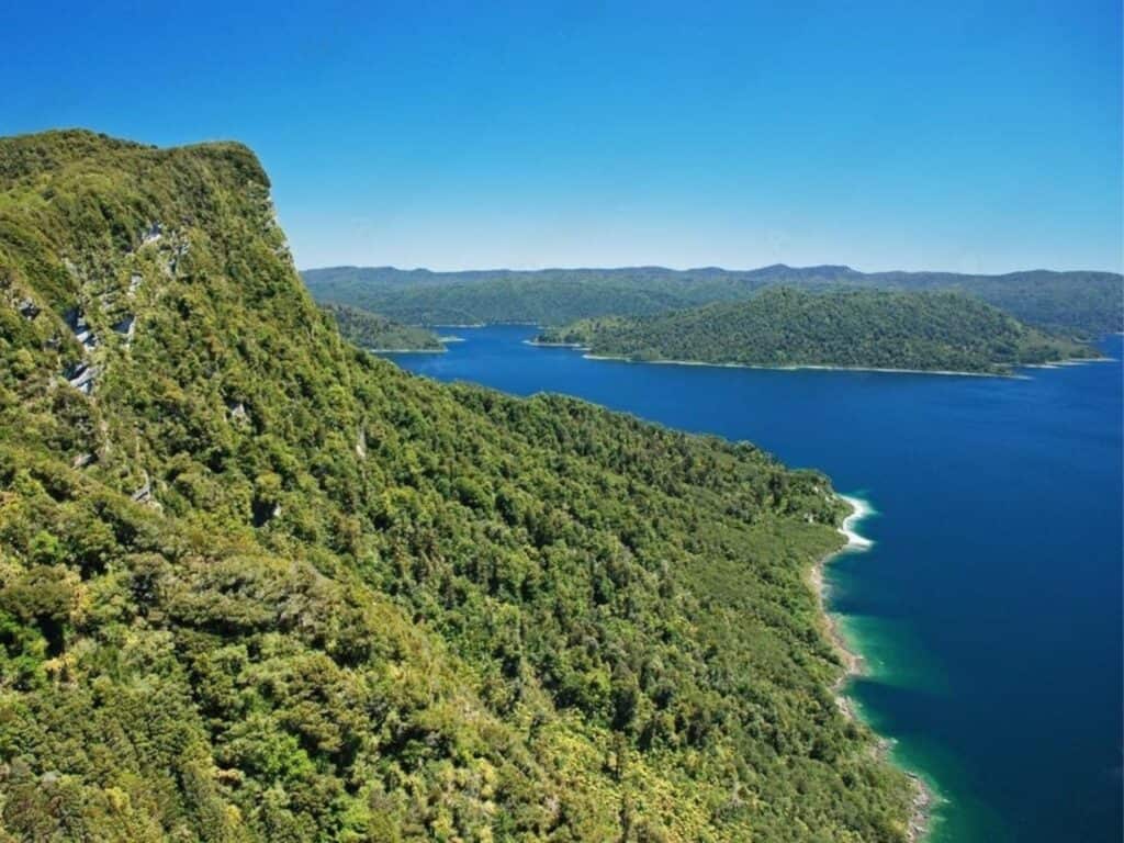
The Lake Waikaremoana Great Walk is a 46-kilometre, multi-day hike through one of New Zealand's most remote and stunning wilderness areas. Winding around the edge of Lake Waikaremoana, the track leads hikers through lush native rainforests, steep ridges, and scenic lakeside sections, with panoramic views over the lake and surrounding Te Urewera landscapes.
Highlights include the towering cliffs of Panekire Bluff, ancient podocarp forests, and misty fern groves. As part of Te Urewera, the track is culturally significant to the Tūhoe people.
Moerangi Track
Duration: 35 km / 21.7 mi
Hiking: 2-3 days | Mountain Biking: 5-7 hrs
Grade: Hike: Intermediate | MTB: Intermediate Grade 3
Best Time to Walk: Year-round
Location: Whirinaki Te Pua-a-Tāne Conservation Park, North Island, New Zealand
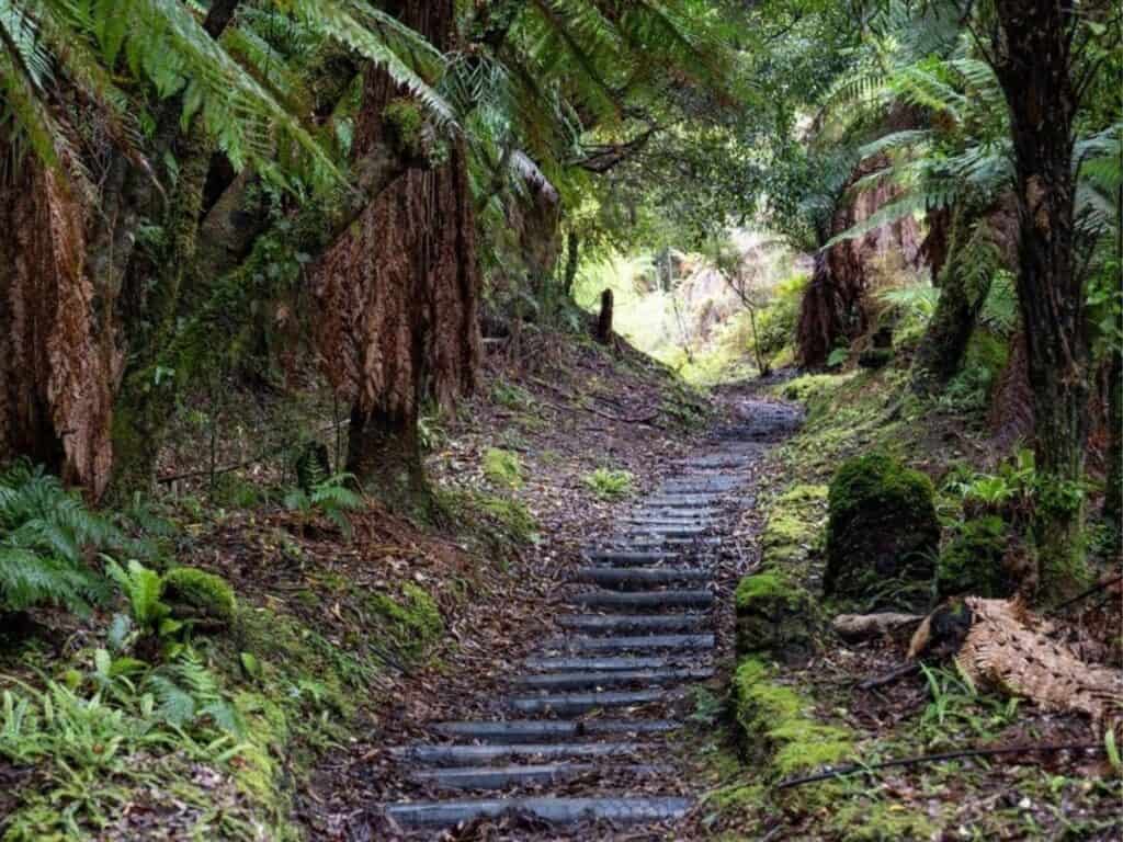
The Moerangi Track is a secluded trek through one of New Zealand's ancient podocarp forests, a journey back in time through ecosystems that have remained largely unchanged for millions of years.
This track is popular among both hikers and mountain bikers, featuring historic logging trails and pristine natural environments. The dense canopy of native trees, including kāhikatea, tōtara, and mātai, provides habitat for a diverse array of birdlife, making this track a haven for birdwatchers.
Route and Highlights:
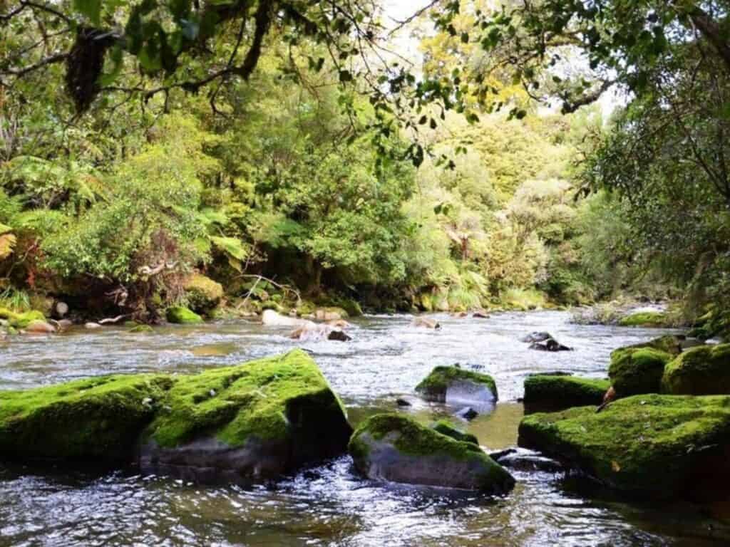
This trail winds its way through the heart of Whirinaki Forest, passing alongside the clear waters of the Moerangi River and through lush fern gullies. Highlights include the impressive Moerangi Hut, situated with panoramic views of the surrounding forest, and several suspension bridges that offer dramatic river crossings. The track's remote feel is compounded by the echoing calls of native birds, such as the kākā and kererū.
Huts and Facilities:
There are three huts along the Moerangi Track: Rogers Hut, Moerangi Hut, and Skips Hut. These standard DOC huts are equipped with sleeping bunks, toilets, and water supplies but no cooking facilities. They provide a comfortable base for overnight stays amidst the deep green of the forest.
Difficulty and Accessibility:
The track is graded intermediate, suitable for hikers with some experience due to the undulating terrain and several long, steep sections. While the trail is well-maintained, the remote setting requires hikers to be self-sufficient and prepared for quickly changing weather conditions, especially in the colder months.
More Hikes in Whirinaki Te Pua-a-Tāne
Whirinaki Te Pua-a-Tāne is a stunning ancient forest and cultural landmark in New Zealand’s North Island, often celebrated as a “dinosaur forest” for its towering podocarps and prehistoric feel.
Covering over 55,000 hectares, it’s a sanctuary of biodiversity with native giants like tōtara, rimu, and kahikatea, as well as rare bird species like the whio (blue duck) and kārearea (New Zealand falcon).
Historically, this forest has been integral to Māori culture, providing resources, spiritual grounding, and a deep connection to the land. There are several hiking and mountain bike trails within and the Whirinaki Recreation Campground is a great base for adventurers and bird watchers.
Te Pua-a-Tāne Circuit
Duration: 78.7 km / 49 mi | 5 days
Grade: Advanced
The Te Pua-a-Tāne Circuit is a multi-day 33 km / 20.5 mi loop with a more isolated, backcountry feel than the Moerangi Track. The Te Pua-a-Tāne Circuit winds through dense podocarp forest, with more gradient.
It emphasises the rich biodiversity of Whirinaki Te Pua-a-Tāne and is well-serviced by backcountry huts.
20. Arohaki Lagoon Track
Duration: 4.6 km / 2.9 mi | 1.5 hours return
Grade: Easy
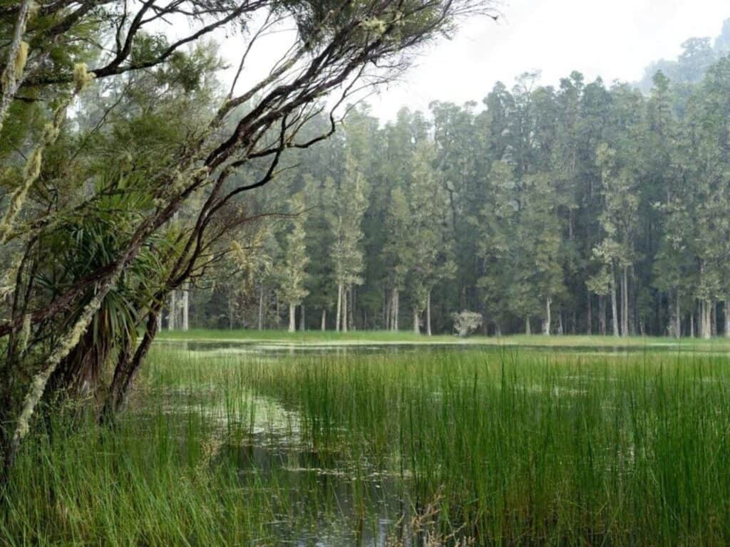
The Arohaki Lagoon Track is an easy-grade hike, suitable for most fitness levels, and is about 4 km / 2.5 mi (2 hours) round trip.
This gentle, well-maintained trail is ideal for birdwatchers, offering excellent opportunities to spot native species like tūī, kererū, and kārearea (New Zealand falcon) in a serene forest setting. Mountain bikes are not allowed on this track, preserving the tranquil atmosphere and allowing hikers or birdwatchers to fully absorb the sounds and sights of the lush podocarp forest.
The track winds beneath towering rimu, kahikatea, and mataī trees, with native birdsong filling the air. In winter and spring, the lagoon creates a mirror-like surface, beautifully reflecting the surrounding forest.


Mangapurua/Kaiwhakauka Track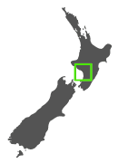
Duration: 40 km / 25 mi
Hiking: 2-3 days | Mountain Biking: 1 day
Grade: Hike: Advanced | MTB: Advanced Grade 4
Best Time to Walk: October – April
Location: Whanganui National Park, North Island, New Zealand
The Mangapurua/Kaiwhakauka Track traverses a historic route through Whanganui National Park, offering not just natural beauty but also a poignant reminder of New Zealand’s settler history. This track follows the paths of early 20th-century pioneer farmers who eventually abandoned their lands. The iconic ‘Bridge to Nowhere,' built in 1936 and now surrounded by dense forest, symbolises their unfulfilled dreams and hardships

Route and Highlights:
The track can be accessed via Whakahoro and leads through regenerating bush that showcases the resilience of nature as it reclaims old farms. The highlight of the track is undoubtedly the Bridge to Nowhere, which stands as a curious monument amidst lush greenery.
Huts and Facilities:
There are several standard backcountry huts along the track, including the Mangapurua Hut, which offers basic facilities. These huts are spaced to support multi-day treks, providing shelter and water but requiring hikers to be self-sufficient in terms of food and cooking equipment.
Difficulty and Accessibility:
While the track itself is not technically difficult, its remote location and the necessity of multiple river crossings make it a challenge suitable for more experienced hikers.

Mountains to Sea Ngā Ara Tūhono
Duration: ~217 km / 135 mi | 5–6 days
Grade: Intermediate (mix of cycle trail and river journey)
The Mountains to Sea Ngā Ara Tūhono is a breathtaking multi-day journey spanning roughly 231 km / 144 miles. It stretches from the volcanic landscapes of Mount Ruapehu to the shores of Whanganui River, showcasing some of New Zealand’s most iconic natural beauty.
This trail network blends ancient Māori pathways with modern tracks and combines hiking, biking, and river journeys. The route follows historic trade and travel trails and highlights New Zealand’s unique biodiversity and deep Māori heritage.
23. Matemateāonga Track
Duration: 42 km / 26 mi | 3–4 days
Grade: Intermediate
The 42 km / 26 mi Matemateāonga Track is a 3-4 day historical journey, following an ancient Māori trail that was later used by European settlers. This trek is characterised by its rich cultural significance and stunning natural features, including dense native bush and dramatic river views. The track ends with a memorable jet boat ride down the Whanganui River, providing a unique way to finish a multi-day hikes
Fly Fish on the Whanganui River
The Whanganui River is home to the World Fly-fishing Championships, and is known for brown and rainbow trout. Trout in the Whanganui generally range from 1-2 kg (2-4 lb), with some larger specimens present.
I remember seeing old sepia photos at my grandparent's home of grandad with his mates surrounded by a bountiful catch of huge trout. Nowadays the fishing season is regulated (catch limits and size restrictions apply), to maintain trout populations, and anglers need a current fishing license.
If you would like to be taken down the Whanganui by a local or if you just want to try your hand at fly fishing, Blazing Paddles has a full-day expedition on the Whanganui River with fly-fishing champion Peter Scott.
How to Find Additional Hikes in the North Island
If you’ve explored our list of 28 incredible adventures and still crave more, the Department of Conservation (DOC) website is your ultimate tool for discovering even more hiking gems in New Zealand’s North Island.
With its user-friendly interface, the DOC website allows you to search for hikes based on region, track grade, and duration. It’s the go-to resource for finding trails that suit your ability and preferences.
The DOC website also provides detailed maps, trail descriptions, and essential information on hut or campsite bookings where necessary. Many North Island trails do not require bookings, making it easier to plan spontaneous getaways.
For a step-by-step guide to using the DOC website and making the most of its features, check out our detailed post: How to Find Hiking Trails in New Zealand.
Understanding the New Zealand Walking Track Grading System
Before heading out on your next adventure, it’s essential to familiarise yourself with the New Zealand Walking Track Grading System. This system categorises trails based on difficulty, helping hikers determine whether a track aligns with their abilities and fitness level. From accessible short walks to expert-level hiking trails, understanding the grading system ensures you’re well-prepared and able for the adventure ahead.
The grading system is especially important when navigating lesser-known North Island hikes, where conditions may vary significantly. Equipped with this knowledge, you can confidently select trails that match your experience and skill set.
For a complete breakdown of the grading system and how to use it effectively, visit our comprehensive guide: The New Zealand Walking Track Grading System.
Beyond the Great Walks in New Zealand
So there you have it: 28 Amazing Hikes in the North Island that are often overlooked. Some are easy, some are extremely difficult, but no matter the grade, they all showcase the ultimate beauty New Zealand has to offer.
New Zealand isn’t a large country. If you’re headed to the “Land of the Long White Cloud”, which is what Aotearoa (the Māori name for New Zealand) translates to, you'll find the distances between hikes short. Short enough to fit more than one hike in!
Make sure you read all of our other Great Guides in this series, from booking huts, to finding more great hikes! And if you liked this guide, it'd mean the world to me if you could share it: the share icons are below.
And if you haven't already, please sign up to my newsletter. Not only do I send out Good Stuff like this guide, but you also get my free e-book on Health, Safety and Hygiene on the Trail. Packed with sensational tips on stuff like snake bites, heat exhaustion, what to do in a thunderstorm… You get the drift. It's golden.
Say Yes to the Most Informative Free Hiking Manual Ever!
You can unsubscribe anytime. For more details, review our Privacy Policy.

Don’t Gatekeep the Good Stuff.
Share this with your mates — or anyone planning a New Zealand adventure!
FAQ
Do hikes on the North Island have huts?
Yes, many North Island hikes have huts, even outside the Great Walks. Examples include Pinnacles Hut in the Coromandel, Pouākai Hut near Mt Taranaki, and multiple huts on Ruapehu’s Round the Mountain Track. Facilities range from basic shelters to large bunkhouses, and conditions can be rustic—so carry a sleeping bag and cooking gear.
Do I need to book huts in New Zealand?
It depends on the track. On popular hikes like the Pinnacles Trail or Aotea Track, huts must be booked in advance, especially in summer. Other huts on backcountry tracks operate first-come with Backcountry Hut Tickets or a Hut Pass. Always check before you go—don’t assume space will be available during peak periods.
How do I get to North Island trailheads without a car?
es, some trailheads are reachable without a car. For example, Tongariro Alpine Crossing shuttles run from nearby villages. In cities, public transport connects to popular day walks, but remote tracks may need private shuttles or a rideshare. Plan your exit too—many point-to-point hikes require a prearranged pickup or return bus
When is the best time to hike on the North Island?
November to April offers the most reliable weather, with longer daylight hours and drier tracks. Winter can still be rewarding but expect snow on alpine routes like Ruapehu or Taranaki. Shoulder seasons are quieter but changeable—always check the forecast, pack rain gear, and be prepared for rapidly shifting conditions on exposed ridges.
How do track grades work in New Zealand?
DOC’s grading helps set expectations. Easy tracks are well formed with gentle grades; Intermediate tracks are rougher with roots, stairs, or steeper climbs; Advanced tramping routes may be unmarked, involve river crossings, and require solid navigation and fitness. Grade can also vary within a single track, especially on longer alpine sections.
Can I camp on North Island tracks?
Yes, but usually only at designated campsites or near huts. Some campsites require bookings, while others are first-come. Wild camping is restricted in national parks and conservation areas, so always follow local rules and leave no trace. Carry out waste, avoid water contamination, and respect cultural sites and private property along the way.
How can I help stop kauri dieback when hiking?
Always use cleaning stations at the start and end of tracks, scrubbing boots and poles to remove soil. Stay on formed paths and boardwalks, avoid muddy shortcuts, and never step over kauri roots. The disease spreads easily through soil, so your care directly protects these ancient forests for future generations of walkers.
Which hikes give alpine views without Tongariro crowds?
Good alternatives include the Pouākai Crossing near Mt Taranaki and the Round the Mountain Track on Ruapehu. Both give sweeping alpine scenery, tarn reflections, and volcanic ridges without the peak congestion of Tongariro. Conditions can change rapidly, so take layers, good navigation, and enough time for long, exposed sections above the treeline.
Are dogs allowed on North Island hikes?
Most national parks and conservation areas don’t allow dogs to protect wildlife, especially kiwi habitat. Some regional parks and selected DOC tracks permit dogs on-leash, sometimes with a permit. Rules vary, so always check track information before setting out. Never assume dogs are welcome—it’s strictly controlled and heavily enforced in many areas.