
The Best Hiking in New Zealand – The Complete Guide to the 11 Great Walks of NZ
New Zealand's Great Walks are renowned as the country's crown jewels, and for good reason! These eleven internationally acclaimed trails offer hikers arguably the best hiking in New Zealand.
Spread across various national parks, these walks showcase the diverse beauty of the natural environment, from towering mountains to lush rainforests and pristine coastlines. Each track is uniquely captivating, with varied terrains, ecosystems, and sights highlighting New Zealand's rich flora and fauna.
The Great Walks of NZ cater to a range of experience levels, making them accessible to both beginners and seasoned hikers. These well-maintained paths are equipped with huts and facilities, that allow for multi-day adventures. Popular tracks, such as the Milford Track, Abel Tasman Coast Track, and the Tongariro Alpine Crossing, attract thousands of hikers annually, drawn by stunning vistas and the promise of adventure.
Beyond their beauty, the Great Walks hold cultural significance, often linked to Māori heritage and stories. Whether traversing alpine passes, meandering along pristine lakes, or exploring coastal cliffs, hikers are immersed in New Zealand’s culture and it's untouched wilderness.
Here's a breakdown of each of the 11 Great Walks of NZ – Let's whet your appetite!

Quick Links
Milford Track | Routeburn Track | Tongariro Northern Circuit | Abel Tasman Coast Track | Kepler Track | Heaphy Track | Whanganui (River) Journey | Rakiura Track | Paparoa Track | Lake Waikaremoana Track | Hump Ridge Track
This article may contain affiliate links. If you make a purchase using one of these links, we may receive compensation at no extra cost to you. See our Disclosure Policy for more information.
Hiking is known as “tramping” in New Zealand and I'll use the word interchangeably throughout the post.
1. Milford Track
Duration: 53.5 km / 33 mi | 4 days
Grade: Intermediate/Advanced
Elevation Gain: 1,750 m / 5,741 ft
Best Time to Walk: November – April
Location: Fiordland National Park, South Island
About The Milford Track
The Milford Track is often hailed as one of New Zealand's premier hiking experiences, and for good reason. Known as “the finest walk in the world,” this track takes you through the heart of Fiordland National Park, showcasing a breathtaking array of landscapes that capture the pristine beauty of New Zealand's wilderness.

The Milford Track is traditionally completed over four days, with each day bringing its own unique sights and challenges. The journey begins at the head of Lake Te Anau, where hikers take a short boat ride to the track's starting point at Glade Wharf.
The third day is considered the highlight of the track. The trail leads over Mackinnon Pass, the highest point on the trail, with panoramic views of the surrounding peaks and valleys. After crossing the pass, you descend into what is known as the “middle earth” waterfalls area. This section includes the stunning Mackay Falls and is some of the most picturesque and dramatic scenery on the Milford Track.

The descent from the pass brings you to Quintin Lodge via the Sutherland Falls, which is one of the world’s tallest and most spectacular waterfalls, plunging 580 meters over three cascades.
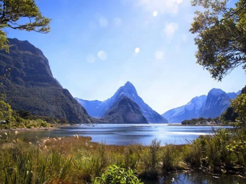
The final day’s hike follows the Arthur River to the majestic Milford Sound, where the trail finishes. Here you get to see Mitre Peak rising dramatically from the dark waters of the sound, and it's an amazing end to a remarkable journey.
Overall, the Milford Track is an unforgettable adventure through some of the most stunning landscapes New Zealand has to offer, combining physical challenges with the rewards of breathtaking vistas and the serene beauty of untouched nature.
The Milford Track is classified as Intermediate/Advanced, suitable for hikers with good fitness. The path is well-formed path, however there are sections with steep inclines, river crossings, and potentially challenging weather conditions. Fiordland has an unpredictable climate that can add an extra layer of difficulty.
Getting to the Trailhead:
Access to the Milford Track requires a boat transfer.
- Starting Point: Glade Wharf, which is accessible only by boat from Te Anau Downs. Regular water taxis (pre-booked through your booking package) ferry hikers from Te Anau Downs to the start of the track.
- Ending Point: Sandfly Point, where you’ll need to catch a pre-arranged boat transfer to Milford Sound. From there, shuttle services are available to return to Te Anau or Queenstown.
Nearest Town: Te Anau (120 km to the trailhead at Te Anau Downs). You can park your car at Te Anau Downs or use the shuttle service. The shuttle service operates from Queenstown or Te Anau to Te Anau Downs (and from Milford Sound to your return destination after the hike).
2. Routeburn Track
Duration: 33 km / 20.5 mi | 2-3 days
Grade: Intermediate/Advanced
Elevation Gain: 1,487 m / 4,876 ft
Best Time to Walk: November – April
Location: Fiordland and Mount Aspiring National Parks, South Island

About the Routeburn Track
The Routeburn Track is a point to point alpine hike, crossing through both Fiordland and Mount Aspiring National Parks. Known for its dramatic alpine landscapes, the track begins at Routeburn Shelter near Glenorchy or at The Divide near Milford Sound, making it versatile for hikers wishing to extend their trek (see below).
The trail starts with an ascent through jade-green beech forests, climbing to Routeburn Falls Hut on the first night, which gives spectacular views over the Routeburn Flats and surrounding peaks.
On the second day, hikers climb to the Harris Saddle, the track’s highest point at 1,255 metres. The climb rewards hikers with awe-inspiring views of the Darran Mountains and the Hollyford Valley. After descending the saddle, hikers arrive at Lake Mackenzie Hut, situated beside a stunning alpine lake. Along the way, the track passes waterfalls like the 174m Earland Falls.
The final day involves a gradual descent into Fiordland National park wth it's moss-laden forests, and alpine lakes. The track concludes at The Divide, which is a convenient link to Milford Sound.

The Routeburn Track is classified as an Advanced tramping track due to steep sections and alpine crossings. As with all New Zealand alpine hikes, exposure to variable weather conditions will increase the difficulty.
Getting to the Trailhead:
The Divide: If starting from the Milford Sound end, The Divide is about a 1.5-hour drive from Te Anau along the scenic Milford Road. Shuttle services are also available from Te Anau and Milford Sound.
Routeburn Shelter: If starting from the Glenorchy side, Routeburn Shelter is located 25 km from Glenorchy, a 1-hour drive from Queenstown. Regular shuttle services operate from Queenstown and Glenorchy.

Alternative Routes to the Routeburn. Extending or Combining with Other Tracks
For hikers who wish to extend their trek and explore additional parts of Fiordland or Mount Aspiring National Parks, there are several alternative tracks to combine with the Routeburn, creating a multi-day adventure beyond the standard 3-day trek.
- Greenstone and Caples Tracks: These two tracks form a natural loop with the Routeburn. Both routes feature rich valley landscapes, native bush, and alpine vistas, making them an excellent complement to the Routeburn’s alpine environment. You can start at the Routeburn Shelter and finish at either Greenstone or Caples Track trailheads near Lake Wakatipu.
Check out our full guide to the Greenstone and Caples Tracks - Hollyford Track: The Hollyford Track is more remote and a great coastal wilderness experience, running through the Hollyford Valley and eventually reaching the Tasman Sea. It starts near the Divide (close to the Routeburn's finish), which gives you the opportunity to continue your journey through Fiordland. The Hollyford is less alpine, and focuses on lush rainforest, rivers, and a dramatic coastline.
- Milford Track: While more logistically challenging, some hikers choose to combine parts of the Milford Track with the Routeburn by connecting at the Divide. This is an excellent chance to experience two of New Zealand’s Great Walks in one extended trip, traversing alpine passes and rainforest settings. However, both require separate bookings and therefore logistical planning.
- Rees-Dart Track: This is a more challenging, multi-day backcountry loop that starts near Glenorchy, not far from the Routeburn Shelter. While it doesn't directly connect to the Routeburn, you can combine both tracks by linking them through the Dart River area. The Rees-Dart starts at Rees River and takes hikers through glaciated valleys, alpine meadows, and back down along the Dart River. This track also gives access to the spectacular Cascade Saddle, with incredible views of Mount Aspiring and the surrounding peaks.
Check out our full guide to the Rees Dart

Don’t Gatekeep the Good Stuff.
Share this with your hiking crew — or anyone planning a New Zealand adventure!
3. Tongariro Northern Circuit
Duration: 44.9 km / 30 mi | 3-4 days
Grade: Advanced
Elevation Gain: 1,574 m / 5,161 ft
Best Time to Walk: October – April
Location: Tongariro National Parks, North Island

About the Tongariro Northern Circuit:
The Tongariro Northern Circuit is a 43-kilometre loop around the iconic Mount Ngauruhoe and Mount Tongariro volcanoes, offering one of New Zealand’s most dramatic and otherworldly landscapes. Typically completed in 3-4 days, this hike traverses the volcanic heart of the North Island, through rugged lava fields, colourful crater lakes, steam vents, and sweeping ridgelines.
The most famous part of the track is the Tongariro Alpine Crossing, a section regarded as one of the best day hikes in the world. Key highlights here include the vibrant Emerald Lakes, the steaming Red Crater, and stunning views of the Blue Lake. Hikers get panoramic views of the Kaimanawa Ranges, Lake Taupō, and, on clear days, as far as Mount Taranaki in the distance.

Hikers on the Tongariro Northern Circuit will witness the aftermath of volcanic activity firsthand. Jagged lava flows snake across the landscape, with massive boulders and volcanic rocks strewn along the trail, a stark reminder of past eruptions.
The Red Crater, with its vivid iron-stained walls, is a striking feature, showcasing deep fissures and rugged formations. Steam vents, or fumaroles, hiss from the earth, releasing sulfurous gases that give the area a distinct, volcanic smell. The Emerald Lakes, filled with mineral-rich, vibrant green water, are set against a backdrop of black volcanic debris, creating a surreal, otherworldly scene.
The Tongariro Northern Circuit is classified as an Advanced track with volcanic terrain, exposed sections, and weather that can change rapidly.
Getting to the Trailhead:
The circuit begins and ends at Whakapapa Village, located on the western side of Mount Ruapehu. Shuttle services from nearby towns like National Park Village are available.

Free New Zealand Hiking Packing List
Pack light and stay organised for your next hike on Aotearoa's famous trails. Add notes, save or print, and share with your hiking partners so everyone knows what’s covered. Works on any device.
4. Abel Tasman Coast Track
Duration: 60 km / 37.28 mi | 3-4 days
Grade: Intermediate
Elevation Gain: 2,018 m / 6,621 ft
Best Time to Walk: Year-round
Location: Abel Tasman National Park, North Island

About the Abel Tasman Coast Track
The Abel Tasman Coast Track is a 60-kilometre coastal trail located in the beautiful sun-drenched Abel Tasman National Park. Known for its golden beaches, turquoise waters, and lush native bush, the track is a unique Great Walk with a relaxed, beachy vibe.
It takes 3-5 days to complete, depending on your pace and how much time you spend exploring the many secluded beaches along the way. There are a number of options on the Abel Tasman Coast Track. You can walk the whole track in either direction, or take a water taxi or kayak between different locations.
Starting at Marahau, the track hugs the coastline, passing through forested headlands and alongside pristine beaches like Anchorage, Torrent Bay, and Bark Bay. One of the highlights is crossing the Awaroa Inlet at low tide, an expansive estuary that feels like walking on the ocean floor. The Tonga Island Marine Reserve is another must-see spot, where you can see playful fur seals basking on the rocks and sometimes even swimming alongside kayakers.
The combination of accessible terrain, stunning coastal landscapes, and opportunities for additional water-based activities makes this Great Walk a favourite among both locals and international visitors.

There are 4 huts and 18 campsites along the Abel Tasman Coast Track. which need to be booked in advance. Many huts and campsites are located right on the beach, with stunning views of the coastline. Wild camping (freedom camping) is not permitted within the national park.
The Abel Tasman Track is a paradise for beach lovers and is a more relaxed hiking experience compared to other Great Walks. The warm climate and minimal elevation gain make this track ideal for hikers of all abilities, and it’s one of the most accessible Great Walks for families.
However, tidal crossings can be a challenge and require a bit of planning. Hikers need to check tide times, especially at Awaroa Inlet, where missing the low tide window can add hours to your journey.

Getting to the Abel Tasman Track
The Abel Tasman Coast Track has its main access points at Marahau in the south and Wainui Bay in the north.
Marahau is the southern entrance and the primary hub for kayaking, with numerous kayak companies operating guided and self-guided trips along the coast. Visitors often combine hiking with kayaking from Marahau, using the convenient water taxi services for return trips.
Wainui Bay, the northern terminus, is more remote, with the final 2 km of the road unsealed and accessible by foot only. Kayaking and water taxi services don’t extend to Wainui, so it's a more isolated start or end point for walkers.
Commercial water taxis operate year-round between Marahau, Kaiteriteri, and Totaranui but don’t serve the northern bays beyond Totaranui.


5. Kepler Track
Duration: 60 km / 37.5 mi | 3-4 days
Grade: Intermediate
Elevation Gain: 2,120 m / 6,955 ft
Best Time to Walk: November – April
Location: Fiordland National Park, South Island

About the Kepler Track:
Unlike the other Great Walks of NZ, which follow historic routes, the Kepler Track was purpose-built for hikers, showcasing the best of Fiordland’s diverse landscapes. The track was designed to cover everything from beech forest and alpine ridges to limestone formations and lake shores.
The first part of the track winds through the beech and podocarp forest of the Kepler Mountains, leading up to the Luxmore Hut. This initial ascent rewards hikers with stunning views over Lake Te Anau and the surrounding landscapes. Luxmore Cave, a short walk from the hut, is an interesting side trip through limestone formations.

The second day traverses along the Luxmore Saddle, with expansive views stretching across the dramatic Fiordland landscape. Hikers then descend into the Iris Burn Valley, where they can take a detour to the stunning Iris Burn Falls before reaching the Iris Burn Hut.
The third day, the trail winds through the beautiful beech forests and wetlands of the Iris Burn, following the meandering river valleys towards Moturau Hut, which sits right on the shores of Lake Manapouri. The final leg of the journey follows the Waiau River, also part of the Te Araroa long-distance trail, before looping back to the starting point near Te Anau.

The Kepler Track is a moderately challenging walk, with significant elevation gain on the first day and exposed ridgelines that can be affected by strong winds and poor weather. However, the track is well-marked and maintained, making it accessible for hikers with a good fitness level. The alpine section requires caution, especially in bad weather, but overall the trail is designed to be hiker-friendly.
Getting to the Kepler Track:
The track starts and ends near Te Anau, making logistics straightforward for hikers.
Kepler Track can be started from:
Rainbow Reach car park: 12 km from Te Anau.
Kepler Track car park: 5 km from Te Anau.
Fiordland National Park Visitor Centre: 50 min walk along the lakefront to the entrance of the track.


6. Heaphy Track
Duration: 78.4 km / 48.7 mi
Hiking: 4-6 days | Intermediate
Elevation Gain: 2,118 m / 6,946 ft
Best Time to Walk: November – April
Location: Kahurangi National Park, South Island, New Zealand

MTB: 2-3 days Advanced: Grade 4
Seasonal restrictions: Mountain biking is only allowed from 1 May – 30 November
About the Heaphy Track
The Heaphy Track is one of New Zealand's longest Great Walks, covering diverse landscapes from the inland forests of Kahurangi National Park to the rugged West Coast. Typically hiked over four to six days, the track gives hikers and mountain bikers a rich tapestry of environments, including moss-covered forests, expansive tussock downs, limestone formations, and wild coastal vistas.

The journey begins in the lush, dense forest of the Aorere Valley, with it's unique flora and fauna. This section is home to the rare and fascinating Powelliphanta, a giant carnivorous land snail. One of the largest snails in the world, Powelliphanta can grow as big as a man’s fist and reportedly suck up earthworms like spaghetti. They are nocturnal creatures and you may find them around Heaphy Hut on a damp night.
The Heaphy Track is also a stronghold for one of New Zealand’s most rarely seen birds – Roroa or Great Spotted Kiwi. The shrill calls of the male Roroa can be heard at night from any of the huts, and they occasionally walk through campsites.

Further along, the Heaphy Track reveals its historical side, passing through areas significant to early Māori for food gathering and pounamu (greenstone) trading. Hikers can also see ancient Māori middens, a glimpse into the region’s rich cultural heritage.
Reaching the central part of the track, hikers cross the expansive upland plain of Perry Saddle. The views here are spectacular, with panoramic vistas over the Tasman Sea and the West Coast, particularly from Perry Saddle Hut.
The final stretch heads towards the West Coast, where the environment dramatically shifts to rugged coastal cliffs, pounding surf, and nikau palm groves. The Heaphy Hut is set close to the mouth of the Heaphy River, with it's stunning coastal scenery, especially at sunset. This region of the track is particularly renowned for its unique coastal flora and fauna, including the giant wētā and various seabirds.
The Heaphy Track’s blend of extensive landscapes, rich cultural history, and diverse wildlife makes it one of the most rewarding Great Walks in New Zealand, appealing to those seeking both adventure and tranquility.

Seasonally, the track elements, such as river crossings, can be influenced by weather patterns, so planning and flexibility are important. While the Heaphy Track can be walked year-round, each season brings its own set of challenges and rewards, so check the DOC site.
The Heaphy Track is one of the more moderate Great Walks in terms of physical difficulty, with gentle gradients and well-maintained paths. However, the length of the track and the remote location require good fitness and planning. Weather conditions on the West Coast can be unpredictable, with heavy rain and strong winds possible at any time of year. Proper gear and clothing are essential, and hikers should be prepared for the isolation of the track.
Getting to the Heaphy
Starting points are either Brown Hut in the Aorere Valley or the Kohaihai River Mouth on the West Coast, and the track can be walked in either direction.
You can start the track either from:
- Brown Hut in Golden Bay – 156 km from Nelson – at the end of Aorere Valley Rd, or
- Kohaihai on the West Coast – 110 km from Westport – at the end of Kohaihai Rd.
Air Access
Air services make it possible to walk the track one way and return by air to near your starting point.
Air New Zealand flies into Nelson, the closest regional airport to the Brown Hut, and Sounds Air flies into Westport, the closest regional airport to Kohaihai. A number of local operators provide air transport into Takaka in Golden Bay and Karamea on the West Coast.
Track transport
Bus and taxi services are available to reach either end of the track from nearby towns. Regular bus services link Nelson and Westport. Vehicle relocation services are also available.
There is mobile phone coverage at both ends of the Heaphy Track.


7. Whanganui (River) Journey
Duration: 87 or 145 km/ 54 or 90 mi | 3-5 days
Grade: Intermediate
Best Time to Paddle: October – April.
Location: Whanganui National Park, North Island

About The Whanganui Journey
Classified as a Great Walk, the Whanganui Journey is unique because it primarily involves canoeing or kayaking down the Whanganui River. This same river, where my Grandad used to fly fish, is an essential part of New Zealand’s Māori and colonial history, making the Whanganui Journey a blend of physical activity with cultural and historical immersion.
The Wanganui River is New Zealand's third longest river and runs from Mt Tongariro to the bay at Wanganui. In March 2017 it became the world's second natural resource (after Te Urewera) to be given its own legal identity, with the rights, duties and liabilities of a legal person.
My grandfather often talked about the Whanganui River, having grown up in King Country. When I visited my grandparents in Taumarunui during school breaks, he would return from the river laden with trout, which Grandma would then smoke.
The Whanganui River is steeped in history from Māori who cultivated the sheltered terraces, building elaborate eel weirs along river channels to early European settlers who used the route to transport passengers and supplies between Taumarunui and Whanganui.

The River
Spanning 145 kilometres from Taumarunui to Pipiriki, this river journey typically takes five days to complete but paddlers can start at 85 km out from the terminus at Whakahoro. The last 3 sections are thought to be the most beautiful.
The journey starts in Taumarunui, where paddlers launch their canoes or kayaks. There are a number of operators offering tours or hiring out canoes or kayaks both in Taumaranui or Whakahoro. The route follows a historic Maori pathway used by early settlers and is rich in cultural heritage .As you progress down the river, the scenery becomes increasingly dramatic with towering cliffs, lush rainforests, and frequent waterfalls cascading down the rock faces.
Paddlers must navigate several rapids as they make their way down the river, adding a touch of excitement to the journey. While these rapids are mostly class I and II, they do require attentive paddling skills, especially in varying water levels influenced by recent rainfall.
One of the major highlights of the Whanganui Journey is the iconic Bridge to Nowhere. Built during the early 20th century to provide access to remote settlements that were part of a government-backed farming scheme, the bridge now stands as a poignant reminder of communal resilience and subsequent abandonment. To reach the bridge, paddlers need to dock and take a short walk through the bush.

The Whanganui Journey is not just a physical journey but also a cultural immersion into the deep history of New Zealand. The combination of serene paddling, occasional exhilarating rapids, breathtaking landscapes, and significant historical sites makes this a truly unique and multifaceted Great Walk experience.
Pōwhiri (welcome ceremony) at Tieke Kāinga marae
Tieke Kāinga is the only DOC hut that is also used as a marae (Māori meeting house). Paddlers have the unique experience when staying at Tieke Kāinga to take part in a pōwhiri, or welcome ceremony, led by local iwi (tribe) members. The ceremony is optional, but offers visitors the chance to learn about the cultural significance of the Whanganui River and the land they’re traversing.
The pōwhiri typically begins with a call of welcome, or karanga, from a tangata whenua (local Māori host). Visitors are expected to respond respectfully, often with a simple greeting or acknowledgment. They then proceed into the marae grounds, following customary protocols as the hosts guide them.
Once inside, the visitors may sit and listen as the tangata whenua offers a formal welcome through speeches and waiata (songs). To conclude, a hongi (a traditional Māori greeting that involves pressing noses together) may be exchanged as a sign of mutual respect and unity.
Visitors should bring a respectful attitude, avoid interrupting, and follow any guidance given by their hosts. Respect for the tikanga (customs) of Tieke Kāinga is essential, and the pōwhiri offers a memorable way to connect with the cultural depth of the Whanganui River.

Difficulty and Accessibility:
While the Whanganui Journey is technically easier than a traditional hike, paddlers still need to be prepared for long days on the water. Basic canoeing skills are required, and paddlers must be able to navigate rapids and deal with potentially unpredictable weather conditions. The river is best suited for intermediate paddlers, although beginners can attempt the journey with a guide.
Not suited to those who are unable to swim.


8. Rakiura Track
Duration: 32 km / 20 mi | 3 days
Grade: Intermediate
Elevation Gain: 1,248 m / 4,094 ft
Best Time to Walk: November – April – Can be accessed year round.
Location: Rakiura National Park, Stewart Island (Rakiura)

About the Rakiura Track
Located on Stewart Island/Rakiura, the Rakiura Track is a wonderfully remote and tranquil (fairly easy) hike that takes approximately three days to complete. I hiked the Rakiura Track over the Christmas period, and even then we felt like we were in complete wilderness.
The island's Māori name, Rakiura, means ‘glowing skies’, and comes from the southern lights, the Aurora Australis. The island’s status as an International Dark Sky Sanctuary also means that, weather permitting, the night skies can be a spectacular highlight of the journey, with fantastic opportunities to see constellations, planets, and of course, the Aurora Australis.
Stewart Island/Rakiura is New Zealand’s third-largest island and southern-most settlement. With sheltered inlets, forested hills, rugged coasts, scattered islets and bizarre granite outcrops, it is remarkable for its variety of landscapes. Rakiura is renowned for its rich biodiversity and birdlife, making the Rakiura Track a haven for nature enthusiasts and bird watchers.

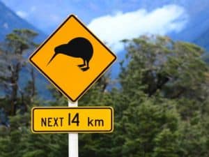
The Stewart Island Brown Kiwi is one of six identified species of kiwi. Kiwi are flightless and largely nocturnal. However, the Stewart Island Brown Kiwi is active during the day and night. Kiwi outnumber humans 43:1 and it is estimated there are 20,000 on Stewart Island. The Stewart Island Brown Kiwi is called Tokoeka in Māori. The name Tokoeka literally translates to “weka with a walking stick” and refers to the kiwi's long beak.
Before you start off, make sure you stop at the Rakiura Visitors centre to get some red cellophane unless you headtorch has a red light. Kiwi are easily spooked and become disorientated under bright light. Wrapping cellophane around your hand or head torch lamp will allow you to view kiwi in their natural habitat.
Notice how “kiwi” doesn’t change in form to show it’s plural? In Māori, plurals are shown through context or markers instead of changing the word itself. You might have heard “Kiwis” as a friendly slang term for New Zealanders. While “kiwi” refers to both the bird and the people, adding an “s” in English makes it clear we’re talking about more than one person rather than the bird. This is an English convention added for clarity and ease.

The trail typically begins at Lee Bay, just a short distance from the island’s main settlement, Oban which is where the ferry terminal is. As hikers set off, they pass the famous chain link sculpture, symbolising the Māori legend that Stewart Island is anchored to the South Island. However, this was my last view as I hiked the Rakiura Track clockwise.
Hiking the Rakiura Track anti-clockwise, your first stop will be Port William Hut, located near the site of an old Māori settlement and later a saw milling area. I camped instead of using the huts and Port William Campsite is just gorgeous! The campsite is set on the shores of the Magnetic Beach and is totally protected by prevailing winds. As with all campsites, there is a shelter, water tank and toilet.
The route passes through diverse ecosystems, featuring towering rimu and kamahi trees, with frequent glimpses of the rugged coastline and inlets of Paterson Inlet/Whaka a Te Wera. The final segment of the Rakiura Track takes hikers back toward Oban, passing through more lush forested areas, including the logging remnants that highlight the island's historical industries.

One of the unique aspects of the Rakiura Track is the chance to experience true wilderness with relatively few fellow hikers, compared to other Great Walks of NZ. The relatively gentle terrain makes the track accessible for hikers of varying skill levels and I saw a number of families hiking together with quite young children.
Getting to The Rakiura Track
The Stewart Island Experience operates the ferry between Bluff and Oban. Tickets cost $110 per adult one way. There are 8 crossings daily each way, 4 departing Bluff and 4 departing Oban, and the crossing takes 1 hour.
This is a passenger-only vehicle, and parking is adjacent to the Bluff Visitor Terminal (additional cost) for ferry passengers. It's an airport-style parking facility, so you collect a ticket on entry and pay when you leave.
The trip across Foveaux Strait can get rather rough – so we suggest taking some sea-sickness tablets with you if you are prone.
The trailhead is an easy walk from the township of Oban.
Pass it on – this guide’s a winner!
Perfect for anyone planning a hike in Aotearoa.
9. Paparoa Track
Paparoa Track
55 km / 34.25 mi
3-4 days Hiking
Elevation Gain: 1,851 m / 6,076 ft
Pike29 Memorial Track
11.6 km / 7.2 mi
Uphill: 5–6h Hiking | 4h Mountain Biking
Downhill: 3.5–5h Hiking | Mountain Biking
MTB grade: Advanced (Grade 4)
Best Time to Walk/Bike: October – April (Open Year Round)
Paparoa National Park, South Island, New Zealand.

About the Paparoa Track
Designed as a dual-purpose trail for both hikers and mountain bikers, the Paparoa Track commemorates the 29 miners who tragically lost their lives in the Pike River Mine Disaster.
Along with the connected Pike 29 Memorial Track, the Paparoa Track traverses the alpine tops of the Paparoa Range, offering breathtaking vistas and a multifaceted tribute to those who perished. This shared-use trail beautifully integrates memory and adventure, where hikers can experience one of the most scenic and meaningful landscapes in New Zealand.
Pike 29 Memorial Track
The Pike 29 Memorial Track opened in February 2024 as an extension of the Paparoa Track. Built by mountain bikers for mountain bikers, it is the first dedicated mountain bike track to pass through a national park in New Zealand and is also the country’s first “Great Ride”.
Starting just north of Moonlight Tops Hut on the Paparoa Track, the Pike 29 Memorial Track extends east into the Pike Valley, concluding at its own entrance. At the terminus is the Pike River Mine portal featuring a memorial and interpretation centre.
Best hiked south to north, hikers and bikers start the Paparoa Track from Smoke-ho car park near Blackball, the track initially climbs through dense beech forest and across alpine tops. Options include stopping off at Ces Clark Hut for the night – turning this trail into a 4 day hike, or continuing on to Moonlight Tops Hut.
At this point, the track traverses the ridge line of the Paparoa Range with panoramic views of the Tasman Sea to the west and the Southern Alps to the east. The alpine environment is striking with tussock grasslands and unique limestone karsts.

Both Ces Clark and Moonlight Tops Huts, situated on the ridgeline, provide spectacular views and sunsets looking out towards the Tasman Sea.
The final day’s journey descends into the lush forested depths of the Pororari River gorge. The ancient forested areas filled with vibrant birdlife and impressive rock formations. One of the highlights of this section is crossing multiple swing bridges over the Pororari River, which meanders through the dense rainforest.
The descent towards Punakaiki takes hikers through towering limestone cliffs, karst landscapes, and lush rainforests, finishing near the iconic Punakaiki Pancake Rocks and Blowholes.
With its diverse landscapes, deep history, and modern facilities, the Paparoa Track stands out as one of the most engaging of New Zealand's Great Walks. It’s perfect for those looking to explore lesser-known wilderness areas while experiencing a poignant connection to the country’s mining history.

The track is considered an intermediate hike, suitable for hikers with a good level of fitness. While there are some steep sections, especially at the start of the track, most of the trail is well-graded and relatively easy to navigate. The track is accessible year-round, although conditions can be challenging during winter due to snow and ice on the higher sections.
There are 3 huts along the Paparoa Track, however, there are none on the Pike 29 Memorial Track. If hiking the Pike 29 Memorial Track as a side trip, it will need to be a return trip within the same day. On this particular Great Walk, there are no campsites and wild camping is not allowed.
Getting to the Paparoa Track
The nearest towns are Blackball, Greymouth and Punakaiki.
The track can be accessed by road at:
- Smoke-ho car park at the end of Blackball Road, 8 km north of Blackball.
- Pororari River Track carpark on SH 6, 1.2 km north of Pancake Rocks at Punakaiki
- Waikori Road carpark on SH 6, 2.4 km south of Pancake Rocks at Punakaiki
Paparoa Track Transport offers a car relocation service.


10. Lake Waikaremoana Track
Duration: 46 km / 28.5 mi | 3-4 days
Grade: Intermediate
Elevation Gain: 2,312 m / 7,584 ft
Best Time to Walk: Year Round
Location: Te Urewera, North Island

About the Lake Waikaremoana Track
The Lake Waikaremoana Track guides hikers around the picturesque shores of Lake Waikaremoana in Te Urewera, a vast area of native rainforest on the North Island, known for its deep Māori cultural and historical significance. The name ‘Waikaremoana' translates to “sea of rippling waters,” a sacred site for the Tūhoe people, who see Te Urewera as Te Manawa o te Ika—the heart of the fish that Maui pulled from the sea, according to Māori folklore.
Te Urewera also holds the distinction of being the first natural feature recognised under New Zealand law as a legal entity in its own right. This four-day trek is not only a journey through lush, ancient rainforests but also a deep dive into the rich Māori heritage and the area’s diverse ecosystems.
Te Urewera spans eight hundred square miles (2,127 km²) of rugged, green ridges and is largely inaccessible except by horseback or helicopter. This remote sanctuary is treasured for its vast ecosystems, with prehistoric native bush, alive with the birdsong of tui and kererū (wood pigeon). If you're lucky you may hear the call of kiwi at night.

The track starts from Onepoto in the southwest and ends at Hopuruahine in the northeast, although it can be walked in either direction. The first leg of the hike climbs steeply from the lake's edge to Panekire Bluff, offering magnificent views over Lake Waikaremoana and the surrounding forested hills. Perched on the bluff, Panekire Hut gives you fantastic views, especially at sunset or sunrise.
The second day involves a steep descent through the dense, “goblin-type” forest of rimus, kahikateas, and beeches, leading eventually to Waiopaoa Hut on the lake's shores. The adjacent campsite, right by the sandy shore, is perfect for a swim.
Day Three follows a fairly level path alongside the lake and includes the stunningly beautiful Korokoro Falls, a must-see side trip located just 30 minutes from the Korokoro campsite.
The final stretch from Marauiti Hut to Hopuruahine features gentler, undulating terrain, with the track weaving through peaceful forest glades and along the tranquil lake. The journey concludes at Hopuruahine, where transport back to the starting point or to any of the waterside huts or campsites can be optionally arranged via water taxi.

The Lake Waikaremoana Track is considered an intermediate hike, but the climb to Panekire Bluff can be challenging, with steep sections and uneven terrain. Weather conditions can change quickly, so hikers should be prepared for rain, even during the summer months. The remoteness of the area adds to the sense of adventure, but it also means hikers need to plan carefully.
Getting to the Lake Waikaremoana Track
The Lake Waikaremoana Great Walk can be accessed from either end – Onepoto or Hopuruahine landing. Hopuruahine is about half an hour's drive from Te Karetu. However Hopuruahine road is not currently suitable for 2WD vehicles.
Hikers can travel via water taxi to either end of the walk or to individual huts and campsites around the lake. Book out of Te Urewera Visitor Centre (Te Kura Whenua).


11. Hump Ridge Track
Duration: 61 km / 38 mi | 3 days
Grade: Intermediate
Elevation Gain: 1,816 m /5,958 ft
Best Time to Walk: Year Round
Location: Fiordland National Park, South Island,

The Hump Ridge Track is New Zealands newest Great Walk – having joined the “chosen ones” in October 2024.
The Hump Ridge Track traverses alpine ridgelines in Fiordland National Park, an area renowned for its snow-capped peaks, waterfalls cascading directly into the sea, ancient rainforests and deep fiords.
It was in the mid-1980s – when changes to government policy saw Tuatapere's forestry industry shut down and the town’s population shrink from 2,500 to less than 1,000 – that residents first bandied about the idea of opening a track to attract tourists. Designed to be walked over three days, it would carry hikers from windswept beaches high into the mountains, where they would have unrivalled 360-degree views from the top of the world of the surrounding tarns (mountain lakes), coastline and even as far away as Stewart Island/Rakiura.
Locals will be quick to tell you that these are the views that inspired the Carpenters’ 1972 hit Top of the World, which was based on a poem sent to the American pop duo by a Southland schoolteacher:
Starting at the coastal settlement of Tuatapere, the track ascends to the subalpine ridgeline of the Hump Ridge, providing stunning views of the Southern Ocean, Te Waewae Bay, and the inland wilderness. One of the unique aspects of this hike is its history – hikers pass through old viaducts and abandoned logging sites, adding a cultural layer to the experience.

The Hump Ridge Track’s lodges offer an exceptional level of comfort, setting them apart from typical DOC huts. At Okaka Lodge and Port Craig Lodge, hikers can enjoy hot showers, flush toilets, heating, and bunk rooms, along with fully equipped kitchens and communal lounge areas with spectacular views. Both lodges provide food and drink options for purchase, so you can travel lighter. For those looking to reduce pack weight or shorten their journey, helicopter transport is available, delivering gear or offering drop-offs and pick-ups.
The Hump Ridge Track is moderately challenging, with significant elevation gain on the first day. It’s suitable for fit hikers with some experience, but the well-maintained track and comfortable lodges make it more accessible than other remote Fiordland hikes. The track can be booked year-round, and weather conditions are milder than many other alpine treks in New Zealand.
Getting to the Hump Ridge Track
The Hump Ridge Track starts from the Rarakau car park near Tuatapere in southern Fiordland. Tuatapere is 1.15 hr from Invercargill Airport, 1.5 hr from Te Anau and 2.5 hr from Queenstown.
Return track transport to or from Tuatapere can be arranged through the Hump Ridge Track website.

Like this? We've got loads more!
Sign up for our weekly email and get your Free Copy of HIKE IT RIGHT.
An 88-page guide to staying well, looking after your body, and handling things when they don’t go to plan
You can unsubscribe anytime. For more details, review our Privacy Policy.
Why the Great Walks Deserve Their Name
So there you have it – Eleven Great Reasons why New Zealand's Great Walks are often described as the jewels in New Zealand's crown. Each one highlights a different face of the country’s wilderness, from the volcanic heart of the North Island to the remote coastlines and alpine passes of the South.
They are also some of the most accessible multi-day hikes in New Zealand, with well-marked tracks, maintained huts, and clear booking systems. That makes them an excellent choice if you’re new to multi-day hikes, but don’t underestimate them.
If you can’t secure a spot on a Great Walk or prefer fewer crowds, there are hundreds of other spectacular tracks to choose from. Check out my other guides
28 Alternatives to the Great Walks in North Island New Zealand, and,
26 Epic Hikes on the South Island That Aren’t Great Walks (But Should Be)
The Great Walks aren’t just about ticking off kilometres; they’re about slowing down and experiencing the very best of New Zealand’s natural and cultural heritage.
What are the Great Walks of New Zealand?
New Zealand’s Great Walks are eleven premier multi-day hiking tracks managed by the Department of Conservation. They showcase the country’s most iconic scenery, from Fiordland’s alpine passes to Abel Tasman’s beaches. Tracks are well-maintained, with bookable huts and campsites. The Great Walks represent the most popular and accessible tramping adventures in New Zealand.
How many Great Walks are there in New Zealand?
There are currently eleven Great Walks across New Zealand. They’re spread between both islands and include famous tracks such as the Milford, Routeburn, Abel Tasman, Tongariro Northern Circuit, Kepler, Heaphy, and the Whanganui River Journey. The newest addition, the Hump Ridge Track, joined the network in 2024, bringing the official total to eleven.
When is the best time to hike the Great Walks in New Zealand?
Most Great Walks are best hiked between late October and April when the weather is warmer and facilities are fully open. Some tracks, like Abel Tasman and Rakiura, can be walked year-round. Winter tramping is possible on alpine tracks but requires specialist skills, avalanche awareness, and carrying equipment for snow and ice conditions.
Do you need to book huts on New Zealand’s Great Walks?
Yes, all huts and campsites on New Zealand’s Great Walks must be booked in advance through the Department of Conservation. Bookings open each year and often sell out quickly, especially for Milford, Routeburn, and Kepler. Advanced booking ensures your place, as wild camping is not permitted along Great Walks tracks within national parks.
How difficult are the Great Walks in New Zealand?
Difficulty varies between tracks. Abel Tasman and Rakiura are suitable for beginners, with gentle terrain and shorter days. Alpine walks like Milford, Routeburn, and Tongariro involve steep climbs and exposed conditions, requiring good fitness. Heaphy and Hump Ridge are longer journeys. All Great Walks are well-marked, but weather changes make preparation essential for safety.
How long does it take to complete New Zealand’s Great Walks?
Each Great Walk has a different length and timeframe. Shorter options like the Routeburn can be done in 2–3 days, while the Heaphy Track may take 5–6 days. The Whanganui Journey is a 3–5 day river trip. On average, most Great Walks take between three and six days to complete fully.
How much does it cost to do a Great Walk in New Zealand?
Prices depend on the track, season, and whether you’re a New Zealand resident or international visitor. Huts typically cost between NZD $20–$40 for residents and $70–$110 for international hikers. Campsites are cheaper. The Whanganui Journey also includes canoe hire. Costs rise in the Great Walk season, so planning your budget is important.
Can beginners hike the Great Walks in New Zealand?
Yes, some Great Walks are ideal for beginners. The Abel Tasman Coast Track and Rakiura Track both feature easy terrain, shorter distances, and year-round access. Even though these are beginner-friendly, hikers should prepare properly with suitable footwear, gear, and bookings. More challenging alpine walks like the Milford or Routeburn are better suited to experienced hikers.
What should I pack for a Great Walk in New Zealand?
Pack essentials include layered clothing, rain gear, sturdy boots, food, cooking equipment, and a sleeping bag. Each Great Walk has different requirements depending on season and terrain. Hut bookings mean you don’t need a tent, but you must carry enough supplies for safety. Preparation is critical as weather can change suddenly, especially on alpine tracks.
What are alternatives to the Great Walks in New Zealand?
New Zealand has hundreds of other excellent multi-day tramping tracks beyond the Great Walks. These alternatives often see fewer crowds but still deliver spectacular scenery. Examples include the Rees-Dart, Greenstone and Caples, and the Travers-Sabine. I’ve written full guides to North Island and South Island alternatives for hikers who want quieter, equally rewarding adventures.