

Hiking the West Highland Way in Scotland’s Highland Heartland
The West Highland Way is Scotland’s best-known long-distance hike, stretching 154 kilometres from the edge of Glasgow to the foot of Ben Nevis. It was the first official long-distance trail in the country and has become a classic route through some of Scotland’s most striking and historic landscapes.
This is a trail that captures the full sweep of the Scottish Highlands. The route takes you from the pastoral lowlands through dense pine forests and up into exposed moorland and ancient glens. There’s history at every turn — old military roads, drovers' paths, abandoned settlements, and stories carried down from the Jacobite uprisings.
And yet it’s also accessible. The track is well-marked, with regular accommodation and a strong hiking culture. It’s a great trail for anyone wanting to explore Scottish landscape and culture on foot, with enough infrastructure to make logistics easy, but enough distance to feel like an achievement.
Nigel and I walked the West Highland Way (WHW) in May 2025. It was his second time on the trail, having first walked it in 2023, and it was good to see it through both fresh and familiar eyes.
You don’t need to carry a tent (though you can). You don’t need to be a mountaineer. You just need to put one foot in front of the other and let Scotland do the rest.
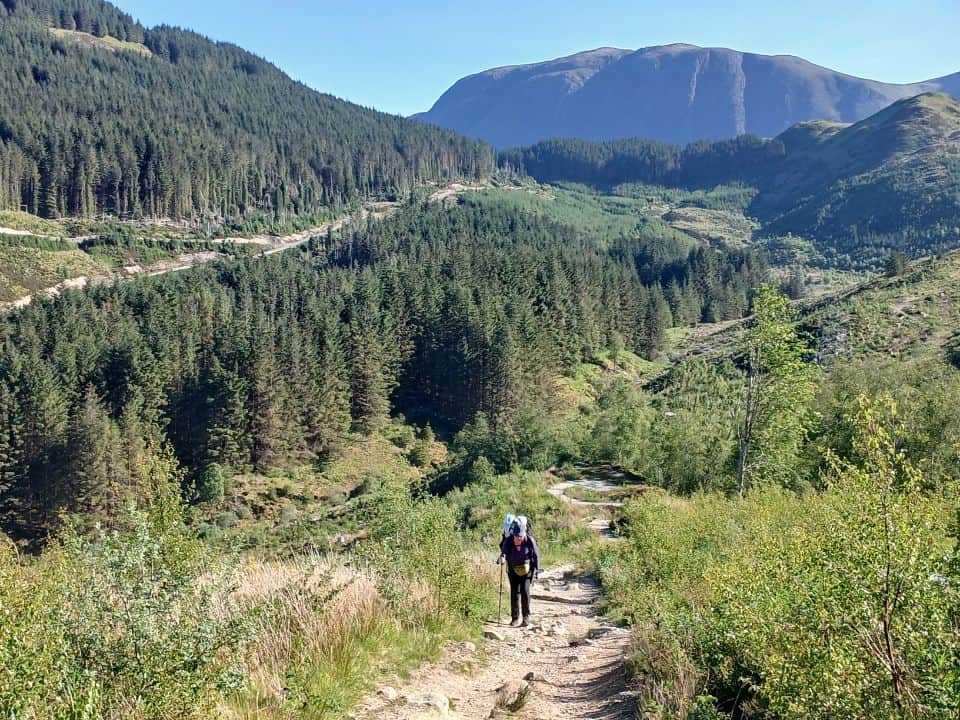
This article may contain affiliate links. If you make a purchase using one of these links, we may receive compensation at no extra cost to you. See our Disclosure Policy for more information.
Quick Links:
Trail Overview | Is the West Highland Way Right for You? | Waymarking and Trail Conditions | Best Time to Walk the West Highland Way | Accommodation | Food and Resupply | Guided and Self Guided Tours | Water on the Trail | Training for the West Highland Way | What to Pack for the West Highland Way | Luggage Transport Services | Getting to and From the Trail
Trail Overview
- Distance: 154 km (96 miles)
- Duration: 6–8 days
- Elevation Gain: 4,852 m (15,213 ft)
- Highest Point: 550 metres (1,804 feet)
- Trail Type: Point to Point
- Grade: Moderate – well marked, but with some longer days
- Best Time to Hike: April to September
The Story Beneath the Trail
If you’re anything like me, you might have relished productions like Braveheart and Rob Roy, or been swept into the world of Outlander and even cult classics like Highlander. The West Highland Way is steeped in the kind of history that fuels those stories. I’ve written a separate post that dives deep into it all; clan feuds, ancient drovers, bloody uprisings, executions, and the most haunting legacy of all, the Scottish Clearances.
Here, though, in this practical guide, I’ve kept a shorter section on the history you actually walk across, and the way the Highlands were remade.
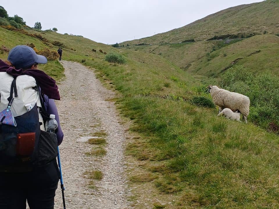
The Short Version of the Long History
Walking the West Highland Way, you don’t just move through landscapes, you move through centuries. Much of the trail runs underfoot along old drovers’ roads, wide stony tracks used from the 16th to 18th centuries to drive cattle south to markets in the Lowlands and England.
After the Jacobite risings of the 18th century, new military roads were forced through the glens by General Wade and later Major Caulfeild. These weren’t scenic paths but horribly instruments of control. They were routes for redcoats to pour into Highland glens, stamping out rebellion, executing rebels, and keeping clans disarmed. You’ll walk long sections of the military roads near Tyndrum and across Rannoch Moor.
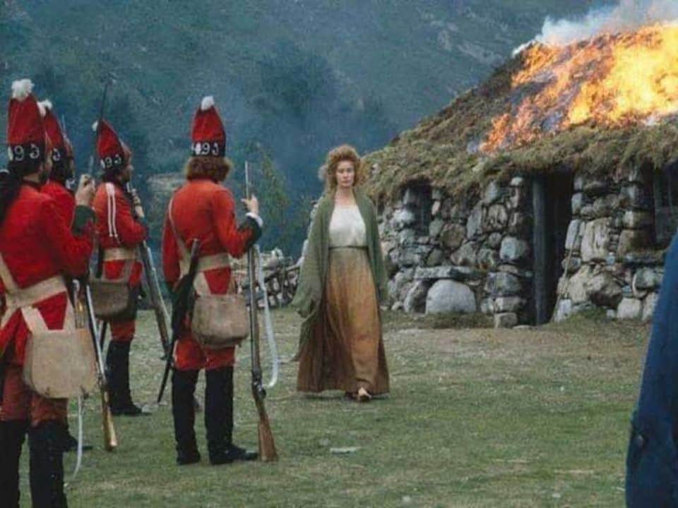
However, the Highland Clearances of the late 1700s and 1800s left the most haunting marks. Landlords evicted entire communities to make way for sheep and later deer estates. Ruined crofts and deserted townships still sit close to the path, silent reminders of lives uprooted. Having Scottish ancestors, victims of the clearances, who sailed to New Zealand on one of the first voyages, this is close to my heart.
On the West Highland Way, the most famous croft ruin is Tigh-na-sleubhaich near Kinlochleven, now a popular lunch stop for walkers. You can read more about all this in our post History along the West Highland Way.


Is the West Highland Way Right for Me?
The good news? This is one of the more accessible long-distance hikes in the UK. I saw walkers of all ages on the trail, including plenty of people in their 70s and even a few in their 80s! All taking it at their own pace. While the West Highland Way certainly has some long days and a few steep sections, it’s not an extreme undertaking, especially if you plan well.
One of the big advantages of this route is flexibility. You’re never more than a day away from a village, and there are multiple opportunities to shorten your itinerary or exit the trail if needed. Many towns have decent transport links, and most accommodation providers will help arrange onward travel if plans change.


You can also build in rest days. Places like Drymen, Tyndrum, and Kinlochleven are excellent spots to stay more than one night, especially if you're tackling the climb up Conic Hill, the lochside scramble beyond Rowardennan, or the Devil’s Staircase. These breaks can make a big difference, especially if you’re managing joints, injuries, or just want to enjoy the scenery without rushing.
And if you’re not up for carrying a full pack, that’s no problem either. There are luggage transfer services that will carry your bag each day, so all you need to focus on is the walking.
👉 If you’re not sure how to prepare physically for this hike, I’ve written a full section on Training for the West Highland Way towards the end of this post. It includes advice for hill fitness, pack weight, and what kind of terrain to expect.

Spread the Highland Love
Beautiful trails are better when shared with your people.
West Highland Way Sections
|
# |
Section: |
Distance: |
Elevation Gain: |
Time: |
|
1. |
Milngavie to Drymen |
12 mi / 19 km |
715 ft / 220 m |
4–5 hrs |
|
2. |
Drymen to Rowardennan |
14 mi / 22.5 km |
1,350 ft / 410 m |
6–7 hrs |
|
3. |
Rowardennan to Inverarnan |
14 mi / 22.5 km |
1,490 ft / 455 m |
6–8 hrs |
|
4. |
Inverarnan to Tyndrum |
12 mi / 19 km |
1,640 ft / 500 m |
5–7 hrs |
|
5. |
Tyndrum to Bridge of Orchy |
7 mi / 11.25 km |
1,115 ft / 340 m |
3–4 hrs |
|
6. |
Bridge of Orchy to Kingshouse |
12 mi / 19 km |
1,650 ft / 505 m |
5–6 hrs |
|
7. |
Kingshouse to Kinlochleven |
9 mi / 14.5 km |
1,640 ft / 500 m |
4–5 hrs |
|
8. |
Kinlochleven to Fort William |
15 mi / 24 km |
1,820 ft / 555 m |
6–8 hrs |
Northbound or Southbound?
Most people walk northbound, starting in Milngavie (just outside Glasgow) and finishing in Fort William. Walking northbound, the landscapes build in drama as the trail moves deeper into the Highlands, and there’s something satisfying about ending the walk beneath Ben Nevis, rather than at a suburban train station. Fort William is also better set up for finishing: more places to stay, better food, and easy rail links to Glasgow or onward to the Isles.


Navigation and Resources
Waymarking and Trail Conditions
The West Highland Way is generally well-marked with brown posts bearing a white thistle icon in a circle. In open terrain and clear weather, these markers are easy to follow. But in some areas, especially through forestry plantations near Crianlarich and Kinlochleven, signage can become patchy. Junctions may appear suddenly, and crisscrossing tracks can make the route less obvious.
For all these reasons, it’s wise to carry a backup map, either paper or digital. This is especially important in the off-season, when there are fewer hikers around to confirm you’re on track. If you also have GPS on your phone or watch, even better.
The weather can also complicate things. Conditions shift quickly in Scotland, and even a clearly waymarked trail becomes disorienting when fog rolls in or visibility drops. Rannoch Moor is one of the most exposed sections. It’s long, boggy in parts, and the path can fade into the surrounding landscape in poor light.


GPS and Digital Navigation
Most hikers now carry a GPX file of the route. If you're new to hiking, think of a GPX file like using Google Maps in the city—but for the trail. It’s a digital track you can load onto your phone or GPS device that shows the full route ahead. Even if there’s no phone signal, you can still see where you are on the trail, follow your progress, and avoid wrong turns. It’s not turn-by-turn directions, but it works as a live map overlay, which is especially useful in bad weather or across open moorland.
You can download a GPX file of the West Highland Way from several sources:
- Official Site – westhighlandway.org
- Knife Edge Press – GPX downloads included with Andrew McCluggage’s guidebook
- FarOut – Long-distance hiking app with offline route, waypoints, elevation, and accommodation info
- Komoot – Popular with European hikers; offline use requires a regional pass
- AllTrails – GPX downloads with Pro subscription
- Gaia GPS – Reliable for offline use, with detailed base maps
Just make sure to download the file before setting off, as signal is patchy in remote areas. Particularly across Rannoch Moor and over the Lairigmor stretch. A backup battery (power bank) is worth carrying if you’re relying on your phone for navigation.

Free West Highland Way Packing List
Pack light, stay organised, and remember every essential for Scotland’s most famous long-distance trail. Add notes, save or print, and share with hiking partners. Works on any device.
Topo Maps
The West Highland Way is fully covered by UK Ordnance Survey Explorer Maps at 1:25,000 scale. These are ideal if you prefer traditional navigation, want to study the surrounding terrain, or just like having a broad view of the landscape.
The relevant sheets are:
- OS Explorer 348 – Loch Lomond South
- OS Explorer 364 – Loch Lomond North
- OS Explorer 377 – Ben Nevis & Fort William
All three maps provide detailed coverage, but carrying full paper sheets adds weight. Some hikers use the OS Maps app or load the sheets onto a GPS device. Digital or paper, they’re a solid option if you’re experienced with topo navigation or want a visual backup to GPX tracks.
Fun Fact:
Ordnance Survey offers a brilliant personalised map service. You can choose any standard map, such as OS Explorer 377 for the West Highland Way, and customise the cover with your own photo and title. If you're into maps, it’s a fantastic way to commemorate your hike and makes for a unique souvenir.


Recommended Guidebook
I recommend Trekking the West Highland Way by Andrew McCluggage (Knife Edge Press), and for anyone looking for a single, reliable source of trail information, it’s hard to beat.
The book includes detailed mapping in the style of OS Explorer maps, but tailored specifically to the trail. That means every junction, elevation shift, and alternate path is clearly laid out, without the bulk of carrying separate sheets. There are also GPX downloads, section breakdowns, estimated timings, and accommodation listings.
I’ve used other books in the Knife Edge series for the Alta Via 1, the Laugavegur Trail, and the Tour des Combins, and they’ve consistently proved accurate, trail-relevant, and easy to use mid-hike. For those who prefer to walk with something physical in hand, this guidebook is more than enough. Plus they too, make an excellent keepsake!

Dinnae Gatekeep the Good Stuff.
Ye’ve had yer turn, now pass it on tae the next soul!
Best Time to Walk the West Highland Way
The official hiking season on the West Highland Way runs from May to September, but not all months are created equal. When you go will shape everything, from how crowded the trail feels to how many times you’ll be reaching for your midge net.
Mid-April to Early June – Often the Best Window
This is usually the sweet spot. The days are long, the midges are still waking up, and statistically, it’s one of the driest times of year in the Highlands. Everything feels fresh and open, with wildflowers on the lower slopes and fewer crowds on the trail. But it’s still Scotland, so “dry” is relative (bring waterproofs!)
Mid-June to August – Peak Season
This is when the WHW gets busy. School holidays, European walkers, and tour groups all converge on the trail, and accommodation books out months in advance. It’s also prime midge season. If there’s no wind, they’ll find you. A good head net, strong repellent, and the ability to keep moving will help.
That said, while everything is open and operating at full capacity in July and August, the weather isn’t always kind. These months can bring humid, changeable conditions with bursts of rain and low visibility on higher ground.
September – Quieter, Wetter, Beautiful
September is visually stunning—the hills start to bronze, and the heather is still in bloom. The crowds thin out, and you’ll likely have longer stretches of the trail to yourself. But expect more rain, cooler nights, and a bit of unpredictability with ferry and bus schedules toward the end of the month.
Midges taper off by late September, but it varies year to year.


West Highland Way Accommodation
There are several ways to walk the West Highland Way, and your accommodation choice will shape your experience. Most walkers stay in B&Bs, guesthouses, or hotels, while others mix it with campsites or walk the whole trail carrying everything on their back. I chose to wild camp, and I’ll come to that below.
B&Bs, Guesthouses, and Hotels
The vast majority of hikers choose to walk inn-to-inn, staying in B&Bs, small hotels, or guesthouses along the route. These range from basic rooms above pubs to comfortable lodges with drying rooms and packed lunch options. Many, if not all, cater specifically to West Highland Way walkers and understand the needs of tired, wet travellers.
Booking ahead is essential, especially in busy periods. Places like Inveroran and Kinlochleven have very limited availability, and accommodation along the route can fill up months in advance.
One practical benefit of staying in B&Bs or hotels is the ability to use a luggage transfer service between stops. It means you can walk with a lighter daypack and arrive each night to a bed, a hot meal, and a roof over your head.
Our Accomodation Guide not only lists accomodation options, but also goes into detail on the various types.


Self-Guided and Guided Tours
If you want to focus on walking and not the logistics, several companies offer self-guided tour packages. These include pre-booked accommodation, daily luggage transfers, and sometimes printed route guides. You still walk independently, but the itinerary is handled for you.
Fully guided tours are also an option, especially for international travellers or solo hikers looking for group support. These are usually small group experiences led by local guides, often with all meals and bookings included.
Camping
Campsites are available at regular intervals and suit those who want flexibility or are walking on a budget. Some are very basic, others have cooking shelters, showers, or small shops. It’s possible to mix camping nights with the occasional B&B, which is a good compromise if you don’t want to camp the whole way.
Be sure to check whether campsites need to be booked in advance, as some do, especially near popular stops. Our Accomodation Guide also lists camping options for each section.


Wild Camping
Nigel and I chose to wild camp the entire trail. Scotland’s outdoor access laws mean that wild camping is legal along most of the West Highland Way, as long as it’s done respectfully: away from buildings, off farmland, and following Leave No Trace principles.
I prefer wild camping because it gives me freedom. I can walk as far as I like, sleep under the stars, and wake up somewhere beautiful. It’s not for everyone, but it adds a rhythm and self-sufficiency to the walk that I personally enjoy.
Food and Resupply
The West Highland Way isn’t wilderness walking the entire way, but it’s definitely not a foodie's stroll either. You’ll pass through villages and towns where you can restock, but the distances between them can be deceptive. If you're walking inn-to-inn, you'll have access to cooked meals in the evenings. But lunches or snacks (trail fuel) still require forethought.
Why Trail Fuel Matters
When you're walking day after day, your body needs more than just three meals. You’re burning through energy steadily, and if you don’t stay on top of it, you’ll start to feel it.
Running low on food while hiking isn’t just uncomfortable, it can actually be dangerous. Without steady fuel, your blood sugar drops. That’s when fatigue creeps in, your thinking gets fuzzy, and your coordination takes a hit. On uneven ground or long descents, that can quickly turn into a fall, a misstep, or a poor decision.
One of the early signs is feeling light-headed, weak in the legs, or suddenly low in mood. It’s often not tiredness, it’s your body running out of fuel.
That’s why it’s smart to eat small amounts regularly as you walk. Think a handful of trail mix, a banana, or a nut bar every hour or so – even if you’re not hungry. You’re not snacking for fun; you’re feeding your body what it needs to stay upright, alert, and moving.
Carbohydrates are broken down into glucose, which your body uses as its main energy source. Without enough of them, your muscles fatigue and your pace drops quickly.
And don’t forget salt. When you sweat, you’re not just losing water. You’re losing electrolytes — especially sodium, which help regulate your muscles and hydration levels. Salted pretzels or nuts are a practical way to help replace what’s lost and keep things running smoothly.
Food isn’t just fuel. On the trail, it’s safety, stamina, and stability!
Lunches and Snacks
Some accommodation will provide a packed lunch; others, especially in towns with a supermarket, may not. I have a detailed post on Food for Day Hikes, which may be useful in this instance.
A number of supermarkets along the route catered to hikers, with small items like hard-boiled eggs, single-serve cheese portions, and other trail-friendly food you can grab without needing a full kitchen. Here are some ideas for snacks and lunches I’d take on the trail:
- Sandwiches or rolls (shop-bought or DIY)
- Trail mix, nuts, dried fruit
- Oat bars, flapjacks, or energy snacks
- Hard cheese, boiled eggs, cured meats
- Fruit – apples travel well and are a nice refreshing snack
Coffee and Tea (or Hot Soup!)
Because Nigel and I were camping, we had our full cooking setup with us. What that meant was the ability to stop mid-morning for a coffee, enjoy a hot cup of tea in the afternoon, or a hot soup at lunch. It was absolutely brilliant on this trail. More than once, while we were making our brew, inn-to-inn hikers would stop to chat, eyeing off our steaming mugs with open envy.
A small, lightweight cooker doesn’t cost much more than a couple of café stops — and the ultralight options on the market now are compact and small, easy to use, and weigh just a few hundred grams.
If you think this is something you could carry, I totally recommend it. Having a proper coffee mid-morning is a real pick-me-up. And don’t forget a packet of Hobnobs to go with it!
One good example is the Jetboil Zip. It’s a compact all-in-one stove that boils enough water for two cups in just two minutes. And for the coffee lover, there’s even a compatible coffee press attachment that turns it into a little French press setup.
Jetboil Zip – Gas Cooker
Sea to Summit Cup – Lightweight Collapsible Cup
For many hikers, this may be the first time using a small gas stove, so make sure you're confident with how it works and plan ahead for fuel. Gas canisters can’t be taken on a flight, but they can be safely carried by bus or train. You can pick one up at any outdoor store in Glasgow, Inverness, or Edinburgh — and I’ve listed other supply points further down the page.
Shops and Supermarkets
There are full supermarkets at:
- Milngavie (right at the start)
- Tyndrum (Green Welly Stop and a small supermarket just near the start of the trail)
- Kinlochleven (good co-op and small eateries)
- Fort William (at the finish of the WHW)
You’ll also find smaller shops or cafes in:
- Balmaha (village shop and café)
- Rowardennan (limited, may be seasonal)
- Crianlarich (short detour)
Camping Resupply
Gas
If you’re camping, you’ll need to factor in gas as well as food. Since you’ll likely be arriving at the trailhead overland, it’s a good idea to pick up gas in Glasgow or Inverness before you begin. Gas canisters are also available at Milngavie, Tyndrum (try the Green Welly Stop), and in Fort William, which has several outdoor stores along the high street.
Milagvie or Tyndrum may have depleted supplies, so I suggest carrying a FlipFuel with you to fill up your canister from the halfies left over at the various campsites.
Food
Milagvie and Tyndrum both have a limited supply of dehydrated meals, but both supermarkets and the Co-op at Kinlochleven has plenty of noodles, cous cous, tins of tuna etc.
For breakfast on the West Highland Way, we stuck with our usual overnight oats. They’re easy to prepare, don’t take up much space, and provide a steady release of energy thanks to their complex carbohydrates. That matters on long, physical days. Oats also contain minerals like iron and magnesium, which support stamina and muscle recovery. On the rare days we opted for a cooked breakfast instead, I found myself feeling flat and hungry much earlier.
👉 Here’s the full overnight oats recipe I use on all my multi-day hikes.

Staying Hydrated on Trail
It’s easy to underestimate just how much water you lose while walking, especially in the Highlands where the weather can be cool, damp, or overcast. But don’t let the cloud cover fool you, you’re still sweating, breathing out moisture, and burning through fluids steadily all day.
Dehydration on trail isn’t always obvious at first. You don’t need to be in the desert, or drenched in sweat, to get into trouble. One of the earliest signs is a headache that creeps in mid-morning or early afternoon. Then you might notice sluggishness, dizziness, or a drop in concentration. When it gets worse, things like poor balance, muscle cramps, nausea, and even confusion can start to show up.
For first-time hikers, this can feel like tiredness — but it’s not. It’s your body running dry.
Water isn’t just for thirst. You need it to regulate body temperature, transport nutrients, and keep your muscles and brain working properly. Without it, your body can’t cool itself or function efficiently. That’s why dehydration can lead to heat exhaustion, even in mild weather, especially if you’re carrying a pack or pushing yourself over long distances.


How Much Water Do You Need?
There’s no single answer, but as a rule of thumb, most adults need at least 2–3 litres per day on a hike like the West Highland Way. If it’s warm, or you’re carrying a heavy load, you may need more. And if you’re drinking tea or coffee, factor in the mild diuretic effect. You’ll need to top up a little extra.
Why Electrolytes Matter
Drinking water is really important — but it’s only half the equation. When you sweat, you’re not just losing fluids. You’re also losing electrolytes: sodium, potassium, magnesium, calcium, and chloride. These minerals keep your nervous system, muscles, and hydration levels in balance. If you don’t replace them, you’re not truly rehydrating — and that can lead to fatigue, cramps, and even more serious issues like hyponatremia.
For day hikers, a salty snack or sports drink might be enough. But on a multi-day trail, especially in warm weather or if you're walking long days, adding electrolyte tablets or powders to one of your water bottles each day is smart. Look for balanced mixes, not just sugar-heavy drink sachets.


Where to Get Water on the West Highland Way
Tap water in Scotland is excellent, and you’ll find regular opportunities to refill along the West Highland Way. If you’re staying in accommodation, you can top up each morning and sometimes again at lunch depending on your route. Villages like Balmaha, Tyndrum, and Kinlochleven usually have cafés, shops, or public toilets with tap access.
Between towns, there are plenty of natural water sources, mostly small streams and burns. But because the trail passes through farmland and areas grazed by livestock, it’s important to treat any water collected from these. Even clear water can contain bacteria, parasites, or agricultural runoff.
If you’re new to hiking and wondering how to do this, the simplest and most reliable method is to carry a lightweight filter. A squeeze-style filter that attaches to a soft water bottle is a good choice — it removes contaminants and most small particles without needing chemicals. If you don’t have a filter, a small pack of water purification tablets is worth carrying in case you need to fill up from a stream or burn unexpectedly.
MSR Pocket Rocket Water Filter
Katadyn BeFree 1L Water Filter
Water Purification Tablets
Training for the West Highland Way
Let’s be clear: you don’t need to be an ultra-marathoner to walk the West Highland Way. But you do need hill fitness, especially if you’re planning to walk consecutive days without rest, or carry a full pack.
Some days are long, some climbs are sustained, and a few sections (like the rough lochside track between Rowardennan and Inverarnan) are harder than they look on paper. What wears you down is the cumulative effect, which is day after day of movement, even if none of the individual stages feel extreme.
So how do you prepare?
🥾 Get Used to Back-to-Back Days
The best training is walking consecutive days on real trails. Even two-day weekend hikes will help. You want to train your feet, joints, and shoulders to recover overnight and be ready again in the morning.
⛰️ Add Elevation
You don’t need to climb mountains, but make sure your training walks include hills and uneven ground. Most of the West Highland Way's elevation gains are manageable, but they add up. Steep descents, like the long downhill from the Devil’s Staircase, can be brutal on untrained knees.
🎒 Practice with Weight
If you’re carrying your own gear, build up to hiking with a full pack. If you're using a luggage transfer service, your daypack will still need to carry water, food, wet weather gear, and basics. Either way, train with what you plan to carry.
🧭 Train in All Weather
Scotland is known for throwing four seasons at you in a single day. Get comfortable walking in wind, rain, and heat, not just sunshine.
⚠️ Listen to Niggles Early
If anything starts to hurt in training (knees, feet, hips), don’t ignore it. It will only get worse on a long trail. Adjust your gear, your gait, or your itinerary. If the problem lingers, see a physio or sports therapist who can give you targeted exercises to strengthen the area before you set out.

Ye Cannae Beat a Highland Trail
Tag a pal who needs a wee wander in their life.
Wild Camping
If you plan to wild camp, be aware that Loch Lomond has by-laws restricting camping in peak season. Camping on common ground in towns is discouraged, but many places have a space set aside for wild campers just outside the village boundary. However, I do prefer to set my tent up on shores of a loch, or high on a ridge for a fantastic sunrise or sunset.
Luggage Transport Services
If you’re staying in accommodation along the West Highland Way, and carrying a full pack is not something you wish to do, several companies offer a luggage transfer service, moving your bag each day from one B&B or hotel to the next. You just carry a day pack and enjoy the trail. It’s popular with inn-to-inn walkers and very well organised. Just be sure to book in advance, especially during peak season.
- AMS Scotland – A family-run service since 2001, running from Milngavie to Fort William, with daily baggage transfers during the main season
- Travel‑Lite – The original West Highland Way luggage carrier since 1995, operating along the full route with insured bags and strong ties to local accommodations
- Baggage Freedom – Budget‑friendly option offering both single- and multi-stop transfers from £45 per bag during March–October
- Sherpa Van – Covers the entire Way, £65 per bag with optional drop-offs at stops like Inversnaid Bunkhouse.
Each provider:
- Collects your bag each morning from your B&B or hotel
- Delivers it to your next staged accommodation (usually by mid‑afternoon)
- Weights are typically limited to ~20 kg per bag
Getting To and From the West Highland Way
The West Highland Way starts in Milngavie, a suburb just north of Glasgow, and ends in Fort William, a hub in the Scottish Highlands. Both ends are well-connected by public transport, which makes logistics relatively straightforward.
Getting to the Start (Milngavie)
From Glasgow, it’s an easy hop to the trailhead:
- By Train: Regular ScotRail services run from Glasgow Queen Street to Milngavie. The journey takes about 25 minutes. Trains are frequent, and no advance booking is needed.
- By Bus or Taxi: Buses run to Milngavie from various points in Glasgow, but the train is faster and more direct. A taxi from central Glasgow is also an option if you’re arriving late or with a group.
Milngavie station is just a few minutes’ walk from the official WHW starting obelisk in the town centre.
Getting Away from the Finish (Fort William)
Fort William is a well-equipped end point with transport links:
- By Train: The Scenic West Highland Line connects Fort William to Glasgow Queen Street. The journey takes around 3.5 to 4 hours. Booking in advance is recommended, especially in summer.
- By Bus: Scottish Citylink runs coaches between Fort William and Glasgow (and beyond). Buses are sometimes faster than the train and can be more frequent.
- Car Hire or Tours: Some hikers rent a car in Fort William if they’re continuing on to other parts of the Highlands like Skye or Cairngorms. Guided transfer services are also available for onward travel or luggage transport.
International Arrivals
Most international hikers arrive via London, as it's the UK’s primary hub for long-haul flights. From there, you can either take a domestic flight to Glasgow or Edinburgh, or travel by train.
Glasgow International Airport is the closest to the trailhead and serves a wide range of short-haul and European routes. Edinburgh also handles a mix of domestic and short-haul international flights.
From Glasgow Airport, take the airport bus into the city centre, then transfer to Glasgow Queen Street Station for a direct train to Milngavie, the official starting point of the West Highland Way.
If you're flying into Edinburgh Airport, take the tram or bus to Edinburgh Waverley Station, then catch a train to Glasgow Queen Street, and connect from there to Milngavie.
Car Parking Along the West Highland Way
If you’re doing part of the West Highland Way as an out-and-back or day-hike, you’ll find car parking at various points along the route, including Milngavie, Balmaha, Tyndrum, and Kinlochleven. These towns are also serviced by public transport, making it easy to return to your vehicle if you're hiking one way. Just check signage as not all car parks allow overnight stays or long-term parking.
Closing Thoughts on a Classic Trail
The West Highland Way is a rite of passage for many hikers visiting Scotland. Whether you walk it solo, with friends, or as part of a guided group, it’s a trail that captures the essence of the Scottish landscape and spirit.
It’s not the most remote or the most technical trail, but it’s steeped in history, shaped by centuries of movement, and backed by a strong hiking culture.
If you're planning a longer trip, it pairs well with the wilder Skye Trail, the lesser known East Highland Way, or a summit of Ben Nevis the day after you finish.
Thank you for reading, it was a pleasure to write. If you enjoyed it, or if it’s inspired you to walk these roads, take a look at our other in-depth guides below. The West Highland Way is an amazing walk and deserves a place on everyone’s bucket list!

Free West Highland Way Packing List
Pack light, stay organised, and remember every essential for Scotland’s most famous long-distance trail. Add notes, save or print, and share with hiking partners. Works on any device.
Frequently Asked Questions
How long does it take to hike the West Highland Way?
Most hikers take 6 to 8 days to complete the full 154 km (96 mile) West Highland Way. Faster walkers may finish in 5 days, while others take 9 or more to include rest days or shorter stages. Your itinerary will depend on pace, fitness, weather, and how much time you want to enjoy the trail.
What is the best time of year to walk the West Highland Way?
Late spring (May–June) and early autumn (September) are considered the best months for hiking the West Highland Way. You'll get long daylight hours and more stable weather. July and August are also popular but busier and coincide with midge season. Winter walking is possible, but requires experience and preparation for harsher conditions.
Is the West Highland Way difficult?
The West Highland Way isn’t technical, but it’s still a physical challenge. You’ll be walking 20–25 km a day on average, with some steep climbs and long stretches between services. Terrain includes rocky paths, old military roads, and exposed moorland. With good planning and gear, it’s suitable for most reasonably fit hikers.
Do I need to book accommodation in advance?
Yes, especially in peak season (May to September). Popular stops like Drymen, Tyndrum, and Kinlochleven can book out early. If you’re walking inn-to-inn, it’s best to book all accommodation before starting. If you’re wild camping, you don’t need bookings, but you’ll still want to plan your camp spots carefully.
Can I camp along the West Highland Way?
Yes — wild camping is legal in Scotland under outdoor access laws, as long as it’s done responsibly. Camp well away from roads and buildings, follow Leave No Trace principles, and avoid enclosed farmland. There are also paid campsites along the route with facilities like toilets and hot showers, if you prefer more comfort.
What gear do I need for the West Highland Way?
Your gear depends on whether you’re camping or staying in accommodation. Essentials include good walking shoes, a waterproof jacket, map/navigation tools, and layered clothing for variable weather. Campers will need a tent, sleeping gear, and stove. Even inn-to-inn walkers should carry snacks, water treatment, and emergency supplies. A full gear list is linked in the post.
Are there midges on the West Highland Way?
Yes. Midges are common from late May to early September, especially around still water and in sheltered areas. They’re most active in the mornings and evenings, particularly after rain. Pack a good head net and repellent (Smidge is popular), and be prepared to camp or rest in breezy spots where midges can’t gather.
Do I need a map for the West Highland Way?
The trail is generally well-marked, but a backup map or GPS is recommended. Signage can be patchy in forestry sections or hard to spot in poor weather. Carry a paper map like OS Explorer 377, or use a digital app with offline maps. GPS isn’t always reliable in remote sections, so don’t depend on signal.
Is the West Highland Way suitable for solo hikers?
Yes. Many people hike the West Highland Way solo, including first-time long-distance walkers. The route is popular and you’ll rarely be alone for long. Solo hikers should plan carefully, carry a map and emergency contact method, and stay aware of weather. It’s a well-supported trail — just prepare properly and hike within your limits.
What’s the best way to get to the West Highland Way?
The trail starts in Milngavie, a suburb of Glasgow. From Glasgow Central or Queen Street Station, it’s an easy train ride to Milngavie (about 30 minutes). The trail finishes in Fort William, which has bus and train connections back to Glasgow or on to other destinations in the Highlands like Skye or Inverness.