

Hiking Frenchmans Cap -Tasmania’s Iconic White Peak
Frenchmans Cap was always on my “to-hike” list. I recall listening in awe to fellow hikers describing the Frenchmans Cap during my first hike on the Great Ocean Walk and thinking, “Wow, so cool.” That was back when I was the new kid in school.
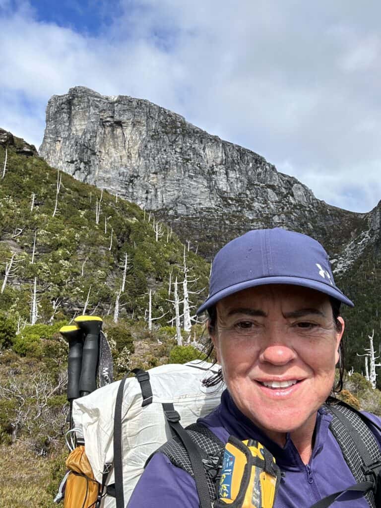
Fast forward a year later, I'm standing on the top of Mt Ossa during my hike through The Walls of Jerusalem to The Overland Track. As I looked out over the ranges towards the white peak of Frenchmans Cap, I mentally made a note to schedule this hike sooner than later.
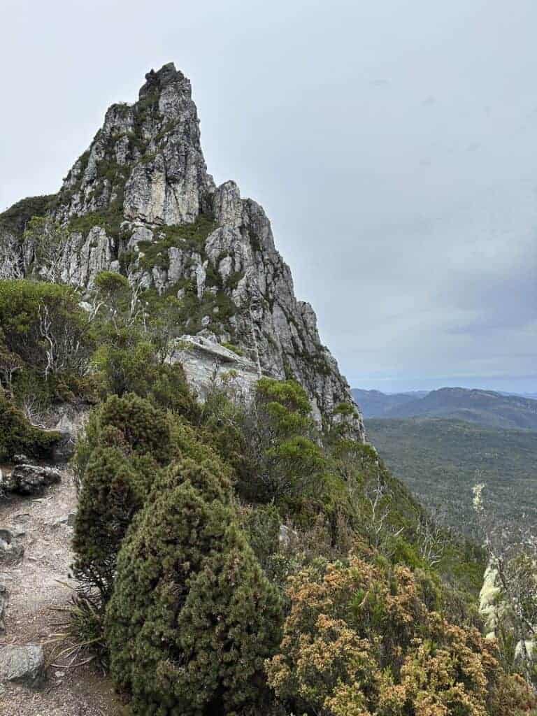
Frenchmans Cap is one of my favourite hikes for many reasons. In just a few days, Frenchmans Cap covers insanely beautiful rainforest, button grass plains, glacial lakes, and stunning gleaming white mountain ridges.
The jagged mountains of the area are composed of Precambrian Quartzite, similar to the mountains of the West and East Arthur Range. Frenchmans Cap is shorter, more manageable, and a good alternative if the Grade 5 Eastern Arthur Range Traverse seems out of your range.
Quick Links – Main Points Covered in this Guide:
- Frenchmans Cap Map and Elevation Profile
- Frenchmans Cap Booking
- Route Description
- Water Sources
- Frenchmans Cap Huts
- Frenchmans Cap Camping
- Track Notes
- How to get to Frenchmans Cap
- Frenchmans Cap Packing List
This article may contain affiliate links. If you make a purchase using one of these links, we may receive compensation at no extra cost to you. See our Disclosure Policy for more information.
Frenchmans Cap Overview
|
Location: |
Franklin-Gordon Wild Rivers National Park, Tasmania, Australia |
|---|---|
|
Distance: |
46 km / 28.5 miles (return) |
|
Elevation Gain: |
2510 m / 8235 ft |
|
Highest Point: |
1338m / 4390 ft (+ FC summit 1488m / 4882 ft) |
|
Duration: |
3 – 5 Days |
|
Trail Type: |
Out and Back |
|
Grade: |
5 |
Frenchmans Cap Map and Elevation Profile

I totally recommend taking a compass and paper map. To purchase topographic maps, head to TasMap or in person at any National Park Visitor’s Centre.
If you need help with how to navigate with a compass and a map, I recommend taking a navigational course. I attended a navigation course at Mt Barney Lodge in Qld. There are in-person training sessions in most locations, but if you can't get to any or need to brush up on your skills (like me), then The Columbia River Orienteering Club has excellent tutorials on YouTube. They also have tutorials on using GPS systems such as GAIA and similar.
As far as an electronic map goes, while I normally use FarOut Guides, they have yet to release the map for the Rees Dart Track Map. I turned to GAIA for my online map for this hike.


Know Before You Go
Frenchmans Cap Booking
To enter the national park, you will need a Tasmanian National Parks Pass, which allows access to all national parks in Tasmania. Various passes are available, but a yearly pass may be a better option if you plan to hike more than one track yearly.
Frenchmans Cap Booking: You need to book this hike through Tasmania Parks and Wildlife Service, as only 10 people are allowed to commence the hike per day.
No fees are required for the trail or huts/camping spots. However, as there is no Frenchmans Cap booking fee, if you decide not to go, it's important to cancel to allow others to take your place
Options and Direction
This is an out-and-back hike, with the option of summiting Frenchmans Cap (3.2 km, 2.5 hours return, elevation 450m)
Frenchman Cap Trailhead
The start and end of the Frenchmans Cap walk is a car park 29 km west of Derwent Bridge on the Lyell Highway. Google Maps Link

Pack Light, Pack Right. Free Multi-Day Hiking Packing List
Plan methodically and keep track of every essential for your next multi-day hike. Add notes and quantities, save or print your list, and share it with hiking partners so everyone knows what’s covered. Works on any device.
Supply and Resupply
There are no resupply options to purchase food on the trail. Your nearest supermarket is Queenstown, which is 57 km to the west. Launceston and Hobart have plenty of supermarkets and camping stores for supplies before heading to the trailhead.
Best time to Hike Frenchmans Cap
December-April has long daylight hours and warmer average temperatures. However, this is alpine Tasmania; rapidly changing weather conditions can occur anytime.
Route Description
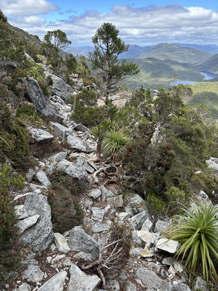
The track is well-marked. Trail conditions vary from the start to the finish. You'll get everything from formed and unformed track, funky wooden step ladders, steep terrain, rock scrambling, and exposed ledges throughout the 3 sections. Frenchmans Cap is known for its funky log stairs that force you to do a duck walk up and down them.

Water Sources
Tasmania has an abundance of rivers and streams where untreated water can be obtained. Both huts, Vera and Tahune, have water tanks with untreated water.
Safety
Deaths have occurred in alpine Tasmania when people have been caught unprepared. Weather conditions in alpine Tasmania can change quickly and frequently. Snow, rain, wind, and sun are all possible at any time of the year, and bushfires can occur between October and March.
When undertaking alpine hikes in Tasmania, you should include, at a minimum, in addition to your basic walking gear, a waterproof jacket with hood and storm front, waterproof over trousers, and warm clothing (a fleece or puffer, thermal base layers, hat, and gloves).
Please see my Frenchmans Cap packing list for recommendations.
Dogs and Drones
Dogs are not allowed. Drones are not permitted to be used within Tasmanian national parks or reserves.


Frenchmans Cap Trail Accommodation
There are two well-equipped huts on the trail, Vera and Tahune (20 and 24 sleeping spaces, respectively). Accommodation inside the huts is on a first-come-first-served basis, and there are also wooden tent platforms outside each hut with chain and nail anchor points.
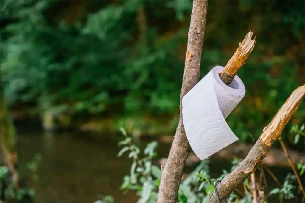
Each hut has composting toilets, a water tank, a fire for when the temperature delves below 10 C, and stainless steel tables and benches. The sleeping spaces are bunk-style wooden platforms with no mattresses; you use your sleeping pad.


Campers can use the hut facilities, but you must register along with the hikers using the huts. Accommodation in the huts is on a first-come-first-served basis.
Vera hut is old style, similar to the older Overland huts such as the original Kia Ora or Pine Valley Huts, whereas the Tahune hut is next level.
The award-winning Tahune Hut is architecturally designed and environmentally sustainable, powered by micro hydro-power, which allows the hut to keep warm all year round with passive heating panels, a heated clothes rack, and USB charging ports.
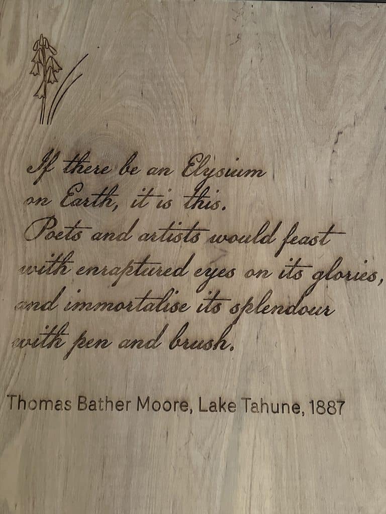
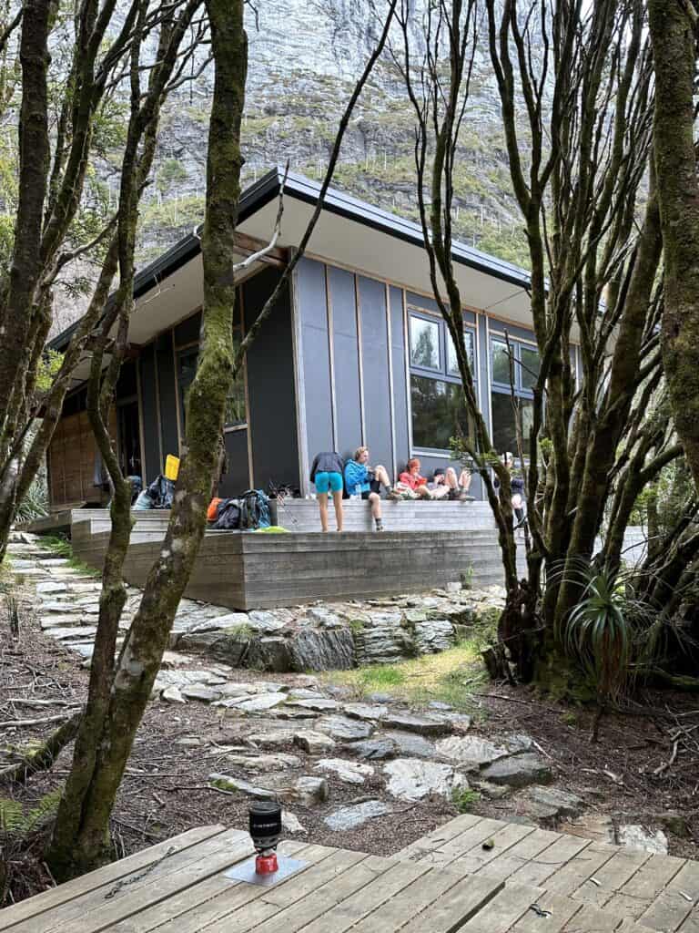
The hut is beautiful inside, with modern wood panelling inscribed with poetry and quotes from early explorers in the same vein as Waterfall Hut and the brand new Kia Ora Hut on the Overland.
Huge windows from the eating area overlook the fantastic views across the West Coast Ranges.
Wild Camping
There are two clearings that make perfect campsites if you are unable to make Vera hut on the first night. The first is opposite the sign-in station, and the second is just before Lodden River as you're walking in.
Neither have any facilities, so it's essential to practice LNT principles. There is another spot shortly after Vera hut on your way to the lake on the right-hand side of the trail.
Even if you are wild camping, you still need to book your hike with Tasmania Parks, as the daily quota is for all walkers and is intended to protect the park's delicate eco-environment.


Sections and Distances between Huts
|
Trailhead Car Park to Lake Vera: |
15 km / 9.5 miles 5 – 7 hours Medium |
|---|---|
|
Lake Vera to Lake Tahune: |
5.5 km / 3.5 miles 4 – 6 hours Hard |
|
Lake Tahune – Frenchmans Cap Summit: |
3.2 km / 2 miles 2.5 hours return Difficult |
Frenchmans Cap Track Notes
Day 1 – Trailhead to Vera Hut / 15 km 6 hrs
Bus from Hobart to Frenchmans Cap
The bus from Hobart dropped me off right at the trailhead car park on the Lyell highway at around midday, which was perfect timing to get to Vera Hut.
A few minutes down the track, you come to a sign-in station, which gives Tasmanian Parks a record of hikers should they need to evacuate or be rescued. Opposite the sign-in station is a small clearing that is a perfect camping spot, should you arrive too late to start on the trail.
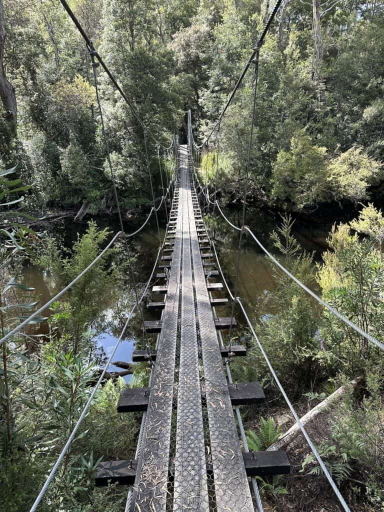
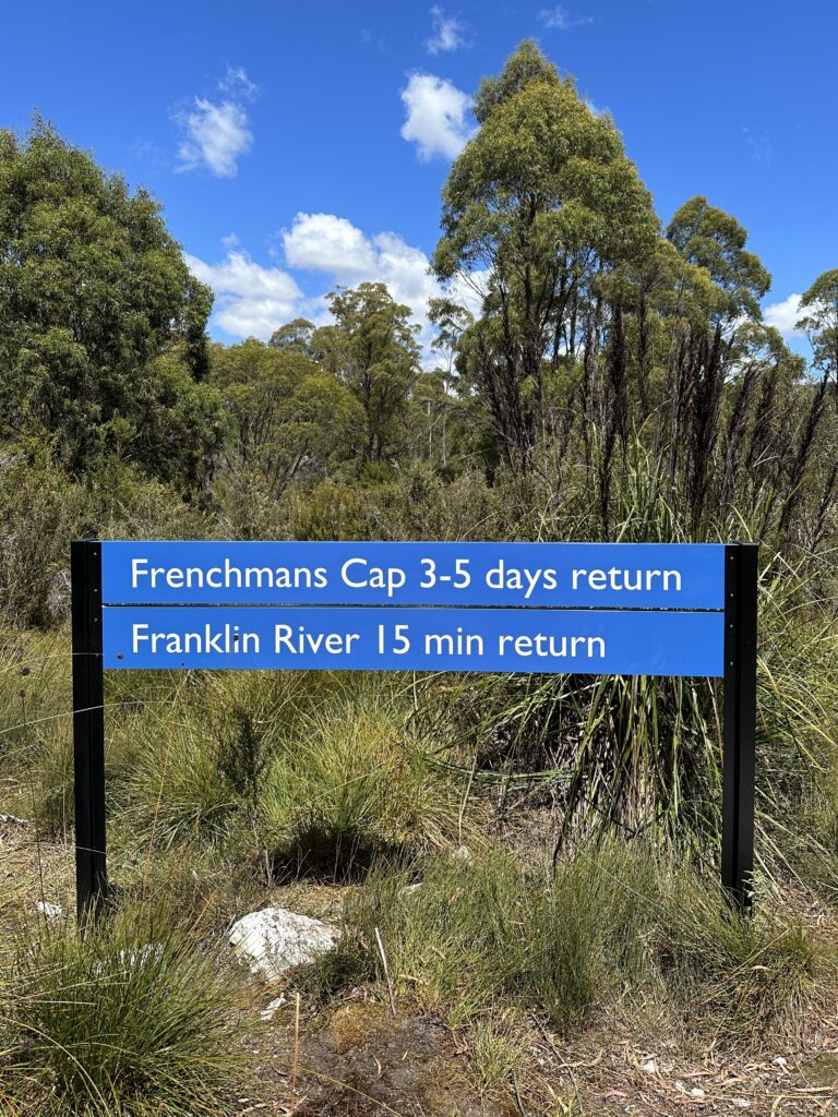
After the formalities are over, the track begins with a crossing of the Franklin River via a swing bridge followed by the foot cleaning station.
Boot Cleaning Stations
A boot cleaning station is located by the Franklin River at the start of the trail. It's there to clean your boots from the phytophthora cinnamomi fungus (known as Cinnamon fungus). Rampant throughout Australia, the fungus poses a significant threat to the Australian environment and spreads rapidly, killing native plants. The park is free of this fungus, so it's essential to clean your trowel, tent pegs, and boots.
The Loddon River
The duckboard track traverses the Loddon Plains, historically nicknamed “Sodden Loddons,” before a 2013 track upgrade. The track is well maintained, and the trail is a nice steady climb to Mt Mullens, where you get your first sighting of the glistening white quartzite dome of Frenchmans Cap.
The swing bridge over the Loddon River is a good place to stop for a snack and breather, although it can be a little mosquito-infested. After the Loddon River, the trail is relatively flat until you reach Lake Vera and the hut.


Lake Vera
Lake Vera has a lovely swimming area, and there's also a little lagoon with a wooden jetty behind the hut you can jump into to refresh. Really lovely after the hike in the hot afternoon sun.
The wooden tent platforms have the typical chain and hook anchor points for securing your tent. When I first used them back on the Overland Track, I had difficulty getting the tension right, but I've nailed it since then. If you're researching this hike, you'll come across various methods for securing your tent using the chain and anchors. Please don't add cup hooks, nails, or anything else that leaves a mark on these wooden platforms.


Instead, use Fishbone Tent Stakes, which are perfect for non-freestanding tents such as the UNBOUND 2P Ultra Light Tent. Alternative solutions include extending your guy ropes beyond the platform and securing them with a spare tent peg, or using a small stick wedged between the platforms.
For the former solution, you may need extra guy rope, which I carry in my Utility Pouch anyway and is always a good idea.
Don’t Gatekeep the Good Stuff.
If you know someone else who'd like this, spread the word!
Day 2. Vera Hut to Lake Tahune 5.5 km 6 hours.
Barron Pass
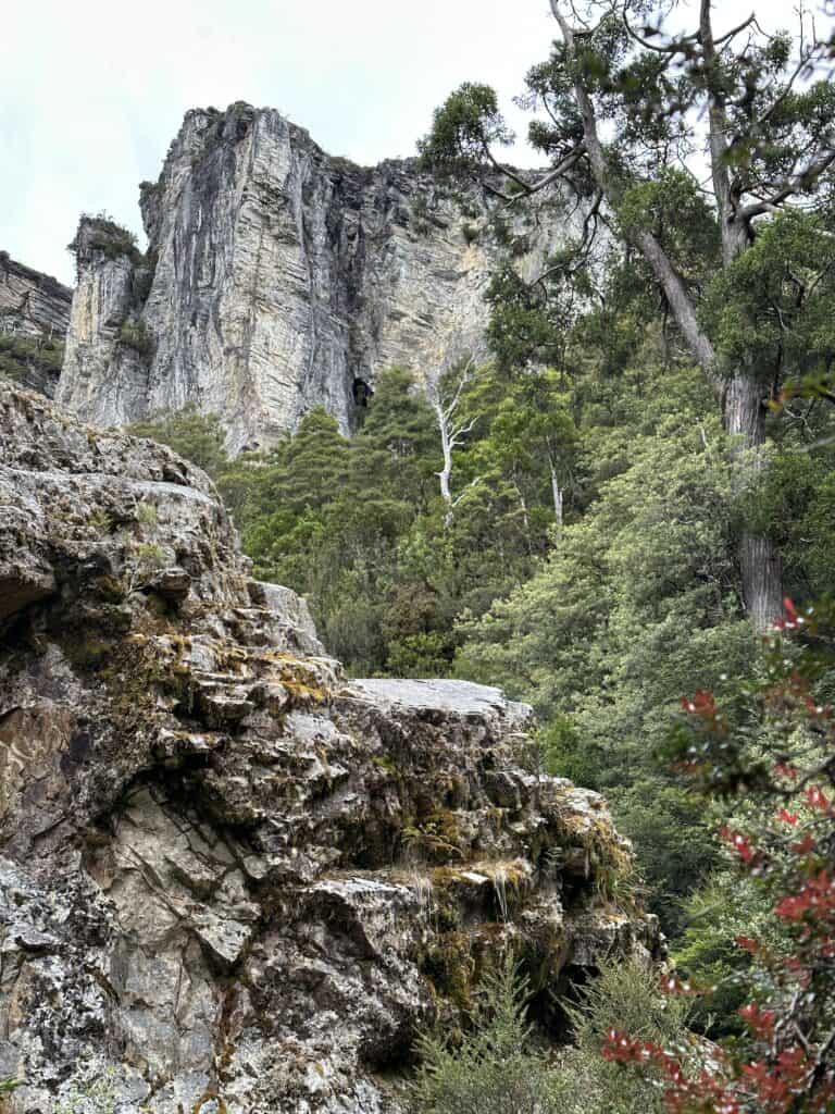
I took my time on this section, stopping for a cup of tea and a journal break under a mesmerizing glistening rock waterfall and then again for lunch, enjoying the vista at the top of Barron Pass before the rain and clouds started rolling in.

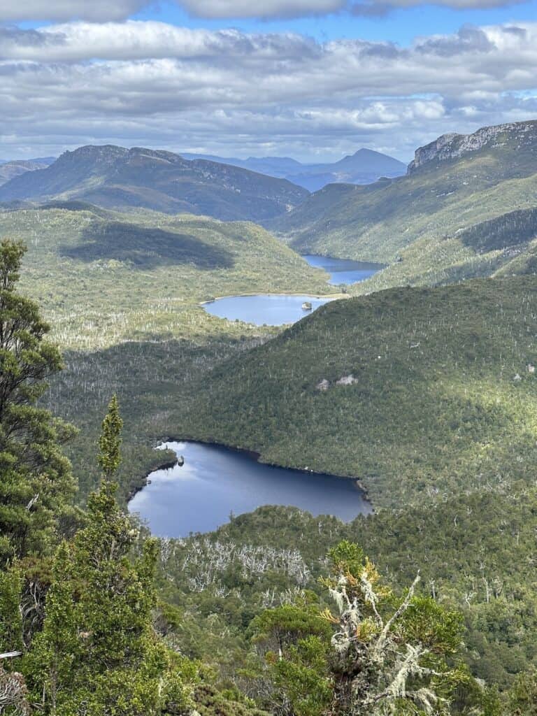
This entire section was just “Wow!” I'd definitely hike Frenchmans Cap again just for the experience.
Leaving Vera Hut, the track hugs the shores of Lake Vera for about a kilometre before heading into the stunning emerald-green rainforest, which continues up the steep ascent to Barron Pass (at 950m).
The view from Barron Pass looks out over the ranges, taking in miles from every direction, including the four lakes Gertrude, Cecily, Magdalen, and Millicent to the southwest.
I stopped here to chill in the sun and have lunch until, 20 minutes later, I donned my rain jacket as the clouds rolled in. Fortunately, it didn't rain more than a spittle, as the next section would have been precarious in the wet.


Sharlands Peak and Artichoke Valley
The remainder of the trail to Tahune Hut is only about 2 km. Still, traversing along the loose rocky track underneath Sharlands Peak took much longer than I had anticipated.
There is a lot of climbing in this section, with “stairs” cut into the banks. I stashed my hiking poles over this next section as they got in the way of all the climbing, as you really need two hands.
The track winds into Artichoke Valley and then through heathland before arriving at Tahune Hut.


Day 3 and Day 4 Lake Tahune – Vera Hut – Carpark
No Frenchmans Cap Summit!
Unfortunately, the following day, we were shrouded in clouds. I waited until around 11am for the weather to improve, but although the clouds lifted around the hut, Frenchmans Cap summit was still engulfed.
There was a ranger stationed at Vera Hut who suggested that the weather might not improve during the day and could potentially worsen the next day. So, as I was on a time crunch, flying out of Hobart in 3 days, I packed up my gear and headed back down the mountain.


When wet, the exposed rocky alpine plateau before Barron Pass (or after arriving at Tahune Hut) can be pretty dangerous, so bear this in mind and make good choices. The wind wasn't too bad, and the rain had let up a few hours earlier, so I made good progress.
Once I got to the top of Barron Pass and started heading down, the weather improved. Once again, I stopped to take in the gorgeous rainforest several times, turning a 6-hour section into almost 7.5.

Vera Hut
Arriving at Vera hut, I almost had the entire place to myself before another party arrived. A spotted quoll wandered across my tent platform before meandering into the bush. My phone was in the tent, so no photo opp., and I just sat there and enjoyed the moment.
The next day, after arriving at the car park, I tried my hand at hitchhiking back to Hobart, as the return bus wasn't coming through until tomorrow, and I had a plane to catch. After about 30 minutes, a lovely family in a people carrier stopped and gave me a ride basically all the way to Hobart. Win.
Transport and Logistics
Public Transport
Frenchmans Cap is one of the few hikes in Tasmania accessible via public transport. The Area Connect bus service runs twice weekly from Hobart to Queenstown return, stopping at The Derwent Bridge Hotel and Frenchmans Cap.
Stopping at Derwent Bridge Hotel is fantastic for those who have come off The Overland and then plan on hiking Frenchmans Cap as the hotel is a 1 hour walk/7 min drive from the Lake St Clair visitor centre. The bus stops right at the car park of the trailhead. Perfect.
Vehicle
Driving from Hobart, it's a 3 hour/200 km drive northwest of Hobart on the A10 (Lyell Highway)
From Launceston, it's a 2.5 hour/197 km drive southwest; however, the route from Hobart is more straightforward if you are planning to hitchhike.
Parking
Parking at the Franklin-Gordon Wild Rivers National Park car park is free, and the car park is immediately off the highway.
Luggage Storage
There is nowhere to store luggage at the start of the trail; however, if you stay at the Derwent Bridge Hotel, I'm sure the owners will look after your bags for a few days.


Getting There and Away
All major domestic airlines fly into Hobart and Launceston.
Where to stay in Hobart
Save Your Pennies
Narrara Backpackers Hobart
Very Good and Won't Break the Bank
Alabama Hotel Hobart
Splash Out
The Henry Jones Art Hotel
Frenchmans Cap Packing List
Check out my Full Gear List for Overnight Hikes
Tasmania Parks recommends all hikers in alpine Tasmania carry the following in case of a sudden change of weather. This is regardless if you are attempting a single-day or multi-day hike. On The Overland, you must sign a form stating you are carrying the following, so they take do this seriously.
As the Franklin-Gordon Wild Rivers National Park is alpine territory, this Frenchmans Cap packing list cover the most critical items you will need.
Rain Jacket with Stormfront. – North Face Venture 2 Women's Waterproof Jacket
If you're unsure what a stormfront is, you're not alone. Nearly everyone who has read the list of requirements for The Overland has asked the same question.
Essentially, the stormfront is the fabric that folds over the front zipper so that rain cannot get past the zipper and wet the inside of your jacket. It's actually on most jackets, and now you know, you'll start noticing it all the time.
A good 3-4 season rain jacket is crucial as part of your Frenchmans Cap packing list, as snow can happen in December – as late as Boxing Day. And I'm here to tell the story!
Waterproof Pants – The North Face Antora Women's Waterproof Pants
Although most hiking pants are quick-dry, and a bit of water isn't usually too much drama, the idea here is not to get wet because it can be fatal in alpine regions if you get wet and cold.
Puffer Down Jacket – (Summer) – Cederberg Super Goose Lightweight Puffer
Puffer Down Jacket – (Winter) – Cotopaxi Fuego Down Womens Jacket
If the weather turns really nasty, you want to put on your insulated jacket when you stop before your body has a chance to cool down.
Clothing layers in hiking (base, mid, and outer) work by trapping air between the item of clothing and your body or the next layer down, so make sure the jacket fits snuggly, as baggy clothes will not keep you as warm. Your puffer can be used as a mid or outer layer.
Beanie – Patagonia Brodeo Unisex Beanie
I carry my beanie on the outer of my pack, and it's the first thing I put on when I stop for a rest or the night. The old myth that we lose 10-45% of our body heat through an uncovered head has been debunked.
However, our core temperature can drop substantially and rapidly with an uncovered head. This is mainly due to the large number of blood vessels in our scalp. As the blood travels around the body, the environment quickly cools the blood crossing the scalp area.
Remove your hat when resuming your walk and have it ready to donn again at the next stop. It's an important item in your Frenchmans Cap packing list, that you many end up using more than once each day.
Pack Light, Pack Right. Free Multi-Day Hiking Packing List
Plan methodically and keep track of every essential for your next multi-day hike. Add notes and quantities, save or print your list, and share it with hiking partners so everyone knows what’s covered. Works on any device.
Gloves – XTM Real Deal Goretex Gloves
You might need them, or you might not. Your hands are one of the first to get really cold when the temperature drops, and you'll be thankful you packed them – or that they were a requirement. These are also lightweight and will dry overnight.
Tent Big Agnes Copper Spur HV UL1 1-person tent
If you're unsure about putting tents up on wooden platforms, a good bet is to get a free-standing tent that can be pitched on rock, sand, or any ground cover that won't accept tent pegs. I've used my Big Agnes Copper Spur HV UL1 1-person tent on every solo trip I've been on, and there will be many more to come.
On wooden platforms, I use Fishbone Tent Stakes, which slot in between the wooden slats, and the tautness of the guy ropes keep the fishbone tail end butted against the wooden slats. Please don't follow the advice on bringing cup hooks or nails if you can't use the chain and anchor system. The wooden platforms weren't designed to be drilled into.
A note to overseas hikers: All Australians carry tents on multi-day hikes, except for the paid 3-Capes, a hut-to-hut hike. Staying in huts only is not to be relied upon.
Packable Day Pack – Sea to Summit Ulta-Sil Day Pack
Packs up to the size of a piece of nigiri and weighs about the same. It will fit all the essentials needed for a side trip – A medical kit, head torch, rain jacket, extra layer, water, and snacks. The Sea to Summit Ulta-Sil Day Pack goes on all adventures with me, and even if you don't use it on the track, it makes a great travel pack when in the nearest town at the beginning or end of your hike.
Bra – Patagonia Switchback Sports Bra
Undies – Under Armour Pure Stretch Hipster 3 Pack Briefs
Make use of the two gorgeous lakes at both Vera and Tahune Hut. My sports bra and underpants are black and serve as a bikini should I need to strip off for swimming.
Final Thoughts on Frenchmans Cap
Frenchmans Cap is a perfect length for those wanting a short hike with Wow factor. Ascending the summit of Frenchmans Cap is the ultimate goal. Still, even if it's not possible due to foul weather, the hike is almost perfect without. It's a strenuous hike up to Barron Pass, but the views are sensational. Graded as a Level 5, it's manageable for those wanting to try a Level 5 hike, with a good range of walking, scrambling, climbing and negotiating paths of scree.

Like This?
We'd love you to share this great guide!
If you Liked this Guide, you Might Also Like:
- Navigating the Overland Track Solo
- Hiking Frenchmans Cap -Tasmania’s Iconic White Peak
- Hiking the Rees Dart Track – Mt Aspiring National Park
- The Rakiura Track – A Great Walk on Stewart Island
- Traverse Walls of Jerusalem to the Overland Track via Lees Paddock
- Hiking The Tahoe Rim Trail – A Guide for Overseas Visitors
- Conquering the Gold Coast Kokoda Challenge
- Plan Your Larapinta Trail Sections, Best Time of Year, Resupply, and Transfers
- Larapinta Trail Food Essentials and Nutrition Plan
Frequently Asked Questions
How do I get to Frenchmans Cap from Hobart?
To reach Frenchmans Cap from Hobart, take the Lyell Highway (A10) towards Queenstown. After approximately 3.5 to 4 hours, you'll find the trailhead car park marked by signs for Frenchmans Cap, near the Franklin River Nature Trail. It's the starting point for the four-day hike to the summit of this iconic Tasmanian mountain.
What is the geology of the Frenchman's cap?
Frenchmans Cap is famed for its striking white quartzite peak, which distinguishes it within Tasmania's Wilderness World Heritage Area. Formed over millions of years, the mountain stands as a testament to the island's complex geological history, predominantly showcasing Paleozoic quartzite that has withstood the elements to create its unique, prominent cap-like dome.
How high is Frenchmans cap in Tasmania?
Frenchmans Cap in Tasmania reaches a commanding height of 1,446 meters above sea level. The mountain's striking summit is a beacon for hikers, offering rewarding panoramic views after a challenging ascent through the rugged, pristine wilderness of the Franklin-Gordon Wild Rivers National Park.
How long is the Frenchmans cap?
The hike to Frenchmans Cap is a 46-kilometer return trek, taking an estimated four to five days to complete. This challenging journey through Tasmania's wild landscapes encompasses varying terrains and climatic conditions, providing avid hikers with a formidable but rewarding multi-day adventure.
How hard is Frenchmans Cap
The Frenchmans Cap trek is considered a challenging hike due to its rough terrain, steep ascents, and unpredictable weather. Covering a distance of 46 kilometers return, it demands good physical fitness, proper gear, and experienced navigation skills. Despite the difficulty, many are drawn to its rugged beauty and the rewarding views from the quartzite summit.
Where do I stay on Frenchmans Cap?
Accommodation on the Frenchmans Cap trek is in the form of basic huts and tent platforms at designated campsites. You can stay at Lake Vera Hut, located about 15 kilometers from the trailhead, and Lake Tahune Hut near the summit. These facilities offer shelter along the hike, but it's wise to carry a tent as huts can be full during peak times.
How to I get to Frenchmans cap ?
To reach Frenchmans Cap, you'll first need to head toward the western wilderness of Tasmania. From Hobart, the journey starts with a drive along the Lyell Highway (A10) toward Queenstown. After approximately 194 kilometers (a 3.5 to 4-hour drive), look for the well-signed trailhead car park, situated just before the Franklin River on the Lyell Highway. This is where the track to Frenchmans Cap begins.
Is Frenchmans Cap near Cradle Mountain?
Frenchmans Cap is not in close proximity to Cradle Mountain; they are in different regions of Tasmania's wilderness. Frenchmans Cap is located within the Franklin-Gordon Wild Rivers National Park, while Cradle Mountain forms part of the Cradle Mountain-Lake St Clair National Park. They are separated by a considerable distance, with the drive taking roughly 4 to 5 hours to get from one to the other.
Which national park is Frenchmans Cap in?
Frenchmans Cap is located in the Franklin-Gordon Wild Rivers National Park, part of Tasmania’s Wilderness World Heritage Area. The park is celebrated for its remote and untouched landscapes, including the iconic Frenchmans Cap, which offers a challenging yet exhilarating hiking experience.
Are there easy hikes in Franklin-Gordon national park?
Yes, Franklin-Gordon Wild Rivers National Park offers several easy hikes alongside more challenging ones like Frenchmans Cap. Shorter, more accessible trails include the Franklin River Nature Trail and the Donaghys Lookout walk. These walks provide a glimpse into the park's stunning scenery without the requirement of a multi-day commitment, making them perfect for casual hikers or those with time constraints.
Can I see Frenchmans Cap from the road?
Yes, Frenchmans Cap can be seen from the road, specifically the Lyell Highway (A10). As you travel along this route through the Franklin-Gordon Wild Rivers National Park, there are spots where you can get a clear view of the mountain's distinctive quartzite peak, especially from the designated lookout points along the highway. It is a particularly striking sight on clear days.