

The Tarn Shelf Circuit – Discovering Jewels in Mt Field
Mt Field National Park is home to the Tarn Shelf Circuit – a glorious day hike among glistening jewel-like tarns.
Mt Field National Park has 4 fantastic long day or overnight hikes, including the Tarn Shelf Circuit, and a wonderful 2-2.5 hour Waterfall Circuit that takes in 3 of the park's gorgeous waterfalls. As well the park has some great accommodation options (and they're not hotels!),
This park has something for everyone!
I visited the park for 2 nights and stayed in the Mt Field Government Huts, which provide an excellent base for the alpine regions of Mt Field National Park.
The rustic huts are nestled among snow gums and overlook a beautiful alpine moorland. They are just a 15-minute walk from Lake Dobson and close by the trailheads for the longer walks.
Quick Links – Main Points Covered in this Guide:
- The Tarn Shelf Circuit – Overview
- The Tarn Shelf Circuit Map and Elevation Profile
- Tarn Shelf Circuit – Track Notes
- Mt Field Camping. – incl Government Huts
- 3 Falls Circuit and Nelson Falls
- TrailRider (all-terrain wheelchair) hire for Nelson Falls
A full list of inclusions can be found in the Table of Contents
You may also like these other helpful Tasmanian Guides
Hobart to Derwent Bridge Road Trip with the 8 Best Stops
Trail Difficulty Rating Guide to Help You Choose the Best Hike
Launceston to Derwent Bridge – A Scenic Road Trip
Strahan to Derwent Bridge with the Best Stops Along the Way
National Park Passes Tasmania – The Complete Guide
A 4 Day Hike on Maria Island
This article may contain affiliate links. If you make a purchase using one of these links, we may receive compensation at no extra cost to you. See our Disclosure Policy for more information.
Hiking the Tarn Shelf Circuit – Overview
|
Location: |
Mt Field National Park, Tasmania |
|
Distance: |
12 km (7.5 miles) |
|
Duration: |
5 – 7 hours |
|
Type: |
Circuit |
|
Trail: |
Unformed track and boardwalk |
|
Grade: |
Medium (Grade 3) |
|
Elevation: |
664 m / 2178 ft |
|
Season: |
Walking this track after the snow melts, November through to April is best. |
|
Fees: |
Tasmanian Parks Pass |
|
Dogs: |
Dogs are NOT allowed |
The Tarn Shelf Circuit Map and Elevation Profile

For an online map of the Mt Sonder walk, I recommend GAIA. Gaia is a GPS enabled app, which allows you to follow the map on your phone and is more accurate than a street map like Google or Apple Maps.
The Mt Field Visitors Centre will have maps you can buy of the park, or you can visit TASMAP, the Tasmanian Govt Mapping Division for a complete selection of Topographic Maps.
With paper maps, you will need a compass and know how to use it. If you have not done a navigational course, or need to brush up your skills – I recommend The Columbia River Orienteering Club. They have excellent navigational tutorials on YouTube, as well as tutorials on using GPS systems such as GAIA and similar.

Pack Light, Pack Right – Free Interactive Checklists
No More Overpacking. No More Forgetting Essentials.
Our free interactive packing lists help you pack methodically and remember everything. Add notes, quantities, save or print, and share with hiking partners so everyone knows what’s covered and what they need. Works on any device.
Available for multi-day wilderness camping, hut-to-hut hikes, and inn-to-inn walks, with new lists added frequently.
Tarn Shelf Circuit – Track Notes
I started out bright and early despite spending much time that morning sitting on the bench outside my hut and just admiring the view. The moorland was spectacular during sunrise, and the wildlife was prolific.
While I didn't see any Tasmanian Devils (I'm always on the lookout!), several wombats sauntered past my coffee seat, and I also saw an adorable bandicoot!


I finally got going and headed to the Tarn Shelf Circuit trailhead at the Lake Dobson Car Park. The car park is at the end of the one and only road through the park, and it's an easy 20-minute walk.
There are toilets, and the Tasmania Parks and Wildlife stand houses a hiking log book. Signing the log book with my intention to walk the Tarn Shelf Circuit and return the same day, I continued up the Mt Field track until I reached Lake Dobson and further on Eagle Tarn.
Both of these lakes were beautiful, but the real gems turned up on the actual tarn shelf. And after a pretty good climb which takes you up to the top of the T-Bar, you arrive at the shelf.
By the time I got up there, I was in the clouds and couldn't see past a few feet in front of me, so I had a bite to eat in Rodway Hut, a one-room emergency shelter. I didn't have to wait long.
These Guides for Day Hiking are Recommended:
What to Pack for a Day Hike – Including the Essentials
What to Wear When Hiking (Winter and Summer)
What Food to Take on a Day Hike
As quickly as the clouds had descended, they started dissipating. That's Tasmania for you – a reminder of how important it is to prepare for all seasons.
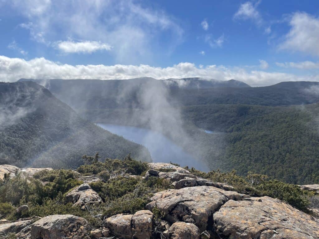
I wandered out of the hut towards the track, and the view that met my eyes was just stunning. The light started hitting the tarns, turning them into glistening gems of blue and green!
Tarns are glacial lakes, often full of tiny, glacially-ground sediment that scatter light and can make the water appear colourful, which is why people are mesmerised by their beauty.

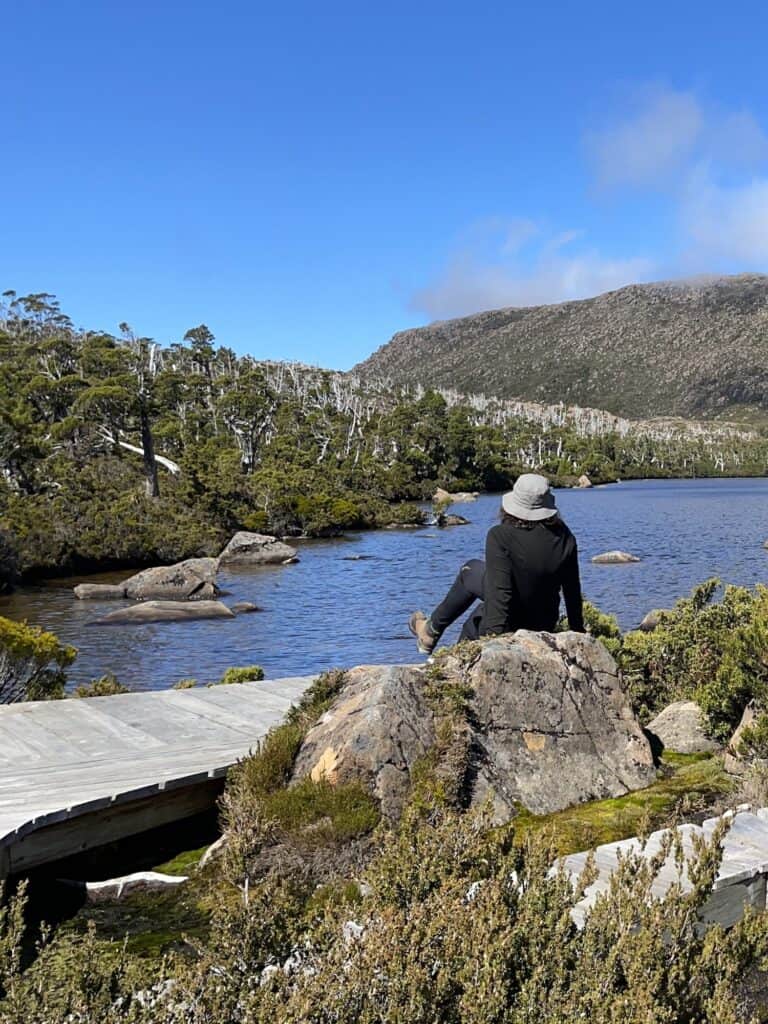
The tarn shelf runs for about 3 km, and is contained on a rocky ridge with gorgeous views to the north and east over Lake Seal and Platypus Tarn. It was this section that I took double time, stopping every few steps for photos; it really was beautiful.
At the end of the tarn shelf, you come across Lake Newdegate, a pretty little lake with a rustic shelter and a junction pointing north west to the Rodway Range and Mt Field West or east to continue on the Tarn Shelf Circuit.
Twisted Tarn is the start of the descent to the very pretty Twilight Tarn, where there's an old ski hut containing old ski relics. The tarn hut is used for emergency purposes only, but there is a drop toilet and a flat area for camping, which I noted for future reference.
READ NEXT: Our Complete Guide to Toileting Responsibly when Hiking
The track continues around Lake Webster, fed by the Broad River. This area is mainly boardwalks through the forest of gums with their stark white limbs. It's very picturesque.
Throughout the entire Tarn Shelf Circuit, I saw possibly 3 other people, although admittedly, it was a Tuesday. All in all, it felt incredibly isolated and peaceful.
With a ton of photo stops and stopping to chill on the shores of various tarns, it took me around 6-7 hours. I could have done a lot faster, but I did make A LOT of stops on this hike.
A shorter version of the Tarn Shelf Circuit would be to walk up to the tram shelf and back. If you were to do this shorter hike, make sure you start out in a clockwise direction.

Interested in
Hiking Safety?
We have a dedicated Hiking Health, Safety and Hygiene Facebook group!
Other Hikes in Mt Field National Park
3 Falls Circuit
2-2.5 hrs circuit, 6km circuit
Grade 2-3: Tracks may have short, steep hill sections, rough surfaces, and many steps.
The 15-minute walk to Russell Falls is wheelchair-accessible.
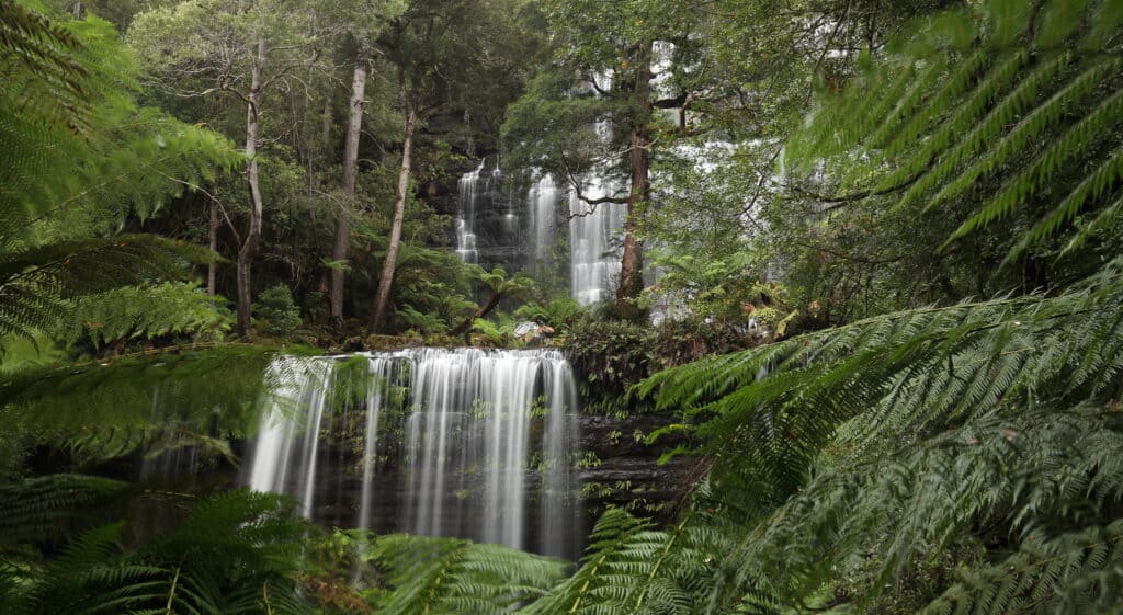
The 3 Falls Circuit in the lower section of Mt Field National Park is perfect for those seeking a nice day hike, especially if using the Mt Field campground as a base.
Mt Field National Park is famous for Russell Falls, and this 6km circuit takes in not only Russell Falls but also some of the other natural features, including the Tall Trees walk and some magnificent specimens of swamp gums (Eucalyptus regnans)—the world's tallest flowering plant.

The loop continues to Lady Barron Falls, a pretty little cascading waterfall, particularly scenic after rain, and Horseshoe Falls. All three falls are composed of marine Permian siltstone, faced by retreating sandstone layers and provide a glimpse of the underlying geology in a heavily forested area where the geology is otherwise hidden beneath vegetation and soils.
Most people walk the circuit anticlockwise, starting with the short walk to Russell Falls and finishing at the visitor's centre.
The visitor centre and café are fully accessible, as are the toilets within the building.
Lakes Belton and Belcher
5-6 hours, 13 kms/8 miles
Grade 5 – This is a challenging walk and suits experienced walkers.
Lakes Belton and Belcher
Mt Field West
Mt Field West, at 1434 metres, is the highest point in Mt Field National Park.
8-9 hours return, 17 kilometres
Grade 5 – This is a challenging walk and suits experienced walkers.
Note: Mt Field West is unsuitable for a day trip during short winter days and is subject to severe weather changes at any time of year. An emergency shelter hut is located on the track at K Col.
These Guides for Multi-Day Hiking are Recommended:
Complete Multi Day Hiking Packing List
What to Wear When Hiking (Winter and Summer)
Complete Nutrition Guide for Multi Day Hikes
Hiking in the Heat
Guide to Hikers First Aid Kit Essentials and Satellite Comms
Mt Field East via Lake Nicholls
4 – 5 hrs circuit, 10km
Grade 4: Bushwalking experience recommended. Tracks may be long, rough and very steep. Directional signage may be limited.
Mt Field East via Lake Nicholls
Pack Light, Pack Right – Free Interactive Checklists
No More Overpacking. No More Forgetting Essentials.
Our free interactive packing lists help you pack methodically and remember everything. Add notes, quantities, save or print, and share with hiking partners so everyone knows what’s covered and what they need. Works on any device.
Available for multi-day wilderness camping, hut-to-hut hikes, and inn-to-inn walks, with new lists added frequently.
Mt Field National Park Food and Accommodation
Food and Supplies in Mt Field National Park
There is nowhere to buy supplies within the park, but there is a café next to the visitors centre offering a variety of food and drinks. The café is wheelchair accessible.
Mt Field National Park Camping – Campsite
Mt Field National Park camping includes one official campground located near the Visitor Center with powered and unpowered sites, ideal for camper vans, caravans, and tents.
Facilities in the campground include a toilet and shower block with coin-operated hot showers, coin-operated washing machines, and clothes driers. There is a communal cooking shelter and free electric barbecues.
Fires are not permitted within the campground, which is a fuel stove-only area. There are, however, some designated fireplaces within the day-use area where fires can sometimes be lit unless fire bans are in place. The staff at the visitors centre will be able to advise you.
Bookings are not required for Mt Field National Park camping; it's on a first come-first served basis. For detailed camping fees and further information, visit the Mt Field National Park camping page here.

Like This?
We'd love you to share this great guide!
Mt Field National Park Camping – Wild or Dispersed Camping
Mt Field National Park camping is ideal for anyone wanting to hike the Tarn Shelf Circuit . For those wanting to turn the Tarn Shelf Circuit into an overnighter, or take on one of the other longer hikes on in Mt Field, wild or dispersed Mt Field National Park is allowed and free, provided you have a valid Parks Pass

Mt Field Government Huts
Located within the Mt Field National Park, the Mt Field Government Huts are situated at approximately 1000m elevation. It’s a short walk to the Mt Dobson car park and the Tarn Shelf Circuit trailhead, so a perfect base for Mt Field hiking.
Each basic but quaint, 2-roomed hut contains a fireplace, table, chairs and 3 bunk beds (6 beds total). There are five huts, and the site also has a communal toilet, water tank and a woodshed with an axe for splitting wood. There are no showers.
There is also no electricity, and guests will need to bring headlamps or battery-operated lanterns. Guests should bring their bedding, cooking utensils and gas cookers. Water is available but should be treated.
The Mt Field Government Huts were built in the 1940s for the Lake Dobson Road workers and are situated towards the end of Lake Dobson Road, which is unsuitable for campervans or buses. The Mt Field Government Huts are in a remote location, and there are no supplies nearby.
To book the Mt Field Government Huts – click here
READ NEXT: The Complete Guide to the Tasmanian Parks Pass
Mt Field – Getting There and Away
Driving
Driving is the easiest way to get to Mt Field National Park, just over an hour's drive from Hobart via New Norfolk and Westerway on the A10 or B62. From Westerway, it is a short, winding drive to the entrance to Mt Field. The drive up to Mt Dobson car park or the Mt Field Government Huts is not accessible for caravans or RVs.
Parking
Parking is free at the Mt Field visitors centre with a Parks Pass.
Public Transport
Unfortunately, there is no public transport.
Mount Field Visitor Centre
66 Lake Dobson Rd
National Park TAS 7140
Phone: 03 6288 1149
Pack Light, Pack Right – Free Interactive Checklists
No More Overpacking. No More Forgetting Essentials.
Our free interactive packing lists help you pack methodically and remember everything. Add notes, quantities, save or print, and share with hiking partners so everyone knows what’s covered and what they need. Works on any device.
Available for multi-day wilderness camping, hut-to-hut hikes, and inn-to-inn walks, with new lists added frequently.
What I Pack for a Day Hike for the Tarn Shelf Circuit.
The Tarn Shelf Circuit is situated in the alpine regions of Tasmania. In winter, Mt Field transforms into a ski destination, featuring the Mt Dobson Ski Field at the very location where the Tarn Shelf Circuit commences.
Alpine weather can change rapidly and with no warning. I have been caught out with snow on Boxing Day (December 26)! Therefore, it is crucial you’re prepared for everything – cold weather, rain, fog, and high altitude strong sunlight.
Below is a checklist of items I bring along for a day hike in alpine regions, including when venturing onto the Tarn Shelf Circuit:
Hiking Day Pack – Osprey Tempest 9 Womans Hiking Daypack
Your hiking pack must be comfortable to wear for at least 8 hours and big enough to carry all the essentials.
I love my Osprey because it has an “Airscape” panel at the back, an Osprey's unique design where the airflow between your pack and back keeps your back dry and sweat-free.
The pack features an adjustable bungee front panel storage for your rain jacket for instant access. It also includes a hydration reservoir sleeve if you use a hydration bladder.
Top – Cotopaxi Sombra Sun Hoodie
I cannot recommend a sun-hoodie enough. I first came across these in the USA, where it appears every hiker and his dog owns one – or wears one, on the trail. They are hard to find in Australia but plentiful in the USA, where almost every outdoor brand has one as part of their merchandise.
Lightweight, breathable, and most importantly, they have a high SPF rating; these hoodies can be worn as a base layer and help protect you against the harsh alpine rays.
Kathmandu makes one, but in my opinion, it was far too thick and heavy to be comfortable on a hot trail. Cotopaxi is the best one available in Australia, plus they have a great giving back ethos.
Footwear – Ultra Raptor Ii Mid Leather Gtx La Sportiva Australia
I often see posts on Facebook in almost every hiking group where people ask a huge group of faceless random strangers for advice on the best boot to buy.
Hiking footwear is a highly personal choice. No two feet are the same. I have normal-width feet, and I buy men's boots. I'm usually a size 41.5 in regular shoes and a size 43 in hiking boots.
I strongly recommend trying on hiking boots at a reputable hiking shop before buying. My boots are so comfortable – for me.
Person Locator Beacon – Ocean Signal Rescueme PLB1 Personal Locator Beacon
Emergency rescues happen more on day hikes than overnight hikes. This might be because there are more people on day hikes or more inexperienced hikers – I'm sure the SES could tell you the stats.
If you are taking up hiking regularly, there is no harm in getting yourself a personal locator beacon. It sets off a signal, giving the emergency services your exact location if you succumb to any emergency.
And it could be as simple as spraining your ankle towards the end of the day when all other hikers have left the trail.
The good news is, you can use this PLB anywhere – even overseas on remote hikes in New Zealand.


Hiking Poles – Black Diamond Trail Back Trekking Poles
I love my hiking poles! Even on day walks, having them as extra stability is gold, especially when coming down a trail and there might be loose ground. The Osprey pack I use has a “Stow-on-the-Go” trekking pole attachment, so my poles can be stored if I need both hands to climb.
Rain Jacket/Windbreaker – North Face Venture 2 Women's Waterproof Jacket
I have a winter and a summer jacket for hiking, as I'm often hiking in subtropical areas as well as alpine throughout the year.
Regardless of the season, I would take my winter hiking jacket on any alpine hike, as the weather has been known to rapidly change throughout the day. It is not unusual to see snow in summer in alpine Tasmania!
It's also essential to ensure your jacket has a storm front to protect against water entering through the zipper.
Beanie and Gloves
Beanie – Patagonia Brodeo Unisex Beanie
Gloves – XTM Real Deal Goretex Gloves
My beanie is the first thing I put on when I stop for a rest. The old myth that we lose 10-45% of our body heat through an uncovered head has been debunked. However, our core temperature can drop substantially and rapidly with an uncovered head.
This is mainly due to the large number of blood vessels in our scalp. As the blood travels around the body, the environment quickly cools the blood crossing the scalp area. Remove your hat when resuming your walk and have it ready to donn again at the next stop.
Your hands are one of the first extremities to get really cold when the temperature drops, and you'll be thankful you packed these lightweight, water-resistant gloves.
First Aid Kit – Hiker Lightweight First Aid Kit
A first aid kit is essential even when day hiking. Accidents can happen at any time to inexperienced and experienced hikers alike.
I've broken my wrist, cut myself, bandaged a friend's sprained ankle, and shared my blister plasters all on day hikes.
My first aid kit appears far more on day hikes than overnight hikes. Why? I have no idea! But it proves how essential the humble first aid kit is.
Insulated Mid-Layer
Puffer/Insulated Jacket – Cederberg Women's Super Goose Lightweight Puffer Jacket (Summer)
OR
Puffer/Insulated Jacket – Cotopaxi Fuego Down Womens Jacket
(Winter)
OR
Fleece North Face Glacier ¼ Zip Womens Jacket
We often talk about layering with hiking or outdoor clothes – but what does that mean? Is it wearing lots of layers so we can remove or add a layer if it gets warmer or cooler?
Well, yes, technically, that is what happens. But the purpose of layering is to trap air between each layer, which will regulate your temperature. That is why a tighter piece of clothing is warmer than a baggy item.
The role of the mid-layer is to keep you warm by insulating, directing any body heat that your base layer didn't retain back into your body and preventing cold air from passing through to your body.
Puffer jackets are excellent mid-layers, and I have both summer and winter weight jackets. Puffer jackets fold up to a small size and pack small as well. You can use a stuff sax which is also waterproof.
If it looks like it'll be a terribly wet day, I'll sometimes take my fleece instead, as I did when I hiked the Freycinet National Park.
Pack Light, Pack Right – Free Interactive Checklists
No More Overpacking. No More Forgetting Essentials.
Our free interactive packing lists help you pack methodically and remember everything. Add notes, quantities, save or print, and share with hiking partners so everyone knows what’s covered and what they need. Works on any device.
Available for multi-day wilderness camping, hut-to-hut hikes, and inn-to-inn walks, with new lists added frequently.
Final Thoughts on The Tarn Shelf Circuit
The Tarn Shelf Circuit is a perfect hike for walkers capable of a Grade 3 moderate hike. The hike is not too challenging, and the views and pretty tarns you get to walk alongside are well worth it. This is one hike I would love to do again.
There are several shorter walks at the base of the Tarn Shelf Circuit, and while you may not get to experience the tarn shelf, you will still see some of the pretty tarns closer to the trailhead.
Considering its proximity to Hobart, the Tarn Shelf Circuit in Mt. Field National Park is surprisingly secluded and remote, making it a perfect day trip for those wanting a good workout topped with solitude in South West Tasmania.
I'm looking forward to returning to Mt. Field National Park during the Turning of the Fagus (deciduous beech trees)!
Like This?
We'd love you to share this great guide!
If You Enjoyed this Guide. – You May Also Like:
- Navigating the Overland Track Solo
- Hiking Frenchmans Cap -Tasmania’s Iconic White Peak
- Hiking the Rees Dart Track – Mt Aspiring National Park
- The Rakiura Track – A Great Walk on Stewart Island
- Traverse Walls of Jerusalem to the Overland Track via Lees Paddock
- Hiking The Tahoe Rim Trail – A Guide for Overseas Visitors
- Conquering the Gold Coast Kokoda Challenge
- Plan Your Larapinta Trail Sections, Best Time of Year, Resupply, and Transfers
- Larapinta Trail Food Essentials and Nutrition Plan
Frequently Asked Questions
How high is the Tarn shelf?
The Tarn Shelf Circuit's highest elevation is 1,293 metres, with a circuit length of 16.3 kilometres and an elevation gain of 721 metres. Hikers venture through a unique alpine landscape, punctuated by the glistening tarns that the route is renowned for, making it a truly spectacular trek.
Do you need a pass for Mount Field National Park?
Yes, all visitors to Mount Field National Park are required to have a valid parks pass. Regardless if visiting for day hikes such as Russell Falls or the Tarn Shelf Circuit. This pass is also necessary for those staying at the Mt Field National Park Camping Ground. You can purchase your parks pass at the Mt Field Visitors Centre.
Where does the word tarn come from?
The word “tarn” originates from the Old Norse word “tjörn,” meaning small mountain lake. It was adopted into the English language to describe a small mountain lake formed in a cirque excavated by a glacier. Tarns are typically found in glacially carved valleys and are a feature of many alpine landscapes, such as the Tarn Shelf Circuit in Tasmania.
Is Russell Falls worth a visit?
Absolutely, Russell Falls is worth a visit, renowned for its accessibility and stunning beauty. The path is well-maintained for all abilities, and an all-terrain TrailRider wheelchair can be hired at the park. The falls are particularly gorgeous after rainfall when the cascades are truly spectacular.
Can you swim at Russell Falls?
Swimming at Russell Falls is not allowed due to the fragile ecosystem and potential for harm to both the environment and visitors. The falls are part of a delicate natural area, and it's important to preserve the integrity of this beautiful Tasmanian landmark by observing from designated viewing areas. Enjoy the stunning views while protecting the park's biodiversity.
Is Russell Falls free?
Russell Falls itself is free to visit; however, you will need a valid parks pass for Mount Field National Park. Although the falls can be accessed without additional charges, remember that the pass is mandatory. Moreover, both camping and parking within Mt Field National Park, which includes access to Russell Falls, are free of charge with the parks pass.
How long is Russell Falls walk?
The walk to Russell Falls is an accessible and quick journey, taking roughly 20 minutes to reach the falls, with the entire round trip totaling about 1.2 kilometers. This easy-access path is ideal for visitors of all abilities seeking to experience one of Mount Field National Park's natural highlights.
How far is Mt Field from Cradle Mountain?
Mt Field National Park is approximately 242 kilometers northeast of Cradle Mountain, which translates to around a 4-hour drive. The journey between these two iconic Tasmanian landmarks takes you through varied landscapes, offering scenic views and the opportunity to experience the diverse beauty of the island's natural environment.