
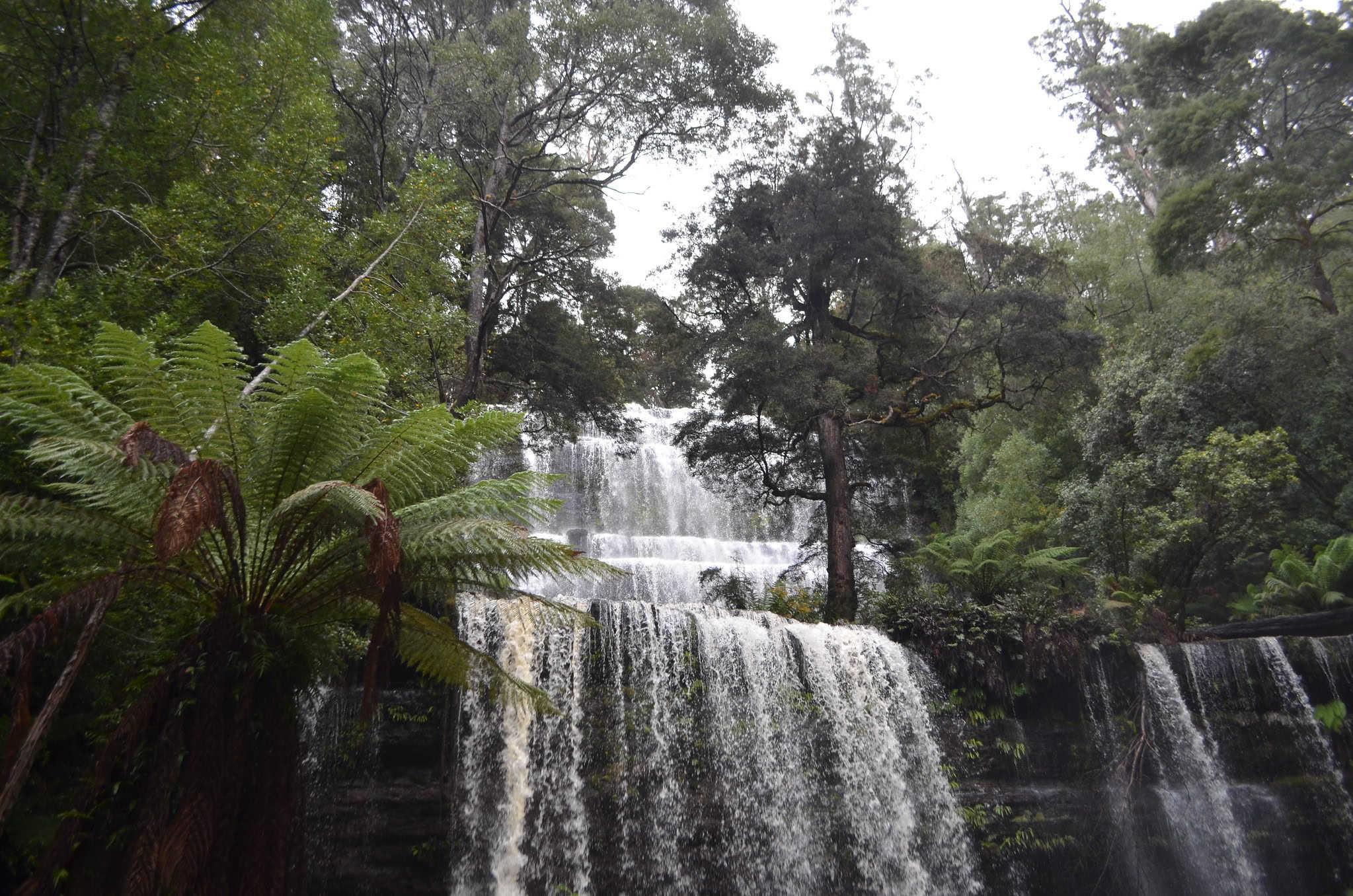
Hobart to Derwent Bridge Road Trip with the 8 Best Stops
Leaving the hustle of the city and travelling from Hobart to Derwent Bridge is a great road trip with plenty to see on the way and many places to stretch your legs. Here are the directions to get from Hobart to Derwent Bridge and some of the best stops and natural landmarks along the way.
Stock with picnic goodies from the Salamanca Market, as lots of the places I’ll show you are perfect wilderness spots to spread that blanket!
As well as this comprehensive Guide for Hobart to Derwent Bridge Road Trip, you might also like to check out these other helpful guides!
The Tarn Shelf – Mt Field National Park
Trail Difficulty Rating Guide to Help You Choose the Best Hiking Experience
Launceston to Derwent Bridge: A Scenic Road Trip Through Tasmania’s Heartland
Strahan to Derwent Bridge with the Best Stops Along the Way
National Park Passes in Tasmania – The Complete Guide
Hiking on Maria Island
This article may contain affiliate links. If you make a purchase using one of these links, we may receive compensation at no extra cost to you. See our Disclosure Policy for more information.
Driving from Hobart to Derwent Bridge:
- Route: The most common route is via the Lyell Highway (A10), which takes you through some beautiful forestry areas and past several natural landmarks, which I have listed below
- Distance and Travel Time: The drive is approximately 180 kilometres and typically takes around 2.5 hours under normal conditions.
Scenery and Stops:
On your drive from Hobart to Derwent Bridge via the Lyell Highway, there are some key spots where you can stop, stretch out, and enjoy a bit of Tasmania's great outdoors, no matter your age or hiking expertise.
I'll point out several natural landmarks along the way where you can get out, take a walk, and breathe in some fresh air, or even just have a picnic. On the road between Derwent Bridge to Hobart, there are walks that cater to a range of fitness and experience levels as well as attractions such as lakes or wildlife centres, where you can just immerse yourself in nature. I’ll include walks for those less mobile as well as experienced hikers.
For the record I’ll be using the Australian Walking Track Grading System, and as well, I’ll note if places are wheelchair accessible and if there are facilities such as toilets.
| Grade 1 Easy | Suitable for wheelchair users with assistance. 5km or less |
| Grade 2 Easy/Medium | May have gentle hill sections or steps. 10km or less |
| Grade 3 Medium | May have short steep sections, rough surfaces and steps. 20km or less. Suitable for most ages and fitness levels. |
| Grade 4 Hard | May be long, rough and very steep. Signage may be limited. |
| Grade 5 Difficult | Tracks are likely to be very rough, very steep and unmarked. Navigation skills required. |
CLICK HERE: For our Guide on the Australian Trail Grading System
Bonorong Wildlife Sanctuary
- Easy
- Suitable for Wheelchairs and Strollers
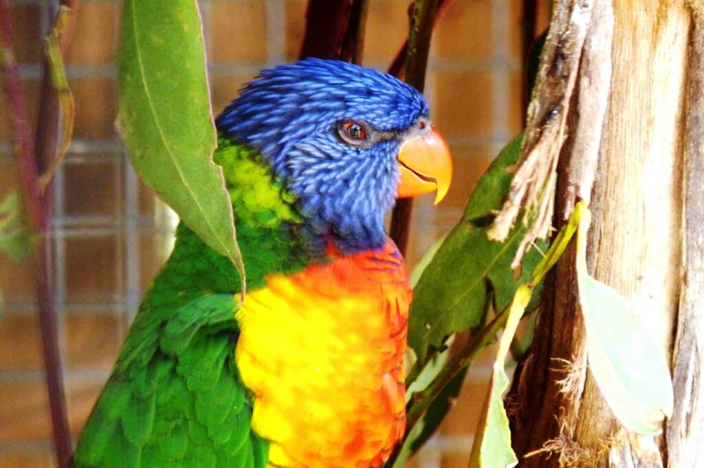
While technically not on the Lyell Highway, the Bonorong Wildlife Sanctuary which is half an hour or 30 kms out of Hobart, deserves a mention. It’s a slight detour from the Hobart to Derwent Bridge drive but a great stop for getting up close with Tasmania's native wildlife and learning about conservation efforts.
Open daily from 9:00 AM to 5:00 PM, the sanctuary lets you meet creatures like Tasmanian devils, kangaroos, and wombats in a setting focused on their care and protection.
You will get the chance to feed and interact with animals, making for a unique and impactful visit. They also run nighttime tours, which are perfect for seeing the nocturnal animals in action. An hour-long tour runs 4 times daily.
The wheelchair-accessible paths inside Bonorong allow for easy walking and are all about encountering animals in a responsible, educational context. It's all about conservation and connection and offers insights into the sanctuary's vital rescue work and the chance to support their mission firsthand.
Bonorong Wildlife Sanctuary Open 7 Days
593 Briggs Road Check website for admission fees.
Brighton, TAS, 7030
+61 3 6268 1184
These Guides for Day Hiking are Recommended:
What to Pack for a Day Hike – Including the 10 Essentials
What to Wear When Hiking (Winter and Summer)
What Food to Take on a Day Hike
Mount Field National Park
- Easy | Russell Falls, wheelchair accessible Return 15 mins each way
(Free Trailrider -all-terrain wheelchair available ) - Easy/Medium | 3 Falls Circuit 2-2.5 hrs 6km
- Medium | Tarn Shelf Track Circuit 5-7 hrs Distance: 12 km
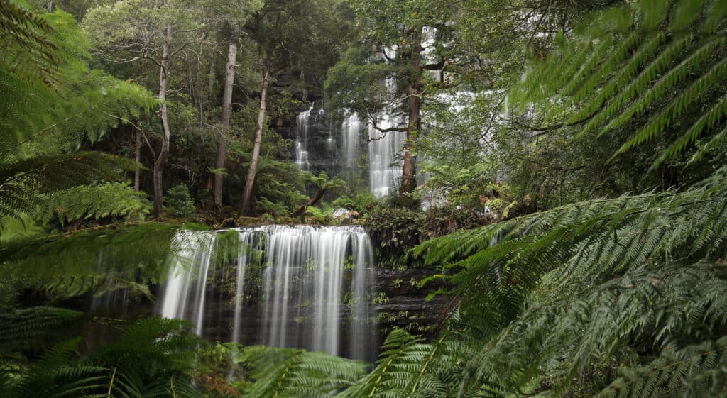
Just an hour's drive from Hobart, this park is one of Tasmania's oldest and my favourite national park. It offers diverse natural attractions, including the famous Russell Falls, towering tree ferns, and some of the tallest eucalyptus forests in the world. It's a fantastic place for short walks or longer hikes, with a campsite, a cafe and a visitors centre.
For those interested in the park's gorgeous waterfalls, the Three Falls Walk combines visits to Russell Falls, Horseshoe Falls, and Lady Barron Falls. This circuit is around 6 km long, typically taking about 2-3 hours to complete.
The walk meanders through varied environments, from lush rainforests to fern gullies, with each waterfall offering its own unique beauty. The stunning, three-tiered Russell Falls is only 15 min on a Grade 1 path and Ideal for those with young children or facing accessibility challenges.
One of my favourite hikes is the Tarn Shelf Track, a gorgeous 5-7 hr hike that takes you through alpine moorland dotted with glistening jewel-like tarns (glacial lakes). It’s not a difficult walk but bushwalking experience is required.

The visitors centre has maps, and will hire PLB’s as well. Make sure you sign the log book at the Lake Dobson carpark to advise Tas Parks of your trip intention.
There are shorter walks up at Lake Dobson as well, which take in Lake Seal and Platypus Tarn. Just be aware the road up to Lake Dobson is not suitable for RV’s or caravans.
The visitor information centre provides essential information, maps, and displays. You will need a Parks Pass to enter into the park as well as stay. There is no need to book campsites, they operate on a first-come, first-served basis.
READ NEXT: Our Complete Guide to Toileting Responsibly when Hiking
Mt Field Accessibility
A TrailRider (all-terrain wheelchair) is available at Mount Field for visitors with impaired mobility. The TrailRider can be used on a range of designated walking tracks inaccessible to conventional wheelchairs. The TrailRider is available to hire free of charge, and advanced bookings are required. To book, please contact the Mount Field Visitor Centre at (03) 6288 1149 or MtField@parks.tas.gov.au.
The visitor centre and café are fully accessible, as are the toilets within the building.
Mount Field Visitor Centre Open 7 Days
66 Lake Dobson Rd Tasmanian Parks Pass is required
National Park TAS 7140
03 6288 1149

Pack Light, Pack Right – Free Interactive Checklists
No More Overpacking. No More Forgetting Essentials.
Our free interactive packing lists help you pack methodically and remember everything. Add notes, quantities, save or print, and share with hiking partners so everyone knows what’s covered and what they need. Works on any device.
Available for multi-day wilderness camping, hut-to-hut hikes, and inn-to-inn walks, with new lists added frequently.
The Salmon Ponds
- Easy
- Suitable for Wheelchairs and Strollers
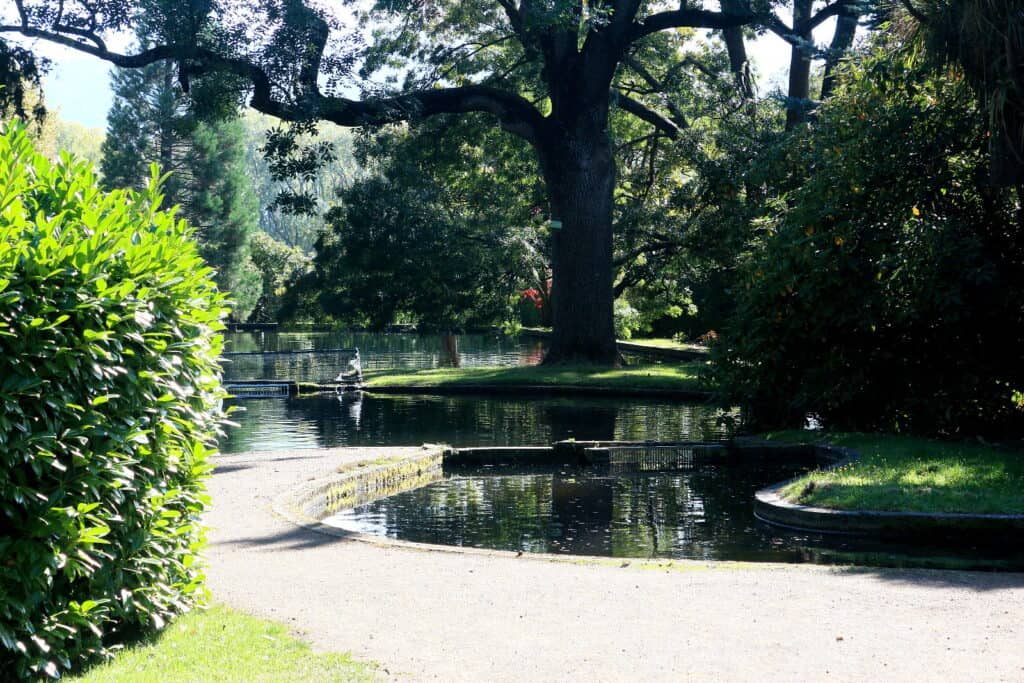
A great stop on your little road trip from Hobart to Derwent Bridge is the Salmon Ponds, just out of New Norfolk.
Set up in 1861, the Salmon Ponds is the oldest trout hatchery in the Southern Hemisphere. This historic location signifies the moment when trout were first introduced to Australia and the start of Tasmania's famous trout fishing industry.
The Salmon Ponds are surrounded by gorgeous 19th-century English-style gardens, where visitors can wander among trees that have stood for over 140 years. As well as the educational hatchery, there’s a gorgeous Riverside Walk (wheelchair accessible), picnic tables and BBQ’s if you bring your own lunch and a cafe.
For over a hundred years, the Salmon Ponds Tasmania has been replenishing Tasmania’s lakes and dams with more than a million trout annually. Even now, amidst its original structures and trees, this place remains active as a hatchery, playing a crucial role in the hatching process.
When you visit the hatchery, you get to see these fish up close, discover their life cycles, and understand the hatchery's breeding programs. This experience teaches us about the significance of sustainable fish farming practices and how these facilities contribute to conservation and recreational fishing in Tasmania.
If you’re lucky, you can also spot wild platypus in the Plenty River, which flows adjacent to the hatchery. Platypus is an iconic Australian mammal known for its duck-like bill and webbed feet, tail like a beaver and furry body like an otter.
These creatures are renowned for their shy nature and unusual appearance, and it’s really exciting to actually see one!. Platypus are best seen early in the morning or late in the afternoon.
Salmon Ponds Tasmania
70 Salmon Ponds Road
New Norfolk, Tasmania 7140

Like This?
We'd love you to share this great guide!
The Styx Valley
- Easy/Medium | Big Tree Reserve 700m – 30 mins
- Easy/Medium | Styx River Ramble 700m – 30 mins
- Medium | Tolkien Track – 3.2km – 1-2 hours
- Medium | Carbon Circuit Walk 1-7km – 1-5 hours.

Another must stop on the Hobart to Derwent Bridge trip is the Styx Valley (aka The Styx Valley of the Giants). The valley is known for its giant eucalyptus trees, which rank among the tallest in the world.
The Styx Valley became part of the World Heritage Area in 2013, thanks to the Wilderness Society's dedicated tree-hugger campaigns against logging in the area. This area in Tasmania is seriously breathtaking and offers several short walks which are easy/moderate and allow you to view these giants, up close and personal.
You can explore the Styx Valley through four signposted walks. The Big Tree Reserve offers a gentle introduction to the majestic trees of the area. The Styx River Ramble provides a peaceful path along the river, while the Tolkien Track delves deeper into the forest.
Along the Tolkien Track, an information board details the efforts of tree climbers from around the globe who converged here to protect these giants. It also explains the crucial ecological roles these trees play. “Gandalf's Staff,” a prominent tree along this track, stands at 84 metres tall with a significant girth, believed to be over 400 years old.
A fourth walk in the Styx Valley is the Carbon Circuit Walk which introduces a different aspect of the Styx Valley's ecology, This walk can be accessed after a 6 km return journey from the locked gate on Jubilee Rd. If the gate is unlocked, you can drive directly to the walk's starting point; otherwise, a key can be obtained from the visitor's centre at Mt Field National Park with prior arrangement.
Car parking is available at the Styx Valley trailheads, but there are no toilets so please practice LNT principles. These walks provide a valuable and immersive experience in one of Tasmania's most precious environments, so please ensure you bring out all rubbish with you.
Styx Valley
Styx Rd, Styx TAS 7140

Interested in
Hiking Safety?
We have a dedicated Hiking Health, Safety and Hygiene Facebook group!
King William Lake
- Easy
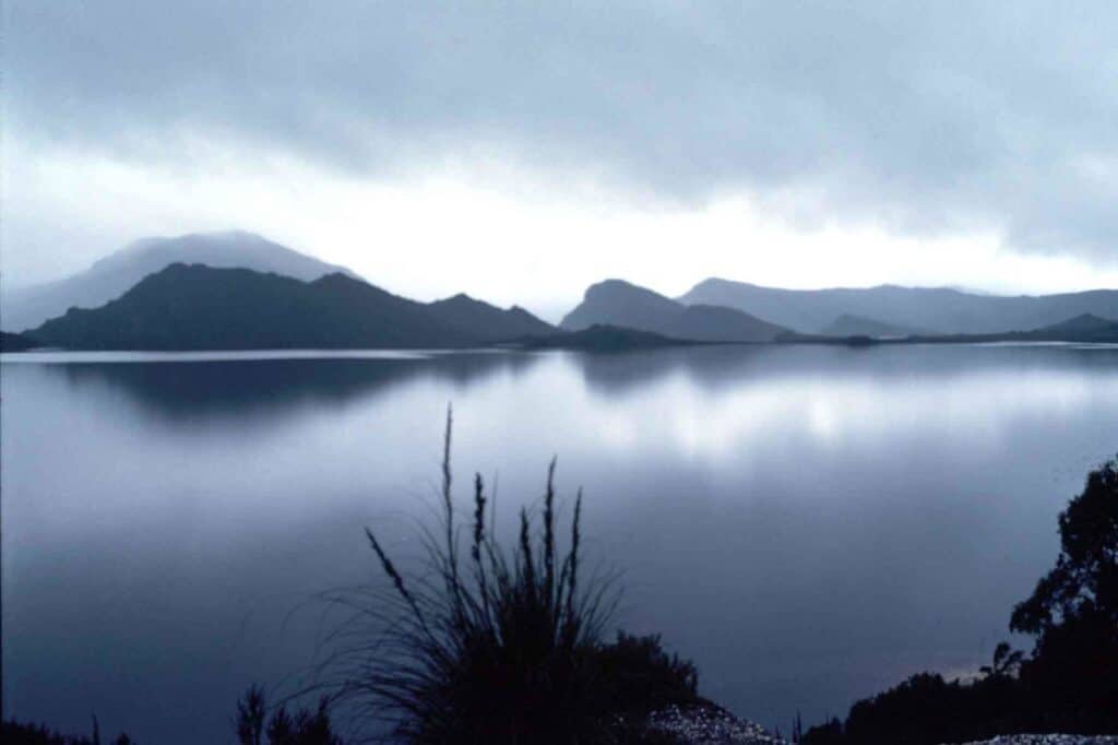
Lake King William is a great stopping off point to stretch your legs, have a picnic, or cast a line if you’re into trout fishing. Lake King William is an expansive man-made reservoir in the heart of Tasmania's central highlands just shy of Derwent Bridge.
Created for hydroelectric power generation, it has transformed into a popular spot for anglers and nature enthusiasts alike, known for its trout and salmon fishing. The lake's surroundings are stark and beautiful, offering a sense of seclusion and wilderness despite its utilitarian origins.
There aren't designated walking trails around Lake King William, but the area's natural beauty is accessible from various points along the lakeshore, where you can explore and enjoy the serene environment.
Facilities are minimal and while there are toilets at some of the carparks, you will need to come prepared with your own provisions and adhere to Leave No Trace principles.
If you're looking to extend your stay on the Hobart to Derwent Bridge road trip, there is the Lake King William Campground, located just 2km from Derwent Bridge. The campsite has no facilities so you must be fully self-sufficient. A Tasmanian Parks Pass is required to use the campground, ensuring your visit supports the maintenance and preservation of this remarkable natural area.
READ NEXT: The Essential Guide to Hiking in the Heat Safely
Tarraleah Falls
- Easy/Medium – 2km -1 hour

Tarraleah Falls has panoramic views of the surrounding highlands and hydro-electric power infrastructure and is right off the Lyell Highway making it perfect stop on your Hobart to Derwent Bridge road trip
Here, you'll see an incredible sight where massive water pipes dive about 600 metres down into a gorge, as part of the area's hydroelectric scheme. It's quite a view and if you’re into architectural photography, you could get quite a good industrial shot
Right at this lookout, you'll find the trailhead for Tarraleah Falls. You'll start by crossing those enormous water pipes, then hit the trail that takes you straight into the forest.
The walk to the falls is about 25 minutes one way, but give yourself some extra time just in case you want to go slower or take more in.
When you get to the waterfall it’s pretty amazing as the waterfall plunges over a cliff into empty space, The track is mostly easy-going, but with just a bit of a descent as you get closer to the falls. If you're reasonably fit, you can head there and back in under an hour, including some time at the falls to enjoy the view and the sound of the water.
READ NEXT: The Complete Guide to the Tasmanian Parks Pass
Tungatinah Lagoon
- Easy
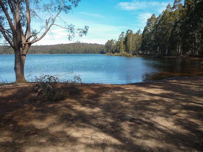
Tungatinah Lagoon, 5.3km North of the Tarraleah Power Station Bridge, offers serene beauty and a peaceful retreat into nature.
Ideal for leisurely walks along its shores, the lagoon is a perfect spot for bird watching, picnicking, or simply enjoying the calm, reflective waters. The surrounding wilderness invites you to unwind and soak in the tranquillity of this picturesque location.
While the lagoon itself is a highlight, nearby, there's a free campground if your wishing to break your journey between Hobart to Derwent Bridge. Accommodating pets, caravans, and big rigs, with a specific area set aside for tents, the campsite allows a maximum stay of 7 days.
Although it provides toilet facilities, campers are advised to be self-sufficient, bringing essentials like gas or fuel stoves, drinking water, food, and firewood. There is a rubbish bin, but please practice LNT principles.
These Guides for Day Hiking are Recommended:
What to Pack for a Day Hike
What to Wear When Hiking (Winter and Summer)
What Food to Take on a Day Hike
The Wall in the Wilderness
- Suitable for Wheelchairs and Strollers
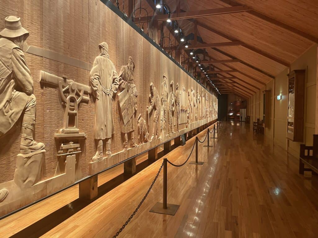
The Wall in the Wilderness, stands as a profound testament to Tasmania's history and natural beauty, all captured through the meticulous craftsmanship of artist Greg Duncan.
This unique attraction features a series of carved wooden panels made from Huon pine, depicting scenes that celebrate the heritage and spirit of Tasmania, including its pioneers, its wilderness, and the everyday lives of its people.
Greg Duncan, the artist behind this remarkable creation, has dedicated years to sculpting these panels, bringing to life the essence of Tasmania with an attention to detail that left me in awe. Each carving is a piece of art, and you really appreciate not just the story being told but also the medium itself, with the natural beauty of the wood enhancing each narrative.
You are welcomed into a space that combines art, history, and a touch of hospitality. There’s soft lighting, gentle music, and the option to enjoy a drink while you peruse the artwork, making the experience both immersive and relaxing. While the café may not always be open, the opportunity to walk along the exhibit with a glass of wine in hand adds an extra layer of enjoyment to your visit.
The Wall in the Wilderness is a must-see on the Hobart to Derwent Bridge trip, capturing the heart and soul of Tasmania in a unique and captivating way.
The Wall in the Wilderness Wheelchair Accessible
15352 Lyell Hwy Bookings essential through the website
Derwent Bridge, TAS
P. 03 6289 1134
Pack Light, Pack Right – Free Interactive Checklists
No More Overpacking. No More Forgetting Essentials.
Our free interactive packing lists help you pack methodically and remember everything. Add notes, quantities, save or print, and share with hiking partners so everyone knows what’s covered and what they need. Works on any device.
Available for multi-day wilderness camping, hut-to-hut hikes, and inn-to-inn walks, with new lists added frequently.
Safety Tips for Driving in Tasmania
- Road Conditions: The Lyell Highway is well-maintained but can be winding and narrow in sections, especially as it passes through mountainous terrain. Drivers should be prepared for variable weather conditions, particularly in winter.
- Caravan Parks: While there are limited facilities directly in Derwent Bridge, nearby areas offer caravan-friendly accommodations. Lake St. Clair Lodge provides options for caravan parking and is an excellent base for exploring the area.
- Driving Advice: Always check road conditions before departing, particularly in winter months when ice and snow can affect travel. Ensure your vehicle and caravan are well-maintained and equipped for the journey, considering extra provisions for remote areas.
- Wildlife Caution: Be alert for wildlife crossing the roads, especially at dawn and dusk.
Like This?
We'd love you to share this great guide!
A Great Road Trip
I've driven this road nearly a dozen times between Hobart to Derwent Bridge. Sometimes, I’ve gone straight through eager to hit the trail at Franklin Gordon Rivers National Park, other times I’ve stopped for a night or two. Whether you take 3 hours or 3 days or even 3 weeks to cover this journey, there is plenty to see and lots of stops to check out natural landmarks.
Once you're at Derwent Bridge, there’s loads to see and do in the immediate vicinity including Cradle Mountain – Lake St Clair National Park, before you head to the West Coast, so check out my other posts! Enjoy and travel or hike safely!
Discover Tasmania's breathtaking landscapes and rich cultural heritage through a trip that could take you from the stunning vistas of Mount Wellington to the serene beaches of the East Coast, or from the historic site of Port Arthur in the Tasman region to the rugged trails of the Overland Track. Explore the lush Huon Valley, the majestic national parks, and the unique Bruny Island. Acknowledge the poignant history and the enduring legacy of the Aboriginal people, deeply interwoven with Tasmania's identity.
If You Enjoyed this Guide. – You May Also Like:
- Navigating the Overland Track Solo
- Hiking Frenchmans Cap -Tasmania’s Iconic White Peak
- Hiking the Rees Dart Track – Mt Aspiring National Park
- The Rakiura Track – A Great Walk on Stewart Island
- Traverse Walls of Jerusalem to the Overland Track via Lees Paddock
- Hiking The Tahoe Rim Trail – A Guide for Overseas Visitors
- Conquering the Gold Coast Kokoda Challenge
- Plan Your Larapinta Trail Sections, Best Time of Year, Resupply, and Transfers
- Larapinta Trail Food Essentials and Nutrition Plan

