
Strahan to Derwent Bridge and the Best Stops Along the Way
The drive between Strahan to Derwent Bridge is seriously stunning! I haven’t included any towns in this guide, so you may like to detour for supplies, or stock up in Strahan or Queenstown.
There are towns you can detour to, but for this road trip, I’m going to concentrate on natural landmarks between Strahan to Derwent Bridge only.
Places where you can get out and stretch your legs, cast that fishing line, or have a picnic by the banks of a gorgeous river. If you’re into multi-day hikes, you are SO on the right road! – think Frenchmans Cap, or Lake St Clair.
You may also like these other helpful Tasmanian Guides
The Tarn Shelf – Mt Field National Park
Trail Difficulty Rating Guide to Help You Choose the Best Hiking Experience
Launceston to Derwent Bridge: A Scenic Road Trip Through Tasmania’s Heartland
Hobart to Derwent Bridge Road Trip with the 8 Best Stops
National Park Passes Tasmania Offer a Gateway to Pristine Beauty
Maria Island
What to Pack for a Day Hike
This article may contain affiliate links. If you make a purchase using one of these links, we may receive compensation at no extra cost to you. See our Disclosure Policy for more information.
I will also note any stops that are wheelchair accessible and list the amenities, so this special part of Tasmania is inclusive for all. But first, for those in a hurry…
The Direct Route – Strahan to Derwent Bridge
Route: The primary and most direct route is via the Lyell Highway (A10), taking you eastward through the heart of western Tasmania's wilderness. This road will take you through dense rainforest and alongside scenic rivers and mountains. You really will get to see Tasmania’s rugged beauty.
Distance and Travel Time: The drive is approximately 138 kilometres and typically takes around 2 hours under normal driving conditions. The road winds through varied terrain, so it's wise to allow extra time for any weather changes as rain, snow or ice can and has happened at any time of the year.
Strahan to Derwent Bridge with Highlights!
You might want to get some picnic food for this trip at the Strahan IGA X-press on 1 Reid St, or head over to The Coffee Shack on The Esplanade for some baked goods.
Queenstown, enroute has way better options it seems for bakeries with fresh cut sandwiches and cakes; including Tracks on 1 Driffield St, or JJ’s Coffee, 13 Orr St.
Note, if you need to stock up on supplies for a multi day hike, there is no camping store in Strahan or Queenstown – but Green's General Store on Conlan St, may sell gas canisters and definitely sells fishing gear. I hear they do an OK pizza as well – that knowledge might come in handy.
For the record I’ll be using the Australian Walking Track Grading System, wherever tracks or walks are concerned.
| Grade 1 Easy | Suitable for wheelchair users with assistance. 5km or less |
| Grade 2 Easy/Medium | May have gentle hill sections or steps. 10km or less |
| Grade 3 Medium | May have short steep sections, rough surfaces and steps. 20km or less. Suitable for most ages and fitness levels. |
| Grade 4 Hard | May be long, rough and very steep. Signage may be limited. |
| Grade 5 Difficult | Tracks are likely to be very rough, very steep and unmarked. Navigation skills required. |
CLICK HERE: For our Guide on the Australian Trail Grading System
West Coast Wilderness Railway

While not technically a natural landmark on the Derwent Bridge to Strahan route, I’m including this amazing tourist attraction. The West Coast Wilderness Railway winds through some of the most scenic parts of the rugged terrain of Tasmania's west coast that you just can’t get to by car.
The West Coast Wilderness Railway is a great stopping point or day trip from Strahan as it offers a unique chance to delve into the region's rugged history and appreciate the engineering ingenuity of Tasmania's pioneering days. This heritage railway, with its meticulously restored steam locomotives and period carriages, provides an immersive experience into the past.
Operating several times a week, with additional services during peak seasons, the railway runs both half day and full day tours. The train navigates through dense rainforest, across historic bridges, and into deep gorges like the King River Gorge.
You'll travel on tracks that were once the lifeline for remote mining communities, passing through locations that played pivotal roles during the mining boom.
At stations like Lynchford and Rinadeena, you can engage in activities such as gold panning and watch the train's unique water refilling process.
The West Coast Wilderness Railway reaches remote locations such as Dubbil Barril, with its turning loop, and the formidable Rinadeena Saddle, which the train climbs using the unique rack and pinion system. This technology is a key feature of the railway, enabling the locomotive to manage steep gradients not possible with conventional adhesion systems.
While on board, a guide provides commentary and local knowledge on the area's cultural significance and the hardships overcome to establish the railway.
Catering is provided, with different classes offering various dining experiences. Bookings are essential.
Accessibility:
While some train rides are not wheelchair accessible due to safety and mobility concerns, The West Coast Wilderness Railway offers a range of accessible facilities. Please visit https://wcwr.com.au/accessibility/ for more information.
Wilderness West Coast Railway Open 7 Days
+61 (03) 6471 0100 Check website for admission fees.
King River Gorge
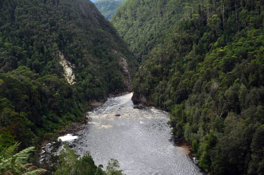
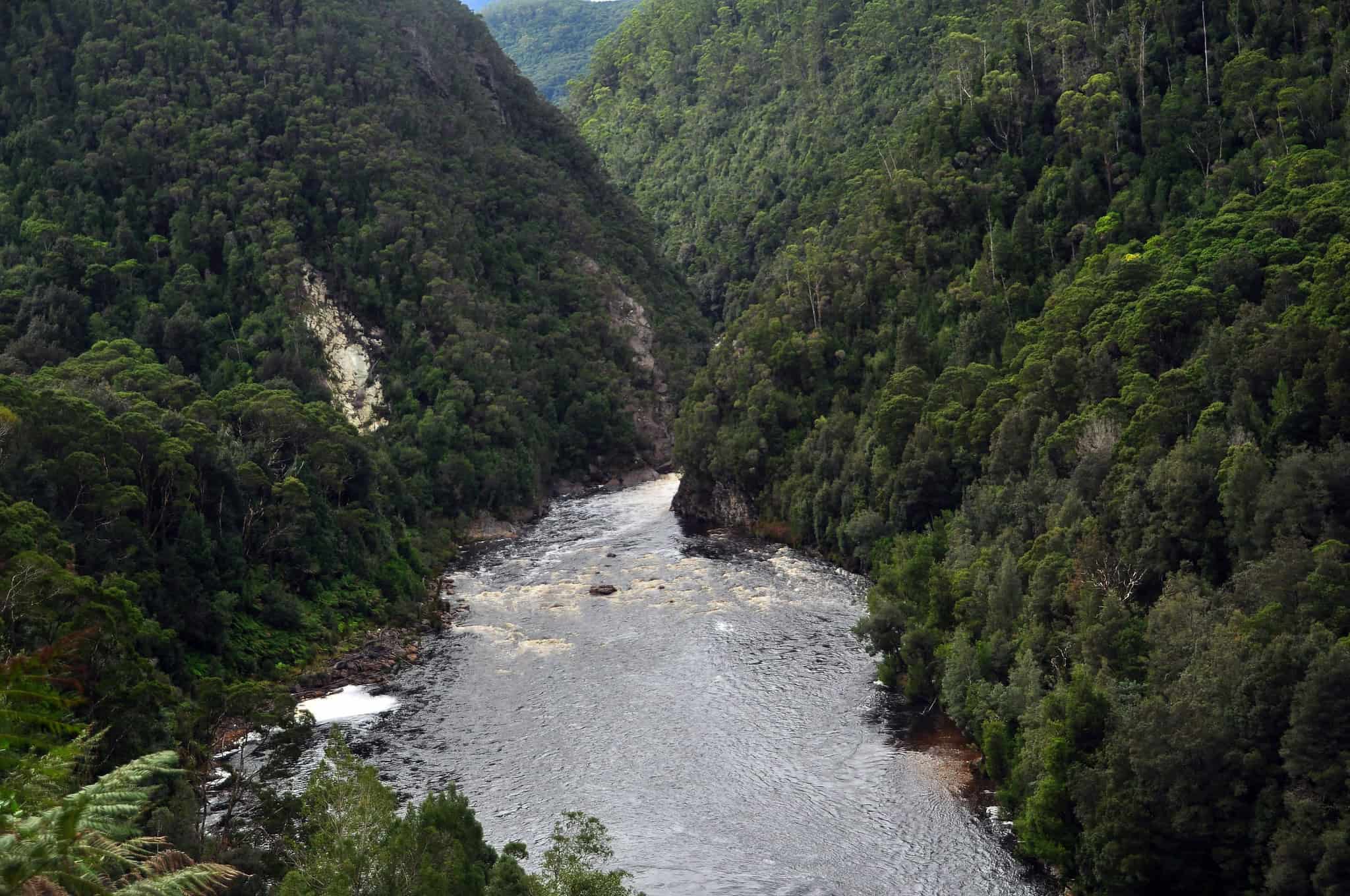
The King River Gorge, located in the rugged wilderness of Tasmania's west coast, is a remarkable natural formation carved by the King River as it winds its way toward Macquarie Harbour. The gorge is recognised for its steep, forest-clad sides and the wild, turbulent waters of the King River, which have historically been a challenge for navigation and transport.
The gorge is a key feature of the West Coast Wilderness Railway experience, and the train journey offers you a close-up view of the river's rapids and the dense rainforest that envelops the gorge, providing a sense of isolation and untouched beauty.
READ NEXT: The Essential Guide to Hiking in the Heat Safely
However, for those interested in a little adrenaline-pumping activity, the gorge is also fantastic for white-water rafting. Activities like this great Rafting and Wilderness Railway Experience will give you the best of both worlds.
While there are no hiking trails that run through the gorge itself, you’ll find viewpoints along the railway and river that allow you to fully absorb the majesty of this wild and historic region.
A Tasmanian Parks Pass is not required.

Like This?
We'd love you to share this great guide!
Horsetail Falls
Easy/Medium 1.2km return – 45 mins.
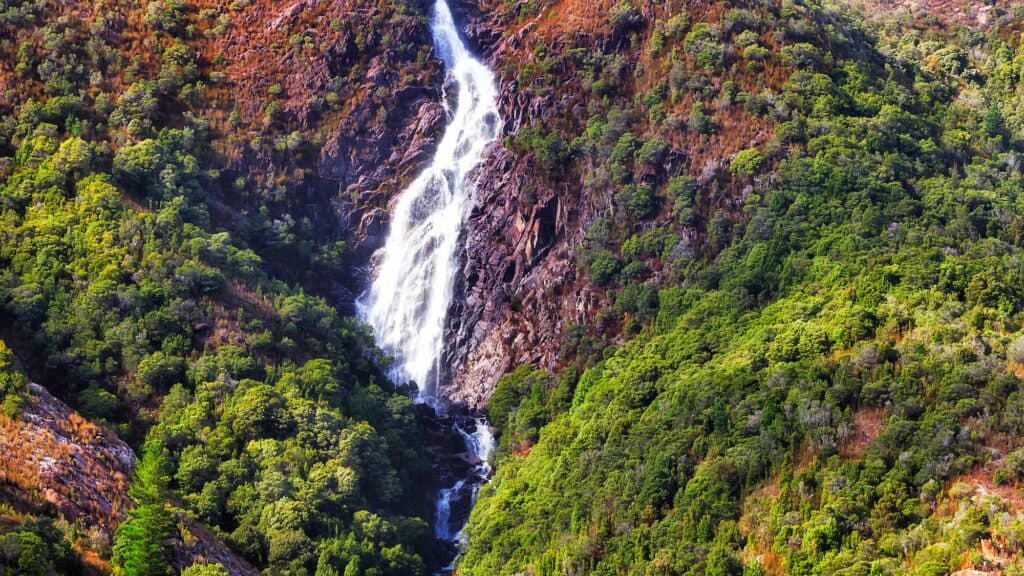
Horsetail Falls near Queenstown, Tasmania, stands out due to its distinctive cascading formation, resembling the tail of a horse as water gracefully descends over a series of rock tiers. This type of waterfall maintains contact with the bedrock as it falls, creating a smooth, flowing appearance.
Especially after heavy rainfall, Horsetail Falls transforms into a powerful spectacle. The falls are set against the stark, dramatic landscape of the West Coast Range and are a stunning example of the area's natural beauty, with the lush vegetation contrasting with the rugged terrain.
Access to Horsetail Falls is via a well-maintained track of stairs and boardwalk, with the total elevation just 94m, so fairly easy. It’s a short but rewarding hike giving you a close-up view of the falls and the surrounding rainforest making it a special destination for those interested in Tasmania's wilderness and geological features.
To access Horsetail Falls, you do not need a parks pass, as it is not located within a national park. Remember to wear sturdy footwear and bring water for the hike. I totally recommend stopping by this gorgeous waterfall on your Strahan to Derwent Bridge road-trip.
READ NEXT: The Hikers First Aid Kit Essentials
Lake Banbury
Suitable for Wheelchairs and Strollers
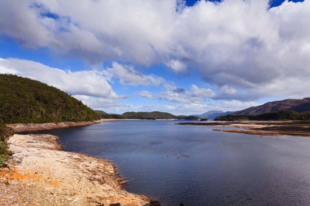
Lake Burbury, is an expansive hydro electric power reservoir and is well-known for its fishing, particularly for trout, with both brown and rainbow varieties in abundance.
There are no specific hiking trails around Lake Burbury, but the area around the lake is suitable for casual walks to stretch your legs and take in the scenic views. Banbury Lake is also popular for water sports such as kayaking and canoeing, however it’s BYO craft as there are no hire facilities.
Picnic facilities are available, complete with tables and BBQs, providing a sensational spot for a lakeside meal with the mountainous backdrop.
There are two boat ramps, for launching watercraft for fishing or leisure. While facilities at Lake Burbury cater to a variety of needs, wheelchair accessibility may be limited due to the natural terrain. There are toilets which are wheelchair accessible.
Visiting Lake Burbury does not require a parks pass, but ensure you have a valid Inland Fisheries Service angling licence, if you plan on casting a line.
If you’re wanting to stop on your Strahan to Derwent Bridge journey, the Lake Burbury Camping Ground is right on the foreshore, perfect for fishing and if that's not your thing, then maybe a drink while you watch the sunset might do the trick.
Lake Burbury Camping Ground is located on the Lyell Highway, twenty minutes east of Queenstown to Derwent Bridge. Campsites are available for a small daily fee and a caretaker is on site. There are two grassed areas, and the campsite is suitable for tents, caravans, and motorhomes. Basic amenities such as a boat ramp and public toilets are available. Bring your own water and firewood.
Lake Burbury Camping Ground
+61 3 6471 4700

Pack Light, Pack Right – Free Interactive Checklists
No More Overpacking. No More Forgetting Essentials.
Our free interactive packing lists help you pack methodically and remember everything. Add notes, quantities, save or print, and share with hiking partners so everyone knows what’s covered and what they need. Works on any device.
Available for multi-day wilderness camping, hut-to-hut hikes, and inn-to-inn walks, with new lists added frequently.
Iron Blow Lookout
Easy – 50 metres – 5 minutes
Suitable for Wheelchairs and Strollers
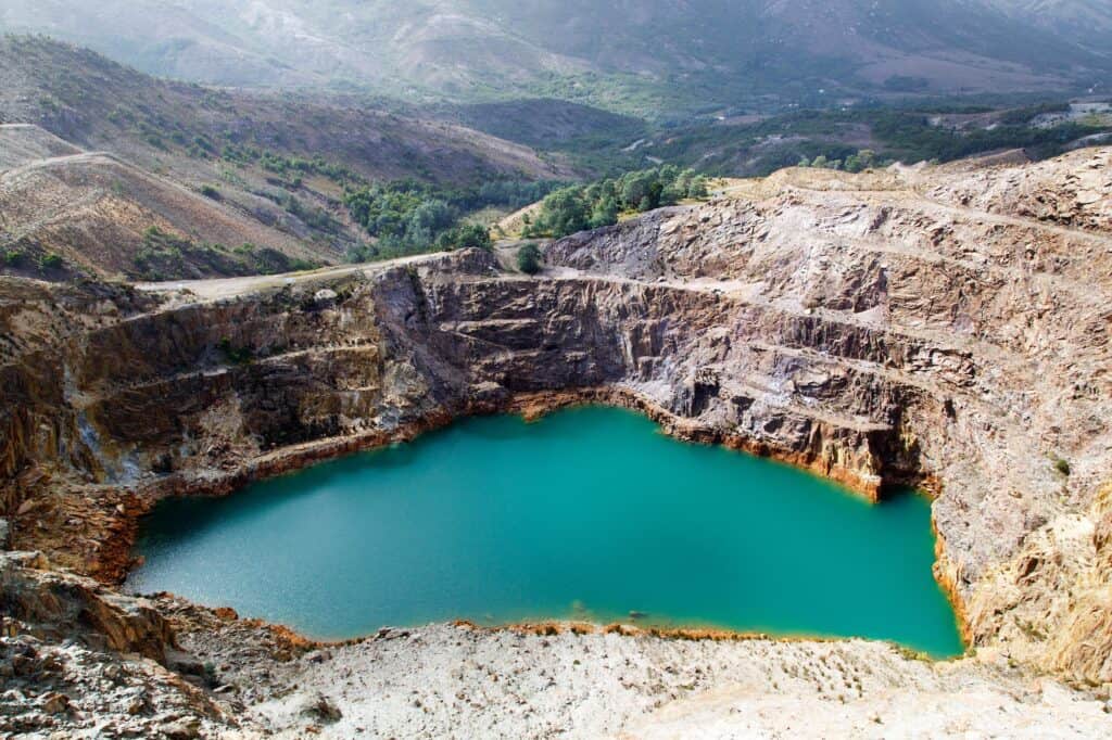
Iron Blow Lookout near Queenstown, Tasmania, is a historical vantage point that brings you face to face with Tasmania’s mining past. Overlooking the original open-cut of the Mount Lyell Mining and Railway Company from the 1800s, the lookout displays a breathtaking scene: a vast crater filled with water tinted by minerals, contrasting against the rugged terrain.
From the parking lot, follow a short, clearly marked path to the Iron Blow Lookout viewing platform. Here, you are greeted with interpretive signage that delves into the significance of Iron Blow, offering insights into the intense mining activities that once dominated the landscape. The signs recount tales of the human endeavour that extracted valuable resources from deep within the earth.
As you stand at Iron Blow Lookout, the view captures both the historical scars of mining and the natural beauty of the West Coast Range. The water in the crater mirrors the sky, while the surrounding slopes show signs of nature's gradual recovery.
Visiting Iron Blow Lookout, you gain a direct and powerful perspective on the interaction between human industry and the environment. The site is a vivid example of the area's past, showing the extent of human endeavour while nature slowly reclaims the altered landscape.
It’s a poignant place to reflect on history and witness the resilience of the natural world. Again, one of my favourite stops on the Strahan to Derwent Bridge road!


Franklin-Gordon Wild Rivers National Park
Easy: Franklin River Nature Trail
Easy: Donaghys Hill Lookout
Medium: Nelson Falls Track
Hard: Frenchmans Cap
Franklin-Gordon Wild Rivers National Park, located in the heart of Tasmania's wilderness, is a UNESCO World Heritage-listed site renowned for its pristine rivers, rugged mountains, and dense rainforests.
Encompassing part of the famous Tasmanian Wilderness World Heritage Area, the park offers a glimpse into some of the most untouched natural environments on the planet.
The park runs parallel to a section of the Lyell Highway so is perfect to explore on your Strahan to Derwent Bridge road trip. In this park, you'll find a network of trails ranging from easy short walks to challenging hikes, including my favourite hike in Tasmania, Frenchmans Cap.
READ NEXT: Our Complete Guide to Toileting when Hiking
One of the best short and easy hikes is the Franklin River Nature Trail. Perfect for beginners or those less mobile, the trail provides an opportunity to experience the lush temperate rainforest up close, with the chance to see the park's iconic river systems, which are pivotal to the region's ecological diversity.
The Franklin and Gordon rivers, which give the park its name, are a mecca for white-water rafters and kayakers, offering some of the most exhilarating adventures in Tasmania's wild landscapes.
Conservation is a primary focus here, with the park protecting a range of rare and endemic plant and animal species. To visit, you'll need a valid parks pass, which contributes to the ongoing preservation efforts.
Make sure you clean your boots at the boot cleaning station. If you're unsure what this means, please check out our article on Boot Cleaning Stations, where you can learn about them and their importance.
Also note, this is alpine Tasmania, where adverse weather conditions can bring about snow or freezing rain without much warning. Be prepared and check out my packing list for both day trips and overnight hikes in Alpine Tasmania.
Check out my Full Gear List for Overnight Hikes
Frenchmans Cap
Hard – 46 km return – 3-5 days.
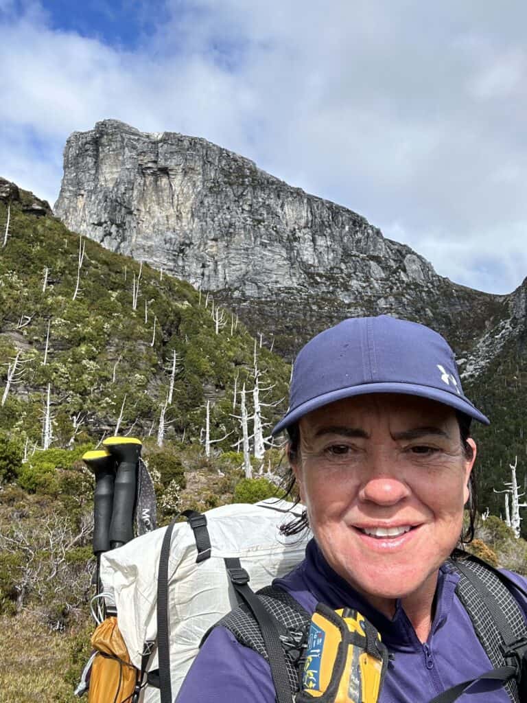
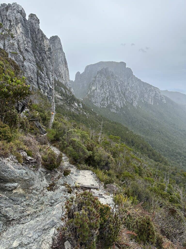
When I did the Frenchmans Cap back in 2023, I thought it was one of the most beautiful hikes, and that I would return. Unfortunately due to adverse weather I was unable to summit Frenchmans Cap, so I have the perfect excuse!
It’s a challenging and rewarding trek through the Franklin-Gordon Wild Rivers National Park in Tasmania. Frenchmans Cap is renowned for its iconic quartzite peak resembling a Frenchman's cap and the peak stands out on many a vista as you make your way to Tahune Hut.
The hike takes you through varied landscapes, from button grass moorlands to ancient rainforests, culminating in breathtaking views from the summit – if the weather is right !
Read the Full Guide to Frenchmans Cap here
This 46-kilometre return track typically requires 3 to 5 days to complete, with hikers needing to be self-sufficient and well-prepared for changeable conditions. The trek's start is marked by the well-known Franklin River Nature Trail, which leads to the ascent of the mountain.
Along the way, you can camp at Lake Vera and Lake Tahune Huts, both with wooden tent platforms. There are also a couple of spots to wild camp before Lake Vera, if you arrive late and unable to make it to Lake Vera by nightfall.
The climb to the top of Frenchmans Cap is steep and can be challenging, but reaching the summit at 1,446 metres provides panoramic views of the surrounding wilderness, including the Franklin River below and the distant ocean on clear days.
Like This?
We'd love you to share this great guide!
The Franklin River Nature Trail
Easy 1.3 km 30 minutes
Suitable for Wheelchairs and Strollers
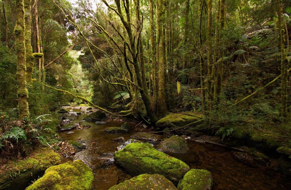
The Franklin River Nature Trail is a wonderful short walk to experience a small slice of the park's vast wilderness. The Franklin River Nature Trail is an easy wheelchair and stroller accessible formed track, and showcases the lush, temperate rainforest that characterises much of the region.
It’s a gorgeous shady walk alongside the Franklin River, which has played a significant role in Tasmania's environmental history. The park, and this trail in particular, offer a chance to connect with nature and learn about the area's ecological importance and conservation story, especially the campaign to save the Franklin River from being dammed in the 1980s, a pivotal moment in Australia's environmental movement.
You'll find interpretive signs along the track that reveal the ecology of the region and the Franklin River's historic role in conservation efforts.
Accessible toilets and a picnic area (no fires), are at the start of the trail. However please pack out all rubbish/garbage and practice Leave no Trace Principles.
These Guides for Day Hiking are Recommended:
What to Pack for a Day Hike
What to Wear When Hiking (Winter and Summer)
What Food to Take on a Day Hike
Frenchmans Cap ViewPoint
Suitable for Wheelchairs and Strollers
Frenchmans Cap Viewpoint offers you a scenic lookout on the Lyell Highway, providing a spectacular perspective of one of Tasmania's most distinctive mountain peaks. Frenchmans Cap, named for its resemblance to the shape of a traditional French hat, rises to an elevation of 1,446 metres and is a striking feature of the Franklin-Gordon Wild Rivers National Park.
The viewpoint is easily accessible from the highway, making it a convenient spot to stop, stretch your legs, and capture photos of the landscape. The viewing area is equipped with informational signage that gives an overview of the peak's geology, flora, and fauna, as well as the challenging hike (Frenchmans Cap) that leads to its summit.
From this vantage point, you can appreciate the grandeur of the peak without the multi-day commitment required for the full hike. It's an ideal location to experience the magnitude of the wilderness area and understand why this peak has become an icon of Tasmanian bushwalking.
There are no facilities at the viewpoint itself, so be sure to plan accordingly. While you don't need a parks pass to visit the Frenchmans Cap Viewpoint, if you're wanting to explore further into the national park, a pass will be required for most other areas.
READ NEXT: The Complete Guide to the Tasmanian Parks Pass
Why is Frenchmans Cap White ?
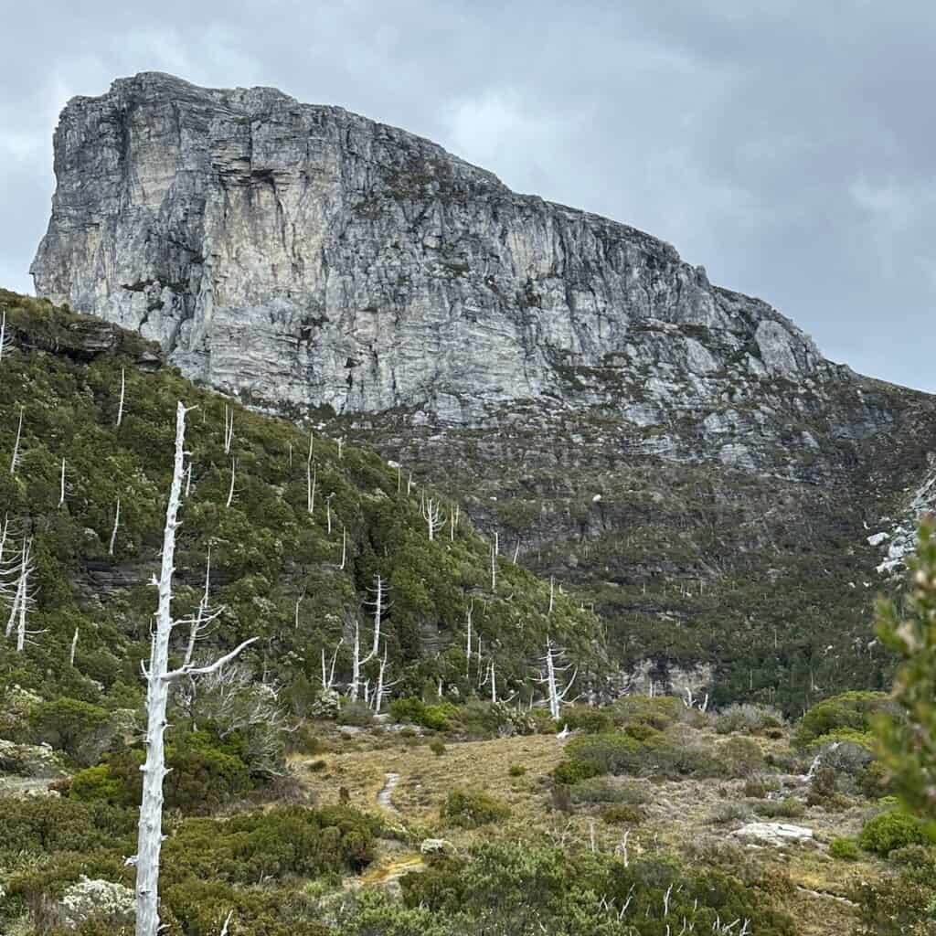
Frenchmans Cap is renowned for its distinctive white summit, which stands out against the typically green and rugged Tasmanian wilderness. The peak's white coloration comes from the quartzite rock from which it is composed. Quartzite is a hard metamorphic rock that is formed from sandstone. It contains a high percentage of quartz, which gives it the white or light-colored appearance.
The geological process that created the quartzite of Frenchmans Cap involved intense heat and pressure over millions of years, which transformed the original sandstone into the durable, crystalline rock seen today. This transformation also resulted in the smooth, often shiny surface of quartzite, which reflects sunlight, enhancing the white appearance of the peak from a distance.
Pack Light, Pack Right – Free Interactive Checklists
No More Overpacking. No More Forgetting Essentials.
Our free interactive packing lists help you pack methodically and remember everything. Add notes, quantities, save or print, and share with hiking partners so everyone knows what’s covered and what they need. Works on any device.
Available for multi-day wilderness camping, hut-to-hut hikes, and inn-to-inn walks, with new lists added frequently.
How to get to Frenchmans Cap Lookout
While driving along the Lyell Highway on the Strahan to Derwent River route,, look for the signs indicating the Frenchmans Cap Viewpoint. This spot is designed to provide a safe place to pull over and enjoy the view.
The viewpoint has parking facilities, but no toilets or picnic facilities


Nelson Falls
Easy 1.1 km – 45 mins
Suitable for Wheelchairs and Strollers
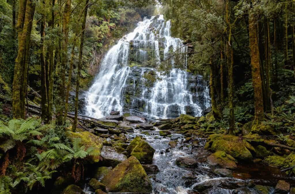
Nelson Falls are easily accessible via a well-maintained track, making them an ideal walk for everyone, no matter age or fitness level. It’s only a short 20-minute walk through an ancient rainforest that will bring you to a spectacular cascade, where water tumbles over moss-laden rocks. Nelson Falls is very photogenic!
As you walk the boardwalk that leads to the falls, you'll pass through lush temperate rainforest, rich with ferns, mosses, and towering trees that provide a cool canopy overhead. Informational signs along the way offer insights into the ancient rainforest's ecosystem
The falls themselves are a breathtaking sight year-round, with the water flow ranging from a gentle cascade in the dryer months to a powerful torrent after heavy rainfall. The viewing platform at the end of the track is the perfect vantage point to take in the falls' full glory.
No parks pass is required for the visit to Nelson Falls, and while there are no facilities directly at the falls, picnic tables and toilets are available at the car park area. Track is suitable for wheelchairs and strollers and a perfect pit stop on your trip between Strahan to Derwent Bridge.
Donaghys Lookout
Easy/Medium 2.3 km – 40 min
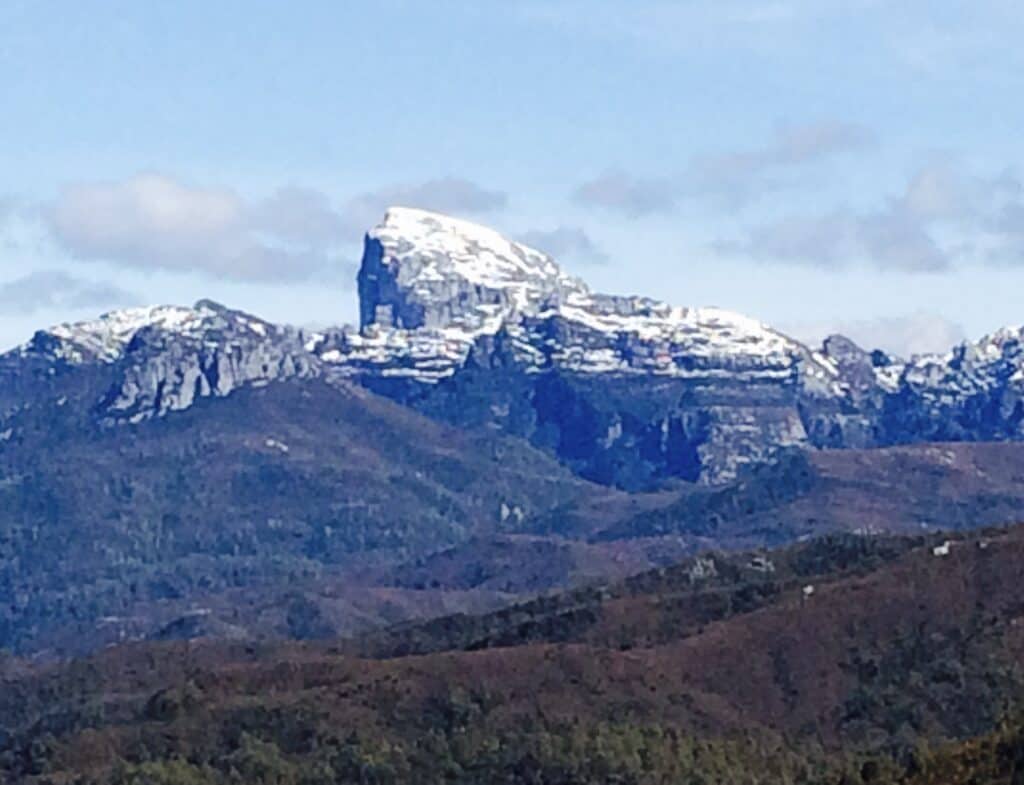
Donaghys Lookout is an awesome little hike with panoramic views of the Franklin River valley and surrounding wilderness within the Franklin-Gordon Wild Rivers National Park.
Starting from the well-marked trailhead near the Lyell Highway, the path ascends through dense, cool temperate rainforest before opening up to a hilltop with the lookout point. This relatively short hike is well-maintained, though it includes some steep sections that require a reasonable level of fitness to navigate. But it’s worth it!
Once you reach Donaghys Lookout, you are greeted with sweeping vistas of the lush forest canopy, the winding Franklin River, and distant mountain ranges. It's an ideal spot for photography or simply soaking in the tranquillity of Tasmania's wild landscapes.
The lookout does not require a parks pass for access, and while there are no facilities at the lookout itself, you can find basic amenities, including toilets, at nearby picnic areas, so please practise Leave no Trace Principles.


A Journey's End from Strahan to Derwent Bridge
So now you have it, a road trip between Strahan to Derwent Bridge which unveils the raw beauty and untamed wilderness of western Tasmania.
The drive from Strahan to Derwent Bridge explores Tasmania's untouched wilderness, merging natural beauty with the essence of adventure. It's a journey where each stop, whether it be the serene banks of the Franklin River or the trails leading to panoramic vistas, fosters a connection with the land.
This path not only showcases the physical splendour of Tasmania but also narrates the story of its preservation and the cultural significance of its landscapes.
For those seeking the outdoors, the route presents opportunities to engage with the environment actively. Whether it's the reflective calm of fishing in a tranquil river, the physical challenge of hiking to Frenchmans Cap, or the exhilarating rush of white-water rafting in King River Gorge, the Strahan to Derwent Bridge journey offers diverse experiences.
The Strahan to Derwent Bridge drive also ensures inclusivity with accessible stops, enabling all travellers to savour the vistas and tranquillity of Tasmania's wilderness.
Heading in the Direction Derwent Bridge to Strahan?
Strahan is famous for its river cruises. The Gordon River Cruises company boasts the best river cruise in the island. Check them out here
Safety Tips for Driving Strahan to Derwent Bridge
- Road Conditions: The Lyell Highway is well-maintained but can be winding and narrow in sections, especially as it passes through mountainous terrain between Strahan and Derwent Bridge. Drivers should be prepared for variable weather conditions, particularly in winter.
- Driving Advice: Always check road conditions before departing, particularly in winter months when ice and snow can affect travel. Ensure your vehicle and caravan are well-maintained and equipped for the journey, considering extra provisions for remote areas.
- Wildlife Caution: Between Strahan and Derwent Bridge is very isolates. Be alert for wildlife crossing the roads, especially at dawn and dusk.
Like This?
We'd love you to share this great guide!
If You Enjoyed this Guide. – You May Also Like:
- The Mt Sonder Walk and a Trek Through Redbank Gorge (Rwetyepme)
- Hobart to Derwent Bridge Road Trip with the 8 Best Stops
- The Tarn Shelf Circuit – Discovering Jewels in Mt Field
- Navigating the Overland Track Solo
- Hiking Frenchmans Cap -Tasmania’s Iconic White Peak
- Hiking the Rees Dart Track – Mt Aspiring National Park
- The Rakiura Track – A Great Walk on Stewart Island
- Traverse Walls of Jerusalem to the Overland Track via Lees Paddock
- Hiking The Tahoe Rim Trail – A Guide for Overseas Visitors
- Conquering the Gold Coast Kokoda Challenge
- Plan Your Larapinta Trail Sections, Best Time of Year, Resupply, and Transfers
- Larapinta Trail Food Essentials and Nutrition Plan